Old Maps of Raysville, Lynchburg for Academic Research
Study the evolution of Raysville with 11 high-resolution historic maps. Whether you're teaching, researching, or modeling changes in land use, these maps provide essential visual documentation of urban, environmental, and geographic change.
- Analyze long-term change: Track patterns in development, transportation, and natural features.
- Ideal for environmental or urban studies: Support academic projects with primary historical map data.
- Use in the classroom or lab: Educators and researchers rely on these maps to bring historical context to life.
These maps are a powerful tool for teaching, research, and visualizing how Raysville has changed over the decades.
Raysville, Lynchburg maps
(11)- 1936 Map of Cumberland Springs
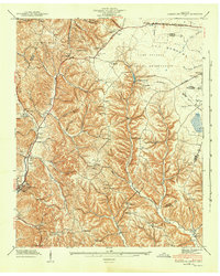
 1936 Cumberland Springs1936 Print · USGSMoore County and Lynchburg are captured in the mid-1930s as a land of narrow hollows and high ridges. Researchers can trace the early layout of Lynchburg and find community centers like Raysville Sch, Smith Chapel, and Cumberland Springs.
 - 1941 Map of Cumberland Springs, 1943 Print
 1941 Cumberland Springs1943 Print · USGSMoore County and the Highland Rim are captured in the early 1940s, just as the nearby military expansion began to transform the local landscape. Genealogists can trace family footprints through community sites like Lynchburg, Bakertown, and Hickory Hill Sch.5 unique versions available
 - 1944 Map of Shelbyville
 1944 Shelbyville1944 Print · USGSMid-century Middle Tennessee is captured here during the wartime mobilization of the 1940s. Genealogists and researchers can trace family lands near Bugscuffle, Shelbyville Mills, and the expansive Camp Forrest Military Res.
 - 1956 Map of Columbia, 1960 Print
 1956 Columbia1960 Print · USGSMiddle Tennessee in the mid-fifties presents a landscape of established river towns and critical rail hubs before the arrival of the modern interstate system. Researchers can trace the routes of the Louisville and Nashville railroad or locate historic landmarks like Stones River National Military Park and the Tennessee National Wildlife Refuge.6 unique versions available
 - 1978 Map of Lynchburg East
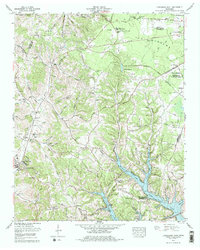 1978 Lynchburg East1978 Print · USGSMoore County in the late seventies is captured here at the intersection of rural heritage and modern development. Researchers can trace numerous family cemeteries such as Sawyer Cem and Bobo Cem or explore the early footprint of Motlow State Community College.
 - 1981 Map of Tullahoma, 1982 Print
 1981 Tullahoma1982 Print · USGSSouthern Tennessee enters the 1980s with a mix of aerospace technology and deep rural roots. Researchers can trace the L & N RR through Shelbyville and Fayetteville or locate family sites like Old Salem Cem and Blanton Chapel near the Cumberland Plateau.
 - 2010 Map of Lynchburg East, 2010 Print
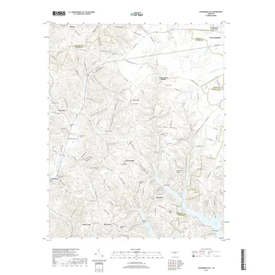
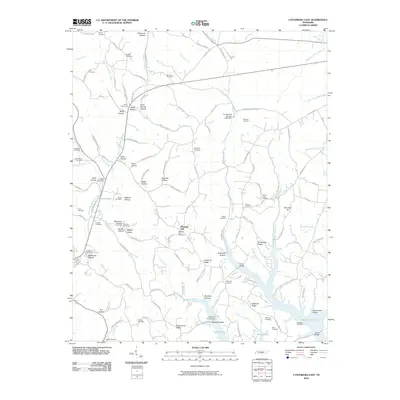 2010 Lynchburg East2010 Print · USGSCovers Raysville, including Tullahoma, Bakertown, and other nearby areas
 - 2013 Map of Lynchburg East, 2013 Print
 2013 Lynchburg East2013 Print · USGSCovers Raysville, including Tullahoma, Bakertown, and other nearby areas
 - 2016 Map of Lynchburg East, 2016 Print
 2016 Lynchburg East2016 Print · USGSCovers Raysville, including Tullahoma, Bakertown, and other nearby areas
 - 2019 Map of Lynchburg East, 2019 Print
 2019 Lynchburg East2019 Print · USGSCovers Raysville, including Tullahoma, Bakertown, and other nearby areas
 - 2022 Map of Lynchburg East, 2022 Print
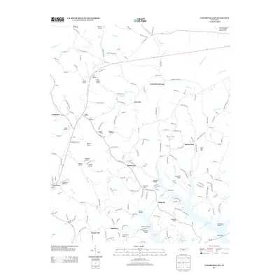
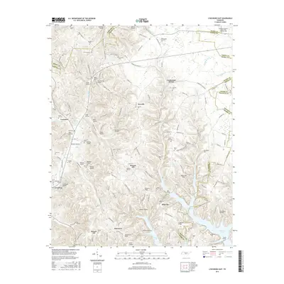
 2022 Lynchburg East2022 Print · USGSMoore County in the early twenty-first century remains defined by its deep hollows and the historic seat at Lynchburg. Researchers can trace local lineage through numerous family burial sites like Dance Cem or visit the campus of Motlow State Community College.
End of results
Showing maps 1-11 of 11
Top cities near Raysville
- Shelbyville historical maps
- Tullahoma historical maps
- Manchester historical maps
- Winchester historical maps
- Fayetteville historical maps
- Estill Springs historical maps
See more
Frequently asked questions
- What are the different types of historical maps available for Raysville?
- What is the oldest map of Raysville?
- Where can I purchase historical maps of Raysville for my home or office?
- Where can I download high-res historical maps of Raysville?
- Are there historical topographic maps available for Raysville?
- Is there historical aerial imagery available for Raysville?
- Where are historical maps of Raysville sourced from?