Old Maps of Morgan County, Tennessee for Genealogy
Trace your family roots with 160 historic maps of Morgan County. These high-res maps reveal old neighborhoods, homesites, landmarks, and streets — helping you uncover where your ancestors lived and how the area evolved over time.
- Explore historic neighborhoods: Identify where your relatives may have lived in the 1800s or 1900s.
- Compare maps over time: Trace the changes in streets, buildings, and landmarks for multi-generational research.
- Perfect for genealogy & ancestry research: Used by family historians and researchers to map out lineage and migration.
These maps are an incredible resource for exploring your personal connection to Morgan County's past.
Morgan County, TN maps
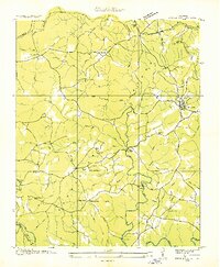
(160)- 1887 Map of Kingston
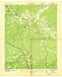
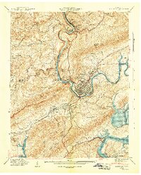
 1887 Kingston1887 Print · USGSCentral Tennessee in the late nineteenth century was a world of river landings and new rail lines. Genealogists can trace family roots through riverside sites like Sevier's Ferry or rural hubs like Bogges X Roads and Ten Mile Stand.
 - 1891 Map of Kingston
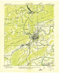
 1891 Kingston1891 Print · USGSEastern Tennessee in the 1890s reveals a river-driven economy at the edge of the Cumberland Plateau. Genealogists can trace early crossings and landings such as Mc Elwee's Ferry and Pinhook Landing, or locate vanished crossroads like Kemmers Old Stand.2 unique versions available
 - 1893 Map of Briceville
 1893 Briceville1893 Print · USGSThe northern Tennessee coalfields and valleys come to life in the 1890s, when mining and rail were transforming the ridges of the Cumberland. Local historians can trace the paths of the Knoxville and Ohio R. R. and early settlements like Jacksboro, Coal Creek, and Oliver Springs.
 - 1893 Map of Kingston, 1905 Print
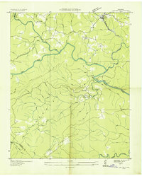
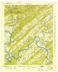
 1893 Kingston1905 Print · USGSEastern Tennessee at the end of the nineteenth century is a landscape of mountain gaps and vital river landings. Researchers can trace early river crossings like Jackson Ferry, the path of the Cincinnati Southern Railroad, and settlements like Rhea Springs and Kingston.5 unique versions available
 - 1895 Map of Wartburg
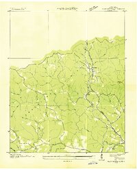
 1895 Wartburg1895 Print · USGSThe Cumberland Plateau of the late nineteenth century comes to life through this record of high-country towns and rivers. Genealogists can trace early homesteads and rail stops from Oneida down to Wartburg, including the distinct colonies at Rugby and Allardt.
 - 1895 Map of Loudon
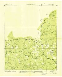
 1895 Loudon1895 Print · USGSEastern Tennessee is mapped here during a decade of rail expansion and river-based commerce. Genealogists and historians can trace family-named river crossings and early industry at Huff Ferry, Hiwassee College, and Brick Mill.6 unique versions available
 - 1895 Map of Briceville
 1895 Briceville1895 Print · USGSThe Cumberland Mountains and Powell Valley met a rapidly expanding railroad network in the late nineteenth century. Trace early industrial footprints and family-named hollows from Briceville and Clinton to the coal-rich slopes of Big Mountain.
 - 1896 Map of Wartburg
 1896 Wartburg1896 Print · USGSThe Cumberland Plateau in the late nineteenth century is captured here as railroads began to transform the mountain economy. Trace the development of utopian Rugby, the county seat at Wartburg, and remote crossings like Island Ford or Big Lick Gap.6 unique versions available
 - 1896 Map of Briceville
 1896 Briceville1896 Print · USGSEast Tennessee's coal and rail corridors are captured here in the late nineteenth century as the industrial landscape of the Cumberland Plateau matured. Researchers can trace early family homesteads and transport hubs through Briceville, Clinton, and the Southern RR line.6 unique versions available
 - 1935 Map of Gobey
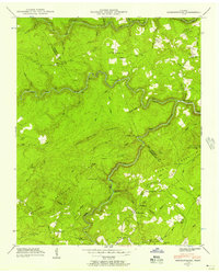
 1935 Gobey1935 Print · USGSMorgan County is captured during the mid-1930s when logging and rail lines defined the life of the plateau. Trace the timber economy through the Lumber Company rail spurs and find family landmarks like Elizabeth Sch and Macedonia Ch.
 - 1935 Map of Camp Austin
 1935 Camp Austin1935 Print · USGSMorgan County in the mid-1930s shows a landscape of plateau settlements and new New Deal infrastructure. Genealogists and historians can trace local landmarks like CCC Camp No 1463, rural outposts like Deermont Sch, and the rail corridor of the Southern.2 unique versions available
 - 1935 Map of Elverton
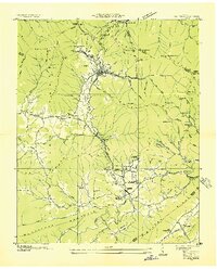
 1935 Elverton1935 Print · USGSMid-1930s Roane County and Morgan County were characterized by river-bottom agriculture and ridgeline settlements before the arrival of the atomic age. Genealogists can trace family landmarks like Gallagher Ferry, Orchard View Sch, and the community of Wheat.
 - 1935 Map of Harriman
 1935 Harriman1935 Print · USGSMid-1930s Roane County reveals a busy rail and river corridor where the Cumberland Escarpment meets the Tennessee Valley. Genealogists and historians can trace family landmarks like Suddaths Ferry, Bazzletown Sch, and the grounds of CCC Camp No 37.
 - 1935 Map of Lancing
 1935 Lancing1935 Print · USGSMorgan County, Tennessee, is captured here in the mid-1930s as the railroad and river networks shaped local life. Genealogists and researchers can trace family lands near Lancing, the settlement at Nemo, and community centers like Catoosa Sch and Clear Creek Ch.
 - 1935 Map of Pilot Mountain
 1935 Pilot Mountain1935 Print · USGSMorgan County’s high plateau country is captured here during the mid-1930s electrification era. Researchers can trace the families near Rome Ch, locate the Pilot Mtn Fire Tower, or follow the Southern rail line through Annadel.
 - 1936 Map of Hebbertsburg
 1936 Hebbertsburg1936 Print · USGSCumberland and Morgan Counties come together in the mid-1930s along the winding Obed River and Daddy Creek. Researchers can locate old community hubs like Hebbertsburg and Frankfort, alongside river crossings at Hegler Ford and Potter Ford.
 - 1936 Map of Hogbell Gap
 1936 Hogbell Gap1936 Print · USGSThe Tennessee Cumberland Mountains are captured during the mid-1930s, revealing a landscape of high ridges and critical mountain passes. Researchers can trace the rugged topography of Bird Mountain and locate early landmarks such as Hogbell Gap and The Garden Spot.
 - 1936 Map of Twin Bridges
 1936 Twin Bridges1936 Print · USGSMorgan County life during the mid-1930s centered on the high ridges of the Cumberland Plateau and the waters of Clear Creek. Researchers can trace old mountain communities through sites like Deer Lodge, Island Ford Sch, and Lavender Ch.
 - 1936 Map of Cardiff
 1936 Cardiff1936 Print · USGSThe Cumberland Plateau meets the valley floor in the mid-1930s, showing a landscape shaped by the ridge and rail. Researchers can trace the development of Rockwood and Cardiff or locate rural landmarks like Dry Hill Ch and Hatley Sch.2 unique versions available
 - 1936 Map of Windrock
 1936 Windrock1936 Print · USGSAnderson County and its neighbors are captured here in the mid-1930s as industrial rail lines bridged the gap between mountain coal and valley towns. Genealogists can trace family names at Grave Hill Cemetery or locate the old Frost Bottom School.
 - 1936 Map of Petros
 1936 Petros1936 Print · USGSMorgan County is shown at the height of its coal-mining era in the mid-1930s. Genealogists and historians can trace the foundations of Brushy Mountain State Prison and industrial camps like Coalfield Camp No 1 and Petros.
 - 1936 Map of Jones Knob
 1936 Jones Knob1936 Print · USGSFentress and Morgan counties in the mid-1930s reveal a landscape of high plateaus and vital river crossings. Researchers can locate remote rural landmarks including Jones Sch, Ashburn Ford, and the distinctive Jones Knob among the deep creek basins.
 - 1941 Map of Harriman
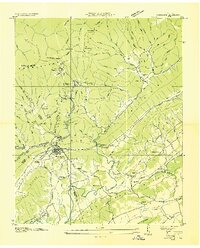
 1941 Harriman1941 Print · USGSHarriman and the Emory River valley are captured here just as the landscape was transforming for the new reservoir system. Researchers can trace the convergence of three major railroads and find family landmarks like Delozier Cem, Woods Chapel, and Cardiff Sch.3 unique versions available
 - 1941 Map of Elverton
 1941 Elverton1941 Print · USGSThe Clinch and Emory Rivers meet at the dawn of the Tennessee Valley Authority era, just as the Watts Bar Reservoir began to fill. Local historians can trace the foundations of old Roane County through Smallman Mill, Gallaher Ferry, and the County Farm.3 unique versions available
 - 1943 Map of Hebbertsburg, 1957 Print
 1943 Hebbertsburg1957 Print · USGSThe Cumberland Plateau landscape near the Morgan and Cumberland county line comes to life in the 1940s. Genealogists and local historians can trace the foundations of mountain life through Frankfort, the New Home Church, and old river crossings like Potter Ford.5 unique versions available
Showing maps 1-25 of 160
Top cities of Morgan County
Frequently asked questions
- What are the different types of historical maps available for Morgan County?
- What is the oldest map of Morgan County?
- Where can I purchase historical maps of Morgan County for my home or office?
- Where can I download high-res historical maps of Morgan County?
- Are there historical topographic maps available for Morgan County?
- Is there historical aerial imagery available for Morgan County?
- Where are historical maps of Morgan County sourced from?