Old Maps of Dayton, Tennessee for Academic Research
Study the evolution of Dayton with 57 high-resolution historic maps. Whether you're teaching, researching, or modeling changes in land use, these maps provide essential visual documentation of urban, environmental, and geographic change.
- Analyze long-term change: Track patterns in development, transportation, and natural features.
- Ideal for environmental or urban studies: Support academic projects with primary historical map data.
- Use in the classroom or lab: Educators and researchers rely on these maps to bring historical context to life.
These maps are a powerful tool for teaching, research, and visualizing how Dayton has changed over the decades.
Dayton, TN maps
(57)- 1886 Map of Cleveland
 1886 Cleveland1886 Print · USGSSoutheast Tennessee in the mid-1880s was a landscape defined by the iron rails and winding rivers that fueled the region's growth. You can trace early river crossings like Savannah Ford and Kincannons Ferry or locate old community centers like Chestua Mills.
 - 1887 Map of Kingston
 1887 Kingston1887 Print · USGSCentral Tennessee in the late nineteenth century was a world of river landings and new rail lines. Genealogists can trace family roots through riverside sites like Sevier's Ferry or rural hubs like Bogges X Roads and Ten Mile Stand.
 - 1888 Map of Chattanooga
 1888 Chattanooga1888 Print · USGSSoutheast Tennessee in the late nineteenth century was a landscape of river ferries and mountain mining. Trace family roots and vanished landmarks near Chattanooga, from the Aetna Mines to historic river crossings like Harrison Ferry.
 - 1891 Map of Kingston
 1891 Kingston1891 Print · USGSEastern Tennessee in the 1890s reveals a river-driven economy at the edge of the Cumberland Plateau. Genealogists can trace early crossings and landings such as Mc Elwee's Ferry and Pinhook Landing, or locate vanished crossroads like Kemmers Old Stand.2 unique versions available
 - 1892 Map of Pikeville
 1892 Pikeville1892 Print · USGSThe Cumberland Plateau in the 1890s shows a rugged landscape of early river ferries and mountain gaps. Genealogists and historians can trace the paths between Sparta and Crossville, locating landmarks like Hodge Ferry and the Rock House tavern.
 - 1892 Map of Cleveland
 1892 Cleveland1892 Print · USGSSoutheast Tennessee is captured in the late nineteenth century as a landscape of river ferries and emerging rail junctions. Genealogists and historians can locate early settlements like Charleston and Riceville or trace the original river crossings at Kincannons Ferry and Helderbrand Ford.
 - 1893 Map of Chattanooga
 1893 Chattanooga1893 Print · USGSSoutheast Tennessee is shown here in the 1890s, when river ferries and coal mines defined the landscape around the booming hub of Chattanooga. Genealogists and researchers can trace family lands near Eldridge Landing, the Mc Nabb Mines, or old settlements like Ooltewah.9 unique versions available
 - 1893 Map of Kingston, 1905 Print
 1893 Kingston1905 Print · USGSEastern Tennessee at the end of the nineteenth century is a landscape of mountain gaps and vital river landings. Researchers can trace early river crossings like Jackson Ferry, the path of the Cincinnati Southern Railroad, and settlements like Rhea Springs and Kingston.5 unique versions available
 - 1895 Map of Cleveland
 1895 Cleveland1895 Print · USGSSoutheast Tennessee thrived along the Hiwassee River and its rail corridors during the 1890s. Genealogists and historians can trace defunct river crossings like Bunker Hill Ferry and milling sites including Chestuee Mills and Longs Mills.
 - 1895 Map of Pikeville
 1895 Pikeville1895 Print · USGSThe Cumberland Plateau was a landscape of mountain settlements and critical gaps in the 1890s. Genealogists can trace family roots through upland communities like Pomona and Lantana, or locate old landmarks like Hale Chapel and Hodge Ferry along the river.7 unique versions available
 - 1901 Map of Cleveland
 1901 Cleveland1901 Print · USGSSoutheast Tennessee was a thriving hub of river and rail commerce at the dawn of the twentieth century. Genealogists can trace family homesteads near vanished landmarks like Marble Switch, Bunker Hill Ferry, or the early settlements of Riceville and Benton.4 unique versions available
 - 1909 Map of Sequatchie Valley, 1955 Print
 1909 Sequatchie Valley1955 Print · USGSBledsoe County at the turn of the century shows a landscape of river-valley agriculture and rugged plateau crossings. Genealogists can locate family homesteads near landmarks like Mansfield Mill, Smyrna Church, or the Melvine Post Office.
 - 1910 Map of Pikeville
 1910 Pikeville1910 Print · USGSBledsoe County at the turn of the century shows a landscape of valley farms and mountain gaps connected by the Nashville Chattanooga and St Louis RR. Researchers can locate early milling sites like Hembree Mill and rural landmarks such as Melvine PO and Saratoga Springs.2 unique versions available
 - 1935 Map of Morgan Springs
 1935 Morgan Springs1935 Print · USGSWalden Ridge and the Tennessee valley transition are documented here in the mid-1930s, showing a landscape of small schools and plateau settlements. Researchers can trace the Cumberland Escarpment to find Henderson Mill, Morgan Springs, and the Incline railroad.
 - 1935 Map of Evensville
 1935 Evensville1935 Print · USGSRhea County is captured in the mid-1930s as the Tennessee Valley Authority begins modernizing the region's infrastructure. Researchers can locate numerous rural landmarks including Henry Ferry, Evens Cem, and old schoolhouses like Locke Sch and Oak Hill Sch.
 - 1935 Map of Big Spring
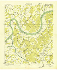 1935 Big Spring1935 Print · USGSThe Tennessee and Hiwassee rivers define the landscape in the mid-thirties, when ferries were the primary links between Meigs and Rhea counties. Genealogists can trace family roots through labels for Big Spring, Salem Ch, and the Garrison Cem.
 - 1935 Map of Graysville
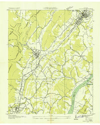 1935 Graysville1935 Print · USGSRhea and Hamilton counties are shown in detail during the mid-1930s, caught between the ridge-and-valley terrain and the river. Genealogists can locate family landmarks like Welch Cem, trace the historic Blythe Ferry, or find CCC Camp No 3470.
 - 1942 Map of Big Spring
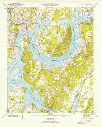 1942 Big Spring1942 Print · USGSThe Tennessee and Hiwassee Rivers meet in the early 1940s, revealing a landscape of reservoir development and deep-rooted farm communities. Genealogists can locate Big Spring and family sites like Shaver Cem, while historians can trace the Cotton Port Ferry.
 - 1942 Map of Evensville, 1946 Print
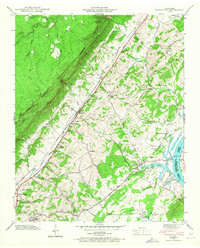 1942 Evensville1946 Print · USGSRhea County is captured here in the early 1940s as the Tennessee Valley Authority projects reshaped the river landscape. Genealogists can trace family names through dozens of landmarks, including Washington Ferry, Smyrna Ch, and the Montgomery Cem.3 unique versions available
 - 1942 Map of Graysville, 1956 Print
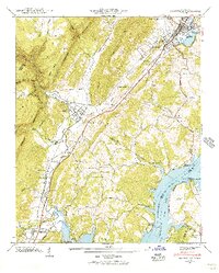 1942 Graysville1956 Print · USGSRhea County and the Tennessee River valley appear here in the early 1940s as newly formed reservoirs altered the landscape. Researchers can trace the historic Blythe Ferry crossing and find long-established local sites like New Providence Sch and the Old Browder Cem.2 unique versions available
 - 1943 Map of Graysville
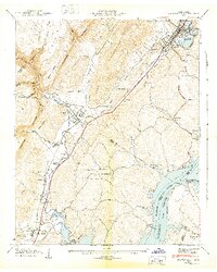 1943 Graysville1943 Print · USGSEast Tennessee at the dawn of the 1940s reveals a landscape of ridge-and-valley settlements tied to the river and rail. Genealogists can trace family names through the Graysville Cem, New Providence Sch, and numerous churches like Garrison Ch.2 unique versions available
 - 1943 Map of Big Spring, 1946 Print
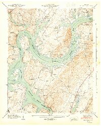 1943 Big Spring1946 Print · USGSThe Tennessee River valley in the early 1940s reveals a landscape reshaped by the newly formed Chickamauga Reservoir. Genealogists and local historians can trace family land near Big Spring, the Cotton Port Ferry, and numerous country churches like Burkett Chapel.2 unique versions available
 - 1953 Map of Chattanooga
 1953 Chattanooga1953 Print · USGSSoutheast Tennessee in the early fifties shows a landscape reshaped by river management and rail power. Trace the rail lines of the Southern Ry through riverside towns or locate the preserved grounds of the Chickamauga and Chattanooga National Military Park.
 - 1956 Map of Morgan Springs, 1958 Print
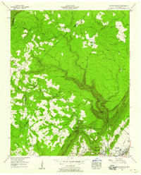 1956 Morgan Springs1958 Print · USGSWalden Ridge and the steep escarpment above Dayton were captured in detail during the mid-fifties, showing the transition from plateau settlements to the valley floor. Genealogists can locate family sites like Kiuka Cem and the Cranmore Cove Mission near the historic Southern rail line.
 - 1957 Map of Chattanooga, 1966 Print
 1957 Chattanooga1966 Print · USGSEast Tennessee in the mid-1960s shows a landscape of massive hydroelectric reservoirs and emerging industrial sites like the Atomic Energy Commission (Oak Ridge Area). Trace the rail networks of the Southern Ry through Chattanooga or locate family-named ridges across the Cumberland Plateau.3 unique versions available
Showing maps 1-25 of 57
Top cities near Dayton
- Soddy-Daisy historical maps
- Spring City historical maps
- Pikeville historical maps
- Decatur historical maps
- Graysville historical maps
Top neighborhoods of Dayton
- North Dayton historical maps
- Taylor Hill historical maps
- Sentinel Heights historical maps
- Edgewater historical maps
- Piney Acres historical maps
- Mountain View historical maps
See more
Frequently asked questions
- What are the different types of historical maps available for Dayton?
- What is the oldest map of Dayton?
- Where can I purchase historical maps of Dayton for my home or office?
- Where can I download high-res historical maps of Dayton?
- Are there historical topographic maps available for Dayton?
- Is there historical aerial imagery available for Dayton?
- Where are historical maps of Dayton sourced from?