1900s (20th Century) Maps of Oneida, Tennessee
Explore 10 historic maps of Oneida from the 1900s (20th Century). These maps offer a rare glimpse into what life looked like during the 1900s — showing old roads, neighborhoods, homes, and landmarks that have changed or disappeared over time.
Whether you're researching your family's past, planning a metal detecting trip, or studying how Oneida's landscape evolved across the 1900s, these high-resolution maps are a powerful tool for exploring the history of this region.
- Focus on a specific era: All maps on this page are from the 1900s, giving you a focused view of this time period.
- See what’s changed: Compare century-old streets, trails, and buildings to today's modern landscape using overlays and satellite layers.
- Research with precision: Use these maps for genealogy, historical research, land use analysis, or educational projects.
- View, download, or print: Maps are fully viewable online in high resolution, and can be downloaded or printed for your own records.
Start exploring Oneida's history through authentic maps from the 1900s. This is your window into the past.
Oneida, TN maps
(10)- 1934 Map of Barthell
 1934 Barthell1934 Print · USGSMcCreary County during the late 1920s reveals a landscape of industrial outposts and river-bound settlements at the edge of the Tennessee line. Researchers can trace the Kentucky and Tennessee Railway corridor or find family roots at Kidds Crossing, Cooperative, and Laurel Hill Ch.
 - 1952 Map of Helenwood, 1953 Print
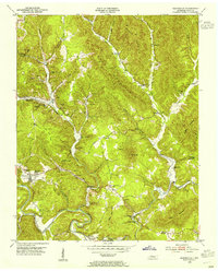
 1952 Helenwood1953 Print · USGSThe Cumberland Plateau in the early fifties shows a rugged landscape shaped by the New River and the coal industry. Genealogists can trace family names through dozens of sites like the Pike Cem, Tunnel Hill Sch, and Mountain View.4 unique versions available
 - 1953 Map of Winfield, 1954 Print
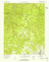
 1953 Winfield1954 Print · USGSThe Tennessee-Kentucky border comes alive in the mid-1950s, centered on the railroad hub of Winfield and the surrounding timberlands. Genealogists can trace family landmarks like Chitwood Cem, Isham, and rural schoolhouses such as Upper Marsh Creek Sch.2 unique versions available
 - 1953 Map of Huntsville, 1955 Print
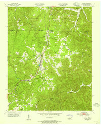
 1953 Huntsville1955 Print · USGSScott County entered the mid-1950s as a landscape of deep valleys and coal mining between the New River and Privet Mountain. Researchers can trace the era's rural infrastructure through Huntsville High Sch, Capitol Hill Sch, and the winding Tennessee railroad line.4 unique versions available
 - 1955 Map of Oneida North, 1956 Print
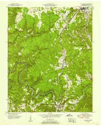
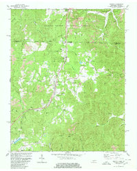
 1955 Oneida North1956 Print · USGSScott County and the Kentucky borderlands come alive in the mid-fifties, showing the rail and ridge life of the plateau. Researchers can trace family history through sites like Atomic Sch, Grave Hill Cem, and the industry at the Strip Mine.4 unique versions available
 - 1956 Map of Corbin, 1966 Print
 1956 Corbin1966 Print · USGSThe Kentucky and Tennessee borderlands are captured here in the mid-fifties, showing the region's shift toward modern interstate travel and reservoir development. Genealogists and historians can trace old community lines near Albany and Monticello or locate early rail junctions along the Southern and Tennessee Central lines.3 unique versions available
 - 1958 Map of Corbin
 1958 Corbin1958 Print · USGSThe Upper Cumberland borderlands appear in the late 1950s as massive reservoirs and early atomic-era growth reshape the region. Trace family roots and vanished landmarks near Lake Cumberland, Oak Ridge, and the Cumberland National Forest.
 - 1979 Map of Oakridge, 1980 Print
 1979 Oakridge1980 Print · USGSThe eastern Tennessee highlands are captured here in the late 1970s, showcasing a landscape of coal mining and mountain conservation. Genealogists and researchers can locate family landmarks such as Potter Cem, Sunbright Sch, and the historic settlement of Rugby.
 - 1980 Map of Winfield
 1980 Winfield1980 Print · USGSThe borderlands of Tennessee and Kentucky are captured here in the late twentieth century as the railroad and mining industries shaped the local economy. Researchers can trace family history through dozens of rural landmarks, from Chitwood Cem and Isham Cem to the local congregations at Second Bethlehem Ch.2 unique versions available
 - 1981 Map of Corbin, 1984 Print
 1981 Corbin1984 Print · USGSThe Kentucky and Tennessee borderlands in the early eighties were characterized by coal towns and deep mountain ridges. Trace family history or rail routes through Stearns, Williamsburg, and the mining settlements near Jellico Mountain along the L & N RR.
End of results
Showing maps 1-10 of 10
Top cities near Oneida
Top neighborhoods of Oneida
Frequently asked questions
- What are the different types of historical maps available for Oneida?
- What is the oldest map of Oneida?
- Where can I purchase historical maps of Oneida for my home or office?
- Where can I download high-res historical maps of Oneida?
- Are there historical topographic maps available for Oneida?
- Is there historical aerial imagery available for Oneida?
- Where are historical maps of Oneida sourced from?