Old Maps of Dunlap, Tennessee for Hiking & Exploration
Hike through history with 41 historic maps of Dunlap. Explore old trails, ghost towns, and forgotten backroads — perfect for outdoor adventurers and local explorers.
- Rediscover forgotten places: Map out old mining camps, roads, and footpaths that no longer exist on modern maps.
- Layer with modern tools: Combine with LiDAR or satellite views to plan hikes through historical terrain.
- Made for exploration: Popular among hikers, overlanders, and local history lovers.
Use these maps to find adventure and explore the hidden past of Dunlap.
Dunlap, TN maps
(41)- 1888 Map of Chattanooga
 1888 Chattanooga1888 Print · USGSSoutheast Tennessee in the late nineteenth century was a landscape of river ferries and mountain mining. Trace family roots and vanished landmarks near Chattanooga, from the Aetna Mines to historic river crossings like Harrison Ferry.
 - 1893 Map of Chattanooga
 1893 Chattanooga1893 Print · USGSSoutheast Tennessee is shown here in the 1890s, when river ferries and coal mines defined the landscape around the booming hub of Chattanooga. Genealogists and researchers can trace family lands near Eldridge Landing, the Mc Nabb Mines, or old settlements like Ooltewah.9 unique versions available
 - 1935 Map of Mount Airy
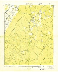
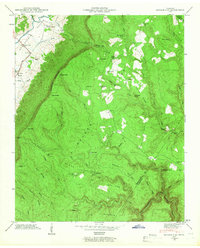
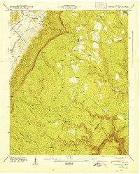
 1935 Mount Airy1935 Print · USGSBledsoe County is documented here in the mid-1930s, showing the agricultural valley between the plateau and the ridge. You can trace early family sites like Ewtonville Siding, Walkers Ford, and Sunny Side Sch along the river and rail lines.
 - 1936 Map of Daus
 1936 Daus1936 Print · USGSThe Sequatchie Valley was a bustling corridor of rail and river industry in the mid-1930s, caught between the Cumberland Plateau and Walden Ridge. Genealogists and historians can locate old schools and cemeteries like John Henry Chapel Sch, Stone Cem, and the community of Cartwright.
 - 1936 Map of Henson Gap
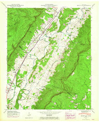
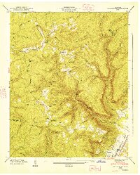
 1936 Henson Gap1936 Print · USGSThe Tennessee highlands near Henson Gap are captured in the mid-1930s as the TVA modernization began to reach these rural ridges. Genealogists and local historians can trace family land near Lewis Chapel Sch, Davis Chapel Ch, and the banks of Soddy Creek.
 - 1936 Map of Savage Point
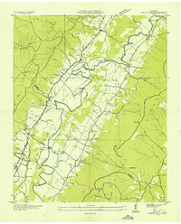
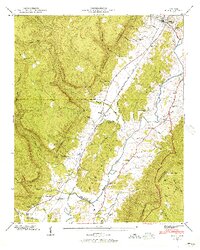
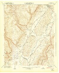
 1936 Savage Point1936 Print · USGSThe high Cumberland Plateau meets the Sequatchie Valley during the mid-1930s, showing the early reach of regional power lines. Researchers can find family burial sites like Mc Laughlin Cem, the local Fredona Sch, and Travis Mill on the creek.
 - 1946 Map of Savage Point
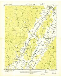
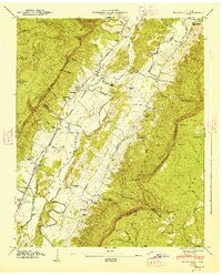
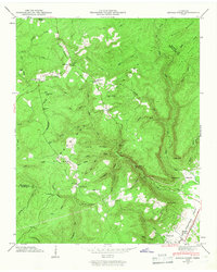 1946 Savage Point1946 Print · USGSThe town of Dunlap and the surrounding heights of the Cumberland Plateau are captured here in the mid-1940s. Genealogists and historians can trace local landmarks like Sequatchie County High Sch, King Cem, and Cagle.4 unique versions available
 - 1946 Map of Henson Gap
 1946 Henson Gap1946 Print · USGSThe Cumberland plateau and Sequatchie valley meet in the mid-1940s at a time of rural reliance on traditional ridge communities. Genealogists and local historians can trace family landmarks like Lewis Chapel, Lewis Cem, and the Alvin C. York Highway.4 unique versions available
 - 1946 Map of Daus, 1956 Print
 1946 Daus1956 Print · USGSThe Sequatchie Valley is captured just after the war as the mountain and valley economies intertwined. Genealogists and historians can trace family roots through numerous sites like Hatfield Cem, New Hope Ch, and the rail stops at Daus and Dunlap.6 unique versions available
 - 1946 Map of Mount Airy, 1965 Print
 1946 Mount Airy1965 Print · USGSBledsoe County is shown in the mid-1940s, with later revisions capturing the valley's development along the Sequatchie River. Researchers can trace old family sites and rural landmarks like Mount Airy Ch, Collier Cem, and the Brush Creek Siding rail stop.4 unique versions available
 - 1947 Map of Daus
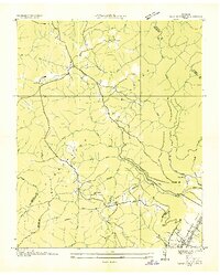
 1947 Daus1947 Print · USGSThe Sequatchie Valley floor and the steep Cumberland Escarpment appear here just after the war, at a peak of rail-and-river connectivity. Researchers can trace family history through a dozen rural landmarks like Stone Cem, Cedar Spring Sch, and Daus.
 - 1947 Map of Henson Gap
 1947 Henson Gap1947 Print · USGSThe Tennessee mountain plateau meets the valley floor just after the war, revealing a landscape of high ridges and isolated homesteads. Genealogists can trace family footprints at Lewis Cem, Davis Chapel, and the community hub at Lewis Chapel Sch.
 - 1947 Map of Mount Airy, 1948 Print
 1947 Mount Airy1948 Print · USGSThe Sequatchie Valley was a vital transport and farming corridor in the late 1940s, hemmed in by the massive Cumberland Escarpment. Genealogists and historians can trace community roots at Mount Airy, Ewtonville, and several family burial grounds like Collier Cem and Hughes Cem.
 - 1947 Map of Savage Point, 1948 Print
 1947 Savage Point1948 Print · USGSThe Sequatchie Valley and Cumberland Plateau meet in this mid-century survey as the town of Dunlap begins its post-war growth. Researchers can trace rural lineages through sites like Lands Chapel, King Cem, and the Sequatchie County High Sch.
 - 1953 Map of Chattanooga
 1953 Chattanooga1953 Print · USGSSoutheast Tennessee in the early fifties shows a landscape reshaped by river management and rail power. Trace the rail lines of the Southern Ry through riverside towns or locate the preserved grounds of the Chickamauga and Chattanooga National Military Park.
 - 1957 Map of Chattanooga, 1966 Print
 1957 Chattanooga1966 Print · USGSEast Tennessee in the mid-1960s shows a landscape of massive hydroelectric reservoirs and emerging industrial sites like the Atomic Energy Commission (Oak Ridge Area). Trace the rail networks of the Southern Ry through Chattanooga or locate family-named ridges across the Cumberland Plateau.3 unique versions available
 - 1959 Map of Chattanooga
 1959 Chattanooga1959 Print · USGSSoutheast Tennessee is shown here during a decade of industrial growth and hydroelectric development. Trace the regional rail networks of the Southern Ry and find landmark sites like Lookout Mountain, Fall Creek Falls State Park, and Chattanooga.
 - 1960 Map of Chattanooga
 1960 Chattanooga1960 Print · USGSSoutheast Tennessee and the southern Appalachians are shown here at the height of the river-management era. You can trace the valley rail lines and locate Lookout Mountain and the expansive waters of Chickamauga Reservoir.
 - 1964 Map of Chattanooga
 1964 Chattanooga1964 Print · USGSSoutheast Tennessee and the western Carolinas appear in the mid-sixties as a powerhouse of river-driven industry and mountain wilderness. Genealogists and historians can trace rail-town lineages along the Southern Ry or locate family landmarks near Watts Bar Lake and Tellico Plains.
 - 1979 Map of Chattanooga, 1980 Print
 1979 Chattanooga1980 Print · USGSSoutheast Tennessee in the late seventies reveals a landscape shaped by massive TVA river projects and the industrial strength of the Cumberland Plateau. Genealogists and historians can trace the rail-to-river network through L & N RR junctions, the University of the South, and the Volunteer Army Ammunition Plant.
 - 1988 Map of Chattanooga, 1991 Print
 1988 Chattanooga1991 Print · USGSSoutheast Tennessee at the end of the 1980s reveals a complex landscape of deep river valleys and high coal-rich plateaus. Researchers can trace the legacy of the L & N RR through Tracy City or locate the sprawling Strip Mines near Whitwell.
 - 2010 Map of Savage Point, 2010 Print
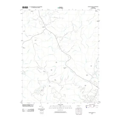 2010 Savage Point2010 Print · USGSCovers Dunlap, including Fredonia, Cagle, and other nearby areas
 - 2010 Map of Henson Gap, 2010 Print
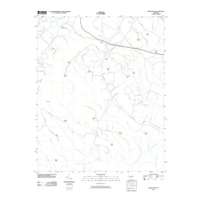 2010 Henson Gap2010 Print · USGSCovers Dunlap, including Hamilton County, Sequatchie County, and other nearby areas
 - 2010 Map of Daus, 2010 Print
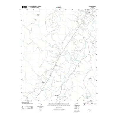 2010 Daus2010 Print · USGSCovers Dunlap, including Liberty, New Hope, and other nearby areas
 - 2010 Map of Mount Airy, 2010 Print
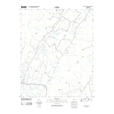 2010 Mount Airy2010 Print · USGSCovers Dunlap, including Elm Hill, Mount Airy, and other nearby areas
Showing maps 1-25 of 41
Top cities near Dunlap
- Chattanooga historical maps
- Soddy-Daisy historical maps
- Signal Mountain historical maps
- Walden historical maps
- Lakesite historical maps
- Gruetli-Laager historical maps
See more
Top neighborhoods of Dunlap
Frequently asked questions
- What are the different types of historical maps available for Dunlap?
- What is the oldest map of Dunlap?
- Where can I purchase historical maps of Dunlap for my home or office?
- Where can I download high-res historical maps of Dunlap?
- Are there historical topographic maps available for Dunlap?
- Is there historical aerial imagery available for Dunlap?
- Where are historical maps of Dunlap sourced from?