1900s (20th Century) Maps of Colonial Heights, Tennessee
Explore 25 historic maps of Colonial Heights from the 1900s (20th Century). These maps offer a rare glimpse into what life looked like during the 1900s — showing old roads, neighborhoods, homes, and landmarks that have changed or disappeared over time.
Whether you're researching your family's past, planning a metal detecting trip, or studying how Colonial Heights's landscape evolved across the 1900s, these high-resolution maps are a powerful tool for exploring the history of this region.
- Focus on a specific era: All maps on this page are from the 1900s, giving you a focused view of this time period.
- See what’s changed: Compare century-old streets, trails, and buildings to today's modern landscape using overlays and satellite layers.
- Research with precision: Use these maps for genealogy, historical research, land use analysis, or educational projects.
- View, download, or print: Maps are fully viewable online in high resolution, and can be downloaded or printed for your own records.
Start exploring Colonial Heights's history through authentic maps from the 1900s. This is your window into the past.
Colonial Heights, TN maps
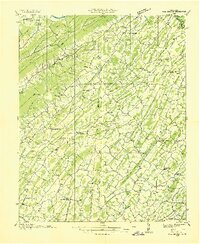
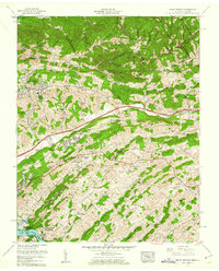
(25)- 1902 Map of Bristol
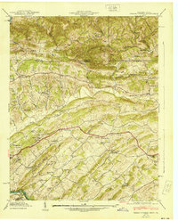
 1902 Bristol1902 Print · USGSThe interstate border region around Bristol appears here at the start of the twentieth century, defined by its deep mountain ridges and river valleys. Researchers can trace the early industrial footprint of the area through numerous landmarks like Bickley Mill, Kings Mill, and the Norfolk and Western RR.6 unique versions available
 - 1904 Map of Roan Mountain
 1904 Roan Mountain1904 Print · USGSUpper East Tennessee and Western North Carolina are documented here at a time when river fords and narrow-gauge railroads still connected mountain hollows. Trace the paths to Hodge Ore Bank, find old Poplar Ridge Church, or locate river crossings like Yoakley Ferry.4 unique versions available
 - 1904 Map of Greeneville
 1904 Greeneville1904 Print · USGSEast Tennessee at the turn of the century reveals a land of ridge-valley farms and early educational centers. Genealogists can trace family roots through historic settlements like Surgoinsville, early institutions like Washington College, and landmarks such as Bashors Mill.4 unique versions available
 - 1935 Map of Sullivan Gardens
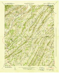
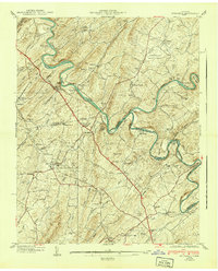
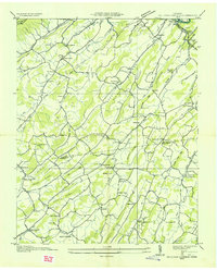 1935 Sullivan Gardens1935 Print · USGSSullivan County in the mid-1930s shows a landscape of ridge-top schools and creek-side mills before the expansion of modern highways. Researchers can locate the Kincheloe Mill, trace the Clinchfield RR through Kendricks Tunnel, and find family sites at Harmony Cem.
 - 1935 Map of Moggasin
 1935 Moggasin1935 Print · USGSThe Virginia-Tennessee borderlands appear here in the mid-1930s, showing the early industrial growth of Kingsport and Gate City. Trace family roots at Wolfe Cem or locate old mills like Speers Ferry Mill along the Clinch River.
 - 1935 Map of Kingsport
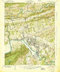
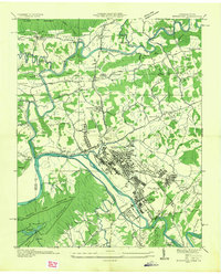 1935 Kingsport1935 Print · USGSKingsport and the surrounding Holston River valley are captured in the mid-thirties as industrial growth began to reshape the landscape. Researchers can locate community anchors like CCC Camp 2427, Sensabaugh Tunnel, and the sprawling Eastman complex.
 - 1935 Map of Spurgeon
 1935 Spurgeon1935 Print · USGSNortheast Tennessee's river valleys come alive in the mid-1930s, showing the intricate landscape where the Holston and Watauga rivers meet. Genealogists and local historians can trace family locations near the Ladies Academy, Boone Creek Mill, and the Clinchfield RR line.
 - 1935 Map of Indian Springs
 1935 Indian Springs1935 Print · USGSSullivan County and the Virginia borderlands are captured here in the mid-1930s as modern power and aviation networks began to reach these rural communities. Genealogists can locate family landmarks like Pyles Cem, Huddle Mill, and numerous neighborhood schools including Shadylawn Sch.
 - 1935 Map of Mages
 1935 Mages1935 Print · USGSThe Tennessee-Virginia borderlands appear here in the mid-1930s, showing a landscape of ridge-and-valley settlements and rural crossroads. Researchers can locate numerous family-centered sites including Pyles Cem, St Joseph Ch, and Mill Point.
 - 1935 Map of Fall Branch
 1935 Fall Branch1935 Print · USGSNortheast Tennessee in the mid-thirties shows a rural landscape of ridges and crossroads at the junction of four counties. Trace family history through dozens of local landmarks like Kincheloe Mill, Evening Star Sch, and Cedar Chapel.
 - 1939 Map of Kingsport
 1939 Kingsport1939 Print · USGSThe industrial hub of Kingsport and the surrounding Holston River valleys come alive in this late-1930s survey. Genealogists and historians can trace the foundations of Borden Village, locate the Sensabaugh Tunnel, and find family landmarks like Dorter Mill.2 unique versions available
 - 1939 Map of Sullivan Gardens
 1939 Sullivan Gardens1939 Print · USGSSullivan and Washington counties were a patchwork of ridge-top schools and creek-side mills in the years before the war. You can trace the Clinchfield Railroad through Kendrick Tunnel or locate ancestral sites like Kincheloe Mill and Harmony Cemetery.
 - 1939 Map of Indian Springs, 1954 Print
 1939 Indian Springs1954 Print · USGSSullivan County, Tennessee, and Scott County, Virginia, are captured here at the end of the 1930s as a network of creek-side farms and mountain gaps. Genealogists can locate family landmarks like Pyles Cem, Bridwell Town, and schools like Gunnings Academy or Shadylawn Sch.
 - 1940 Map of Indian Springs
 1940 Indian Springs1940 Print · USGSThe Tennessee and Virginia borderlands come alive in this pre-war survey of Sullivan County. Genealogists and local historians can trace the family networks of Bridwell Town, locate Gunnings Academy, and find long-standing mills like Huddle Mill.
 - 1940 Map of Spurgeon
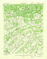
 1940 Spurgeon1940 Print · USGSSullivan and Washington Counties are shown just before the war as a landscape of sharp river bends and early aviation. Genealogists can locate family landmarks like the Buffalo Cem, Mt Zion Ch, and the vanished Ladies Academy.4 unique versions available
 - 1955 Map of Johnson City
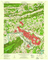
 1955 Johnson City1955 Print · USGSEast Tennessee and the bordering highlands of Virginia and Kentucky appear here during the post-war industrial boom. You can trace the complex network of mountain ridges and new TVA lakes, from Johnson City to the coalfields near Middlesboro and Lynch.
 - 1957 Map of Johnson City, 1966 Print
 1957 Johnson City1966 Print · USGSUpper East Tennessee and Southwest Virginia are shown here during the mid-sixties transition of the Appalachians. Researchers can trace the industrial rail hubs of Kingsport, the sprawling waters of Cherokee Lake, and the historic Cumberland Gap.
 - 1959 Map of Boone Dam, 1960 Print
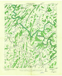
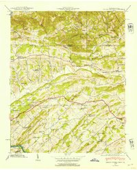
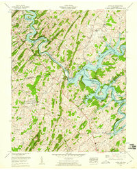 1959 Boone Dam1960 Print · USGSSullivan and Washington Counties are captured in a period of major change as the TVA dam projects reshaped the Holston Valley. Researchers can trace family roots at Hales Chapel, explore the early footprint of Tri-City Airport, or locate the submerged bends of the Watauga River.3 unique versions available
 - 1959 Map of Kingsport, 1960 Print
 1959 Kingsport1960 Print · USGSKingsport and its surrounding river valleys reached a peak of industrial development and suburban growth during the late fifties. Researchers can trace family roots through numerous local sites like Oak Hill Cem, Lynn View High School, and the historic Fort Robinson.6 unique versions available
 - 1959 Map of Indian Springs, 1961 Print
 1959 Indian Springs1961 Print · USGSSullivan County at the close of the 1950s shows a landscape of ridge-top farms and growing valley suburbs along the Virginia Tennessee border. Genealogists can locate family landmarks like Pettyjohn Mill, Huddle Mill, and numerous cemeteries including Hickman Cem and Baker Cem.5 unique versions available
 - 1959 Map of Sullivan Gardens, 1962 Print
 1959 Sullivan Gardens1962 Print · USGSSullivan County and Washington County meet here during the late fifties, where the river landscape was being reshaped by modern infrastructure. Researchers can locate dozens of family burial sites like Easley Cem and early landmarks such as Kincheloe Mill and Pactolus Ch.3 unique versions available
 - 1960 Map of Johnson City
 1960 Johnson City1960 Print · USGSUpper East Tennessee and the surrounding tri-state area are shown in the mid-fifties during the height of the TVA reservoir era. Trace the industrial rail lines of the Southern and Louisville and Nashville between Kingsport and Johnson City.
 - 1963 Map of Johnson City
 1963 Johnson City1963 Print · USGSThe Tri-Cities and the surrounding Appalachian ridges are shown in detail during the early sixties, highlighting the era's vital rail and river networks. Genealogists and historians can trace the routes of the Clinchfield RR and locate settlements from Rogersville to Elizabethton.
 - 1980 Map of Johnson City, 1981 Print
 1980 Johnson City1981 Print · USGSEast Tennessee in the early eighties shows a landscape of mountain ridges and growing valley towns. Trace local history through Washington College and the Andrew Johnson National Cemetery, or find sites like David Crockett Birthplace State Park.
 - 1981 Map of Bristol
 1981 Bristol1981 Print · USGSAppalachia and the Tri-Cities region are shown at a peak of industrial and rail development in the early eighties. Researchers can trace the Clinchfield Railroad through the mountains or find local landmarks like King College and the Holston Army Ammunition Plant.2 unique versions available
End of results
Showing maps 1-25 of 25
Top cities near Colonial Heights
- Johnson City historical maps
- Kingsport historical maps
- Bristol historical maps
- Elizabethton historical maps
- Bloomingdale historical maps
- Church Hill historical maps
See more
Top neighborhoods of Colonial Heights
- Summer Hills historical maps
- Blue Ridge Estates historical maps
- Colonial Acres historical maps
- Deerfield historical maps
- Hemlock historical maps
- Lake Crest historical maps
See more
Frequently asked questions
- What are the different types of historical maps available for Colonial Heights?
- What is the oldest map of Colonial Heights?
- Where can I purchase historical maps of Colonial Heights for my home or office?
- Where can I download high-res historical maps of Colonial Heights?
- Are there historical topographic maps available for Colonial Heights?
- Is there historical aerial imagery available for Colonial Heights?
- Where are historical maps of Colonial Heights sourced from?