Old Maps of Maynardville, Tennessee for Hiking & Exploration
Hike through history with 25 historic maps of Maynardville. Explore old trails, ghost towns, and forgotten backroads — perfect for outdoor adventurers and local explorers.
- Rediscover forgotten places: Map out old mining camps, roads, and footpaths that no longer exist on modern maps.
- Layer with modern tools: Combine with LiDAR or satellite views to plan hikes through historical terrain.
- Made for exploration: Popular among hikers, overlanders, and local history lovers.
Use these maps to find adventure and explore the hidden past of Maynardville.
Maynardville, TN maps
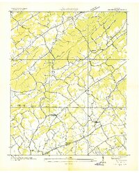
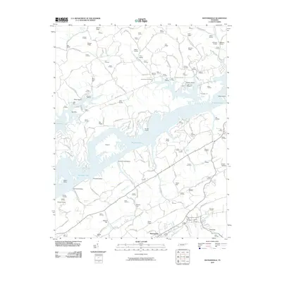
(25)- 1897 Map of Maynardville
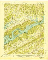
 1897 Maynardville1897 Print · USGSEast Tennessee in the late nineteenth century was a landscape of high ridges and vital river fords. Genealogists and historians can trace old homesteads and transit hubs like Nances Ferry, the Lead Mine at New Prospect, and Massongills Mill.
 - 1900 Map of Maynardville
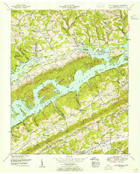
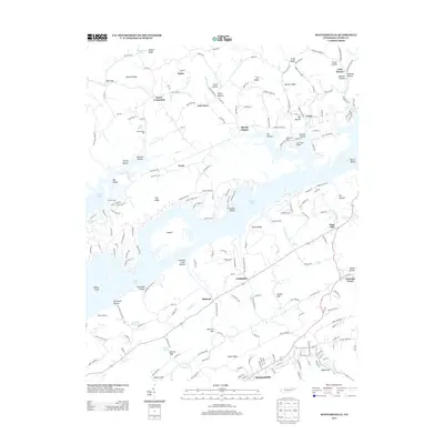
 1900 Maynardville1900 Print · USGSEast Tennessee was a world of river fords and mountain gaps at the turn of the century, dominated by the winding Clinch and Powell rivers. Genealogists can trace family roots through specific landmarks like Massongills Mill, Church Grove, and Sharps Chapel.4 unique versions available
 - 1935 Map of Graveston
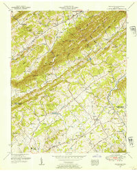
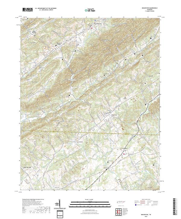
 1935 Graveston1935 Print · USGSEastern Tennessee in the mid-1930s was a landscape of small schools and valley settlements centered around Maynardville and Corryton. Genealogists and historians can trace family roots through landmarks like Millers Chapel, the Graveston Mill Pond, and Plain View Sch.
 - 1936 Map of Gorryton
 1936 Gorryton1936 Print · USGSNortheast of Knoxville in the mid-1930s, the landscape was being reshaped by the newly flooded Norris Reservoir. Genealogists and historians can trace numerous rural landmarks, including Welch Mill, Big Ridge Park Cemetery, and the Southern Railway corridor.
 - 1936 Map of Mc Lean Rock
 1936 Mc Lean Rock1936 Print · USGSUnion and Claiborne counties appear just as the Tennessee Valley Authority was reshaping the land in the mid-1930s. Researchers can locate family roots at Rose Hill Ch & Cem, trace the early operations of Lead Mine, or find the historic Speedwell Academy.
 - 1936 Map of Maynardville
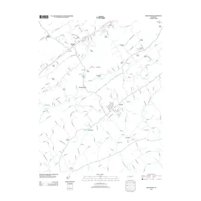
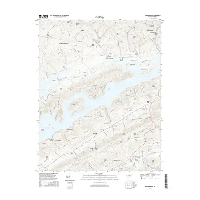
 1936 Maynardville1936 Print · USGSIn the mid-1930s, the rising waters of Norris Reservoir began reshaping Union County. Genealogists and local historians can trace family land and community landmarks like Berry Peter Mill, Lickskillet, and Big Barren Cem.
 - 1941 Map of Graveston
 1941 Graveston1941 Print · USGSNortheast of Knoxville in the early 1940s, these ridge-and-valley communities remained oriented around local schools and the Southern railroad line. Genealogists can trace family landmarks like Ailor Cem, the Graveston Mill Pond, and Little Flat Creek Ch.2 unique versions available
 - 1941 Map of Maynardville
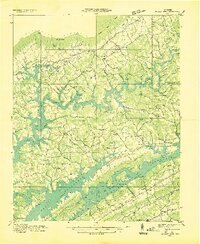
 1941 Maynardville1941 Print · USGSUnion County during the transformative early years of the TVA project shows a landscape of traditional settlements meeting new infrastructure. Researchers can trace family history at the Berry Peters Mill, Sharps Chapel, and dozens of burial sites like Lay Cem and Tharp Cem.
 - 1952 Map of Maynardville, 1954 Print
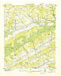
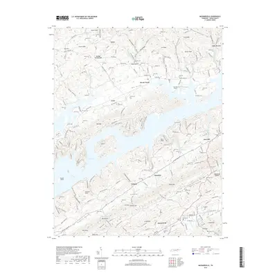
 1952 Maynardville1954 Print · USGSMaynardville and the surrounding Tennessee valleys are captured here during the early 1950s, a time when the landscape was adapting to the creation of NORRIS LAKE. Genealogists and historians can trace family roots through numerous sites like the Berry-Peters Mill, Ellisons Store, and the Pleasant View Church.3 unique versions available
 - 1952 Map of Graveston, 1954 Print
 1952 Graveston1954 Print · USGSUnion and Knox Counties are shown in the early fifties as the rural landscape of East Tennessee maintained its tight-knit network of ridge-side farms and rail-line towns. Genealogists can trace family names across dozens of sites like the Alder Springs Cemetery, Bullrun School, and the community of Corryton.4 unique versions available
 - 1955 Map of Johnson City
 1955 Johnson City1955 Print · USGSEast Tennessee and the bordering highlands of Virginia and Kentucky appear here during the post-war industrial boom. You can trace the complex network of mountain ridges and new TVA lakes, from Johnson City to the coalfields near Middlesboro and Lynch.
 - 1957 Map of Johnson City, 1966 Print
 1957 Johnson City1966 Print · USGSUpper East Tennessee and Southwest Virginia are shown here during the mid-sixties transition of the Appalachians. Researchers can trace the industrial rail hubs of Kingsport, the sprawling waters of Cherokee Lake, and the historic Cumberland Gap.
 - 1960 Map of Johnson City
 1960 Johnson City1960 Print · USGSUpper East Tennessee and the surrounding tri-state area are shown in the mid-fifties during the height of the TVA reservoir era. Trace the industrial rail lines of the Southern and Louisville and Nashville between Kingsport and Johnson City.
 - 1963 Map of Johnson City
 1963 Johnson City1963 Print · USGSThe Tri-Cities and the surrounding Appalachian ridges are shown in detail during the early sixties, highlighting the era's vital rail and river networks. Genealogists and historians can trace the routes of the Clinchfield RR and locate settlements from Rogersville to Elizabethton.
 - 1981 Map of Morristown
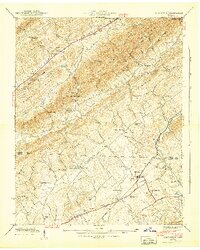
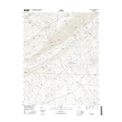
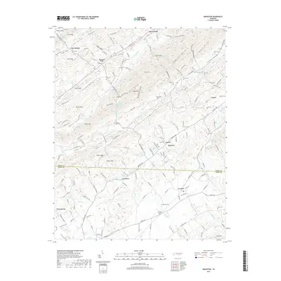
 1981 Morristown1981 Print · USGSEast Tennessee's ridge-and-valley corridor is captured here in the early eighties, showing the region's transformation by TVA reservoirs. Genealogists and historians can trace family locations near Alpha Ch, follow the Southern Railway, or locate the Young Mine.
 - 2010 Map of Graveston, 2010 Print
 2010 Graveston2010 Print · USGSCovers Maynardville, including Plainview, Luttrell, and other nearby areas
 - 2010 Map of Maynardville, 2010 Print
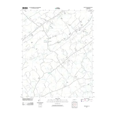
 2010 Maynardville2010 Print · USGSCovers Maynardville, including Oak Grove, Dykes, and other nearby areas
 - 2013 Map of Maynardville, 2013 Print
 2013 Maynardville2013 Print · USGSCovers Maynardville, including Oak Grove, Dykes, and other nearby areas
 - 2013 Map of Graveston, 2013 Print
 2013 Graveston2013 Print · USGSCovers Maynardville, including Plainview, Luttrell, and other nearby areas
 - 2016 Map of Graveston, 2016 Print
 2016 Graveston2016 Print · USGSCovers Maynardville, including Plainview, Luttrell, and other nearby areas
 - 2016 Map of Maynardville, 2016 Print
 2016 Maynardville2016 Print · USGSCovers Maynardville, including Oak Grove, Dykes, and other nearby areas
 - 2019 Map of Graveston, 2019 Print
 2019 Graveston2019 Print · USGSCovers Maynardville, including Plainview, Luttrell, and other nearby areas
 - 2019 Map of Maynardville, 2019 Print
 2019 Maynardville2019 Print · USGSCovers Maynardville, including Oak Grove, Dykes, and other nearby areas
 - 2022 Map of Graveston, 2022 Print
 2022 Graveston2022 Print · USGSEastern Tennessee valley life comes into focus as the communities of Maynardville and Corryton bridge the Union and Knox County line. Trace family roots across dozens of burial sites like Rockydale Cem or landmarks such as the Union County Courthouse.
 - 2022 Map of Maynardville, 2022 Print
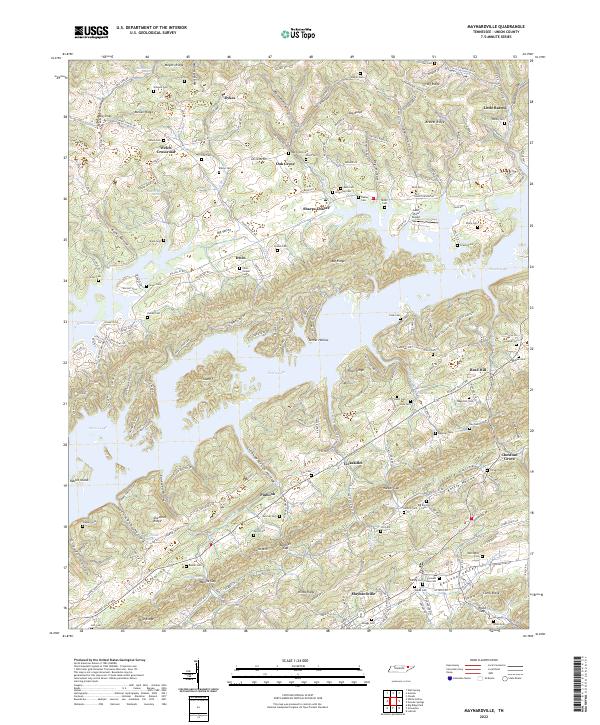 2022 Maynardville2022 Print · USGSMaynardville and the surrounding Union County ridges are shown here as they appeared in the early twenty-first century. Genealogists can trace family heritage through dozens of sites like Graves Cem and Irwin Chapel Cem, or explore the unique geography of Norris Lake.
End of results
Showing maps 1-25 of 25
Top cities near Maynardville
- Knoxville historical maps
- Powell historical maps
- Halls Crossroads historical maps
- New Tazewell historical maps
- Mascot historical maps
- Strawberry Plains historical maps
See more
Top neighborhoods of Maynardville
Frequently asked questions
- What are the different types of historical maps available for Maynardville?
- What is the oldest map of Maynardville?
- Where can I purchase historical maps of Maynardville for my home or office?
- Where can I download high-res historical maps of Maynardville?
- Are there historical topographic maps available for Maynardville?
- Is there historical aerial imagery available for Maynardville?
- Where are historical maps of Maynardville sourced from?