2020s Maps of Clifton, Tennessee
Explore 4 historic maps of Clifton from the 2020s. These maps offer a rare glimpse into what life looked like during the 2020s — showing old roads, neighborhoods, homes, and landmarks that have changed or disappeared over time.
Whether you're researching your family's past, planning a metal detecting trip, or studying how Clifton's landscape evolved across the 2020s, these high-resolution maps are a powerful tool for exploring the history of this region.
- Focus on a specific era: All maps on this page are from the 2020s, giving you a focused view of this time period.
- See what’s changed: Compare century-old streets, trails, and buildings to today's modern landscape using overlays and satellite layers.
- Research with precision: Use these maps for genealogy, historical research, land use analysis, or educational projects.
- View, download, or print: Maps are fully viewable online in high resolution, and can be downloaded or printed for your own records.
Start exploring Clifton's history through authentic maps from the 2020s. This is your window into the past.
Clifton, TN maps
(4)- 2022 Map of Eagle Creek, 2022 Print
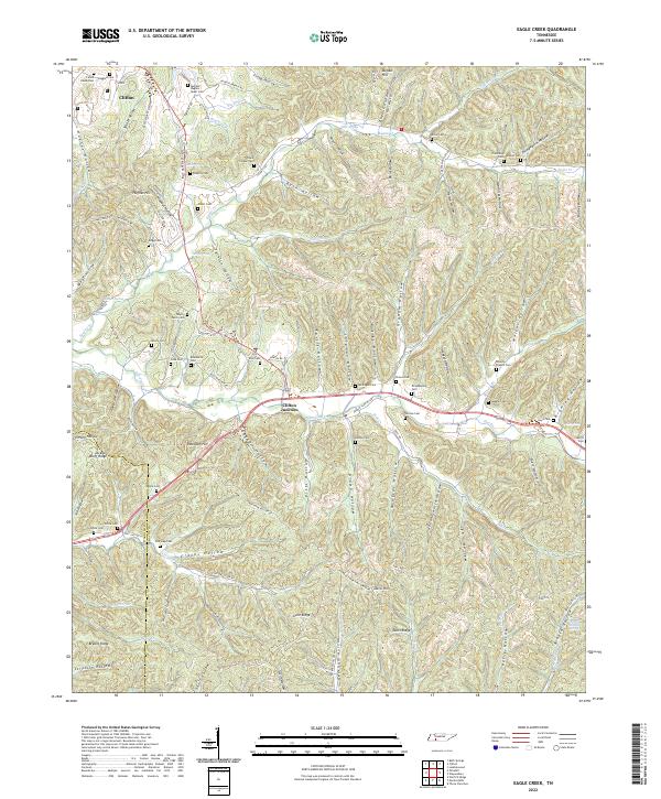 2022 Eagle Creek2022 Print · USGSModern-day Wayne County and Hardin County maintain their rural character across a terrain of ridges and deep hollows. Genealogists can trace family heritage at Evans Chapel Cem, Philadelphia Cem, and along Hardin Cr.
 - 2022 Map of Clifton, 2022 Print
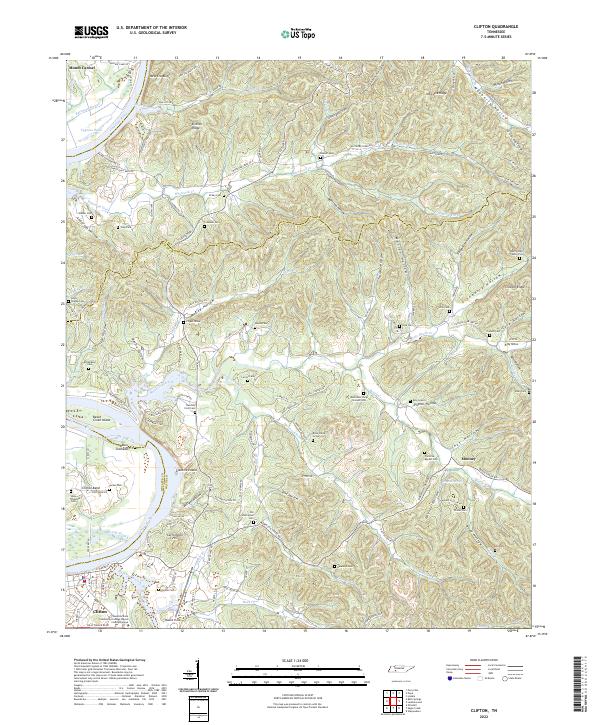 2022 Clifton2022 Print · USGSThe Tennessee River bend at Clifton is captured here in the early twenty-first century, showcasing a landscape of deep hollows and historic riverfront settlements. Researchers can trace numerous family burial sites and landmarks like the Henry Culp Family Plot, Carrollville Hill, and Glenkirk Island.
 - 2022 Map of Bath Springs, 2022 Print
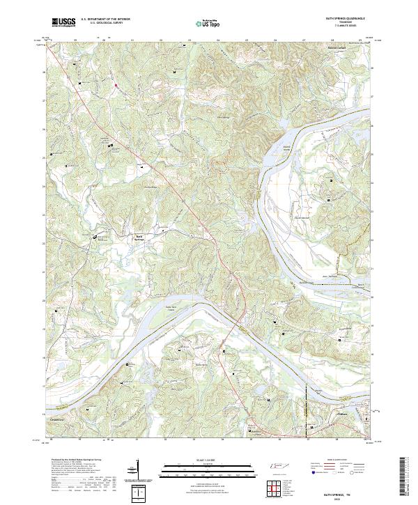 2022 Bath Springs2022 Print · USGSThe Tennessee River valley at the Decatur and Hardin county line comes alive in this 2022 survey. Genealogists can trace family names across dozens of sites including Slater Cem, Lott Landing Cem, and the historic Bath Springs Baptist Church.
 - 2022 Map of Olivehill, 2022 Print
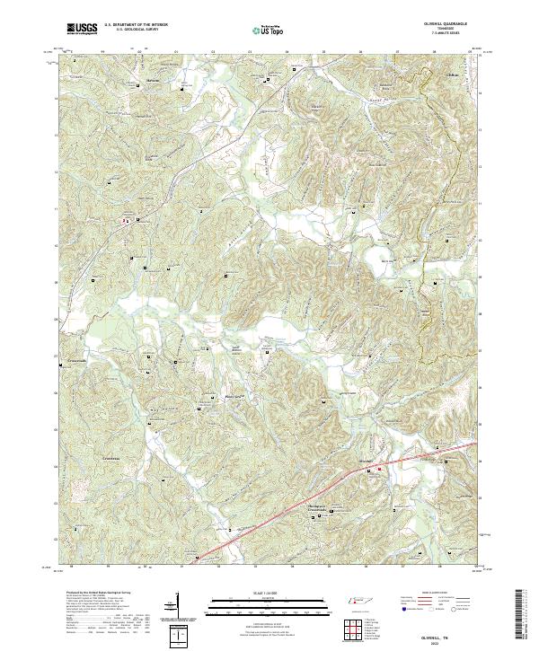 2022 Olivehill2022 Print · USGSEastern Hardin County life is centered around the creek valleys and hollows of Olivehill and Clifton. Genealogists can trace family names through the Dillon Farm Cem, Havana Church, and the Northcutt Elementary school grounds.
End of results
Showing maps 1-4 of 4
Top cities near Clifton
- Savannah historical maps
- Waynesboro historical maps
- Linden historical maps
- Decaturville historical maps
- Saltillo historical maps
Frequently asked questions
- What are the different types of historical maps available for Clifton?
- What is the oldest map of Clifton?
- Where can I purchase historical maps of Clifton for my home or office?
- Where can I download high-res historical maps of Clifton?
- Are there historical topographic maps available for Clifton?
- Is there historical aerial imagery available for Clifton?
- Where are historical maps of Clifton sourced from?