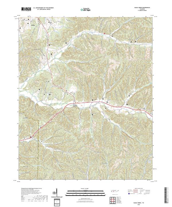
2022 Map of Eagle Creek
USGS Topo · Published 2022About this map
The hills of eastern Wayne County and neighboring Hardin County are defined by a complex network of hollows and ridges flanking Eagle Cr and Hardin Cr. Near the community of Clifton, the landscape is heavily marked by family-named landmarks and local burial sites, such as the Benham - Hughes - Speer Cem and Lizard Glade Cem. The road network, including the historic Toll Gate Pike, connects these remote reaches to Clifton Junction, where transportation routes converge along the dissected plateau.
Find a feature on this map
121 named features on this map. Tap any name to fly to it.
Don’t see what you’re looking for? This feature index may not catch every label — zoom into the map to look around manually.
Map Details
Editions of this 2022 Eagle Creek Map
This is the sole edition of this map. No revisions or reprints were ever made.
Other maps of this area

1905 · Waynesboro
USGS Topo · 1:125,000

1936 · Wolf Pit Ridge
USGS Topo · 1:24,000

1936 · Eagle Creek
USGS Topo · 1:24,000

1936 · Olivehill
USGS Topo · 1:24,000

1936 · Bath Springs
USGS Topo · 1:24,000

1936 · Leatherwood
USGS Topo · 1:24,000

1936 · Clifton
USGS Topo · 1:24,000

1936 · Three Churches
USGS Topo · 1:24,000

1936 · Waynesboro
USGS Topo · 1:24,000

1936 · Martins Mills
USGS Topo · 1:24,000