1950s Maps of Brentwood, Tennessee
Explore 6 historic maps of Brentwood from the 1950s. These maps offer a rare glimpse into what life looked like during the 1950s — showing old roads, neighborhoods, homes, and landmarks that have changed or disappeared over time.
Whether you're researching your family's past, planning a metal detecting trip, or studying how Brentwood's landscape evolved across the 1950s, these high-resolution maps are a powerful tool for exploring the history of this region.
- Focus on a specific era: All maps on this page are from the 1950s, giving you a focused view of this time period.
- See what’s changed: Compare century-old streets, trails, and buildings to today's modern landscape using overlays and satellite layers.
- Research with precision: Use these maps for genealogy, historical research, land use analysis, or educational projects.
- View, download, or print: Maps are fully viewable online in high resolution, and can be downloaded or printed for your own records.
Start exploring Brentwood's history through authentic maps from the 1950s. This is your window into the past.
Brentwood, TN maps
(6)- 1952 Map of Antioch, 1954 Print
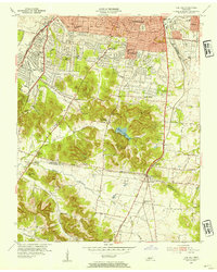
 1952 Antioch1954 Print · USGSIn the early fifties, southeast Davidson County was a landscape of expanding rail hubs and rural crossroads. Researchers can trace the layout of Radnor yards, the original Nashville Municipal Airport (Berry Field), and community landmarks like Antioch and Whitsetts Cem.2 unique versions available
 - 1953 Map of Oak Hill, 1954 Print
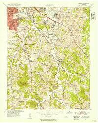
 1953 Oak Hill1954 Print · USGSSouth of Nashville in the early fifties, this area shows a landscape of growing suburbs and institutional landmarks before the interstate era. Genealogists and historians can trace family locations near Woodlawn Cem, Robertson Academy, and Brentwood Sta.2 unique versions available
 - 1956 Map of Columbia, 1960 Print
 1956 Columbia1960 Print · USGSMiddle Tennessee in the mid-fifties presents a landscape of established river towns and critical rail hubs before the arrival of the modern interstate system. Researchers can trace the routes of the Louisville and Nashville railroad or locate historic landmarks like Stones River National Military Park and the Tennessee National Wildlife Refuge.6 unique versions available
 - 1956 Map of Nashville, 1971 Print
 1956 Nashville1971 Print · USGSThe Tennessee-Kentucky borderlands come into focus in the mid-1960s as major reservoir projects transformed the Cumberland and Tennessee river valleys. Researchers can trace the rail networks of the Louisville and Nashville and visit sites like Fort Campbell and Fort Donelson National Military Park.2 unique versions available
 - 1957 Map of Nolensville, 1958 Print
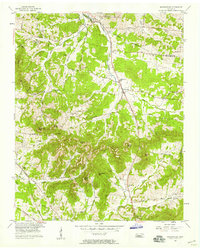 1957 Nolensville1958 Print · USGSMid-century Williamson and Davidson Counties reveal a landscape of family farms and rural churches before modern development. Genealogists can trace ancestral ties through Battle Cem, Pettus Cem, and community centers like Nolensville School.4 unique versions available
 - 1959 Map of Nashville
 1959 Nashville1959 Print · USGSMiddle Tennessee and Southern Kentucky come into focus during the late fifties, showing the region's transition into a modern transportation and military hub. Researchers can trace the sprawling Fort Campbell Military Reservation or locate historic rail stops along the Tennessee Central Ry and Illinois Central RR.
End of results
Showing maps 1-6 of 6
Top cities near Brentwood
- Nashville historical maps
- Murfreesboro historical maps
- Franklin historical maps
- Smyrna historical maps
- Spring Hill historical maps
- La Vergne historical maps
See more
Top neighborhoods of Brentwood
- Murray Estates historical maps
- Brentwood Estates historical maps
- Brentwood Park historical maps
- Dekemont Downs historical maps
- Cambridge Hills historical maps
- Laurel Wood Estates historical maps
See more
Frequently asked questions
- What are the different types of historical maps available for Brentwood?
- What is the oldest map of Brentwood?
- Where can I purchase historical maps of Brentwood for my home or office?
- Where can I download high-res historical maps of Brentwood?
- Are there historical topographic maps available for Brentwood?
- Is there historical aerial imagery available for Brentwood?
- Where are historical maps of Brentwood sourced from?