2020s Maps of Amarillo, Texas
Explore 8 historic maps of Amarillo from the 2020s. These maps offer a rare glimpse into what life looked like during the 2020s — showing old roads, neighborhoods, homes, and landmarks that have changed or disappeared over time.
Whether you're researching your family's past, planning a metal detecting trip, or studying how Amarillo's landscape evolved across the 2020s, these high-resolution maps are a powerful tool for exploring the history of this region.
- Focus on a specific era: All maps on this page are from the 2020s, giving you a focused view of this time period.
- See what’s changed: Compare century-old streets, trails, and buildings to today's modern landscape using overlays and satellite layers.
- Research with precision: Use these maps for genealogy, historical research, land use analysis, or educational projects.
- View, download, or print: Maps are fully viewable online in high resolution, and can be downloaded or printed for your own records.
Start exploring Amarillo's history through authentic maps from the 2020s. This is your window into the past.
Amarillo, TX maps
(8)- 2022 Map of Amarillo East, 2022 Print
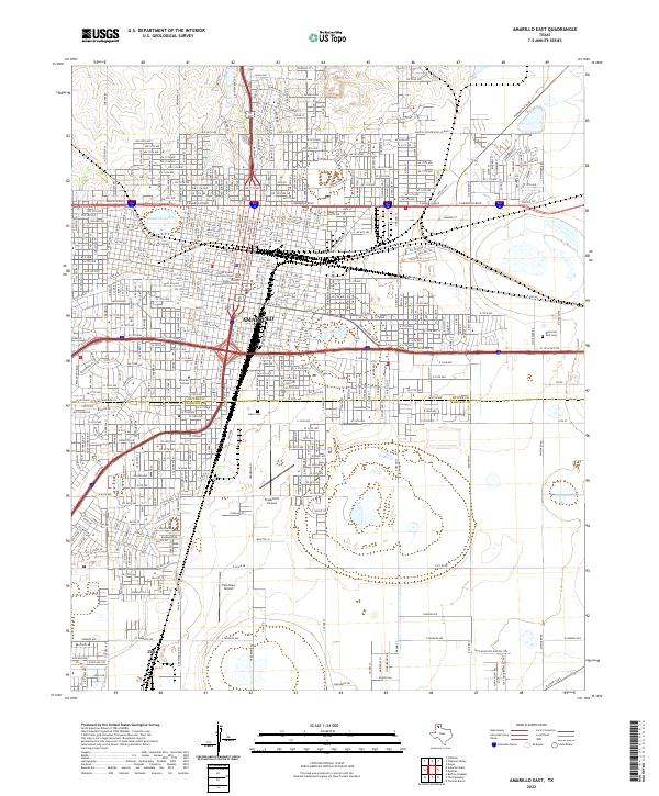 2022 Amarillo East2022 Print · USGSThe High Plains city of Amarillo is shown at its modern extent, centered on the civic architecture and sprawling neighborhoods of the Texas Panhandle. Researchers can locate the Potter County Courthouse, trace the grounds of Llano Cem, and see the early-settled area of Zita.
 - 2022 Map of Pullman, 2022 Print
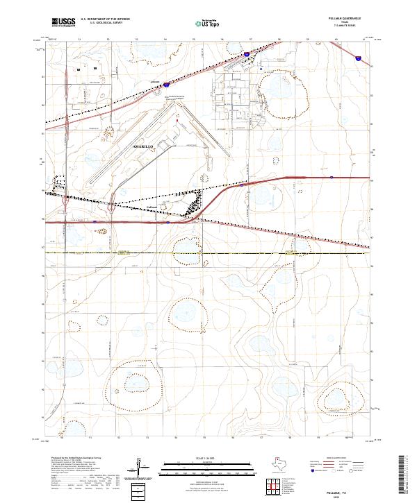 2022 Pullman2022 Print · USGSThe eastern edges of the Texas Panhandle are captured here during a period of steady growth along the county line. Researchers can trace the layout of Amarillo and the Rick Husband Amarillo International Airport alongside rural routes like Juett Atterbury Rd and S Masterson Rd.
 - 2022 Map of Cliffside, 2022 Print
 2022 Cliffside2022 Print · USGSThe High Plains meet the canyon breaks northwest of Amarillo in the 2020s, showing a mix of established ranchlands and modern residential expansion. Researchers can find Townsend Cem and trace the paths of West Amarillo Creek and Brickplant Rd.
 - 2022 Map of Mayer, 2022 Print
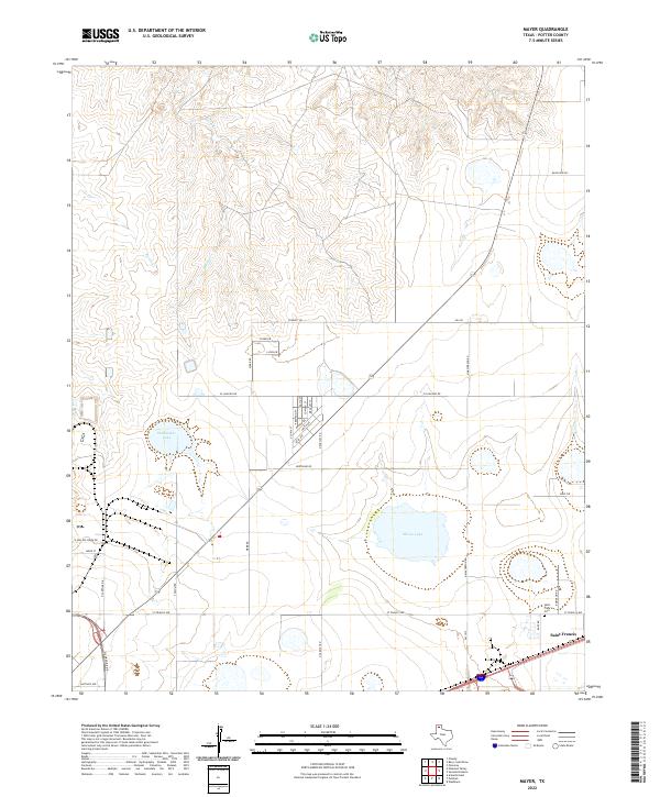 2022 Mayer2022 Print · USGSThe High Plains of Potter County are shown here in the modern era as residential clusters emerge near the settlement of Saint Francis. Genealogists and local historians can trace family locations near Saint Francis Cem or along Stalanaker Lake and Bonita Cr.
 - 2022 Map of The Palisades, 2022 Print
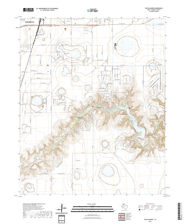 2022 The Palisades2022 Print · USGSThe canyonlands south of Amarillo are captured in this modern survey, showing the residential growth surrounding Palo Duro Canyon. Researchers can trace the development of The Palisades and the shoreline of Lake Tanglewood alongside landmarks like Blue Sky Airfield.
 - 2022 Map of Buffalo Stadium, 2022 Print
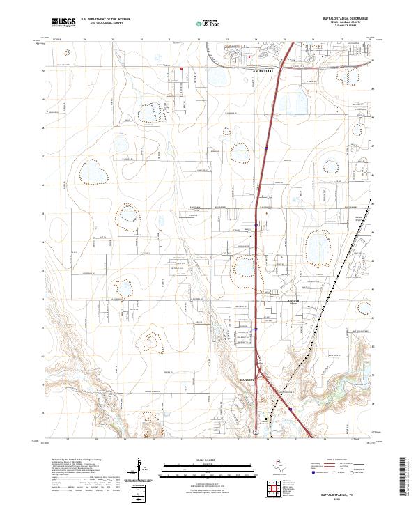 2022 Buffalo Stadium2022 Print · USGSRandall County's southern expansion is visible in this recent study of the corridor between two major West Texas hubs. Trace local developments and landmarks like Rockwell Place, Buffalo Airport, and the Memory Gardens Cem near the fork of the Red River.
 - 2022 Map of Pleasant Valley, 2022 Print
 2022 Pleasant Valley2022 Print · USGSThe northern outskirts of Amarillo and the community of Pleasant Valley are captured here as they appeared in 2022. Researchers can trace the development of the suburban grid into the creek-cut plains near Gluck, Juilliard, and along Indian Creek.
 - 2023 Map of Amarillo West, 2023 Print
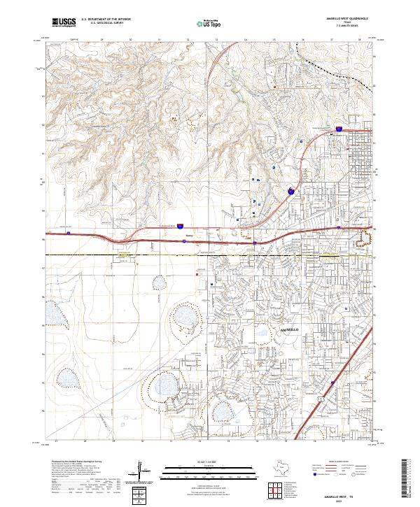 2023 Amarillo West2023 Print · USGSThe western edge of Amarillo is captured in this recent survey, showcasing the city's suburban growth into Potter and Randall counties. Trace the modern road network around Soncy, find landmarks like the Saint Peters Episcopal Church Columbarium, and follow West Amarillo Creek.
End of results
Showing maps 1-8 of 8
Top cities near Amarillo
- Canyon historical maps
- Lake Tanglewood historical maps
- Timbercreek Canyon historical maps
- Palisades historical maps
- Bishop Hills historical maps
Top neighborhoods of Amarillo
- Dumas Junction historical maps
- Pleasant Valley historical maps
- Pullman historical maps
- Bivins Addition historical maps
- Route 66 Historic District historical maps
Frequently asked questions
- What are the different types of historical maps available for Amarillo?
- What is the oldest map of Amarillo?
- Where can I purchase historical maps of Amarillo for my home or office?
- Where can I download high-res historical maps of Amarillo?
- Are there historical topographic maps available for Amarillo?
- Is there historical aerial imagery available for Amarillo?
- Where are historical maps of Amarillo sourced from?