2020s Maps of Lufkin, Texas
Explore 3 historic maps of Lufkin from the 2020s. These maps offer a rare glimpse into what life looked like during the 2020s — showing old roads, neighborhoods, homes, and landmarks that have changed or disappeared over time.
Whether you're researching your family's past, planning a metal detecting trip, or studying how Lufkin's landscape evolved across the 2020s, these high-resolution maps are a powerful tool for exploring the history of this region.
- Focus on a specific era: All maps on this page are from the 2020s, giving you a focused view of this time period.
- See what’s changed: Compare century-old streets, trails, and buildings to today's modern landscape using overlays and satellite layers.
- Research with precision: Use these maps for genealogy, historical research, land use analysis, or educational projects.
- View, download, or print: Maps are fully viewable online in high resolution, and can be downloaded or printed for your own records.
Start exploring Lufkin's history through authentic maps from the 2020s. This is your window into the past.
Lufkin, TX maps
(3)- 2022 Map of Lufkin, 2022 Print
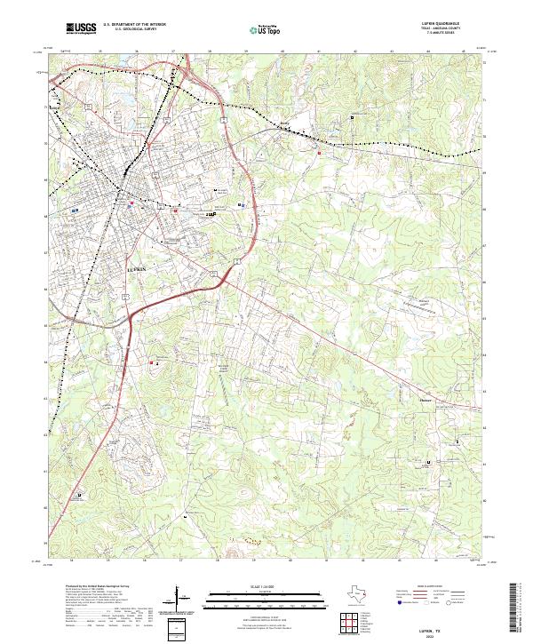 2022 Lufkin2022 Print · USGSLufkin and its surrounding East Texas communities are captured here in the early 2020s, showing a landscape defined by collegiate growth and civic history. Trace family roots at Garden of Memories Cem or Homer Cem, and locate landmarks like the Angelina County Courthouse.
 - 2022 Map of Redland, 2022 Print
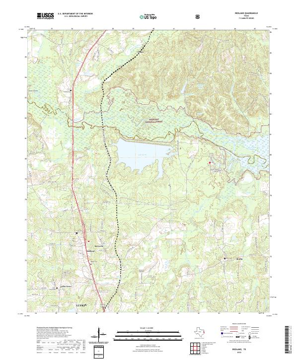 2022 Redland2022 Print · USGSThe Angelina River basin north of Lufkin shows a landscape of dense national forest and vital water resources in the early 2020s. Genealogists and historians can locate family burial sites like Walker Cem and trace the proximity of Redland to Lake Kurth.
 - 2022 Map of Keltys, 2022 Print
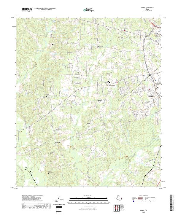 2022 Keltys2022 Print · USGSThe northern outskirts of Lufkin and surrounding rural Angelina County are captured in this modern survey. Genealogists can trace family burial sites at Old Union Cem, Narraway Cem, or the small settlements of Peavy and Keltys.
End of results
Showing maps 1-3 of 3
Top cities near Lufkin
- Diboll historical maps
- Hudson historical maps
- Huntington historical maps
- Redland historical maps
- Wells historical maps
- Burke historical maps
Top neighborhoods of Lufkin
Frequently asked questions
- What are the different types of historical maps available for Lufkin?
- What is the oldest map of Lufkin?
- Where can I purchase historical maps of Lufkin for my home or office?
- Where can I download high-res historical maps of Lufkin?
- Are there historical topographic maps available for Lufkin?
- Is there historical aerial imagery available for Lufkin?
- Where are historical maps of Lufkin sourced from?