2020s Maps of Pleasanton, Texas
Explore 3 historic maps of Pleasanton from the 2020s. These maps offer a rare glimpse into what life looked like during the 2020s — showing old roads, neighborhoods, homes, and landmarks that have changed or disappeared over time.
Whether you're researching your family's past, planning a metal detecting trip, or studying how Pleasanton's landscape evolved across the 2020s, these high-resolution maps are a powerful tool for exploring the history of this region.
- Focus on a specific era: All maps on this page are from the 2020s, giving you a focused view of this time period.
- See what’s changed: Compare century-old streets, trails, and buildings to today's modern landscape using overlays and satellite layers.
- Research with precision: Use these maps for genealogy, historical research, land use analysis, or educational projects.
- View, download, or print: Maps are fully viewable online in high resolution, and can be downloaded or printed for your own records.
Start exploring Pleasanton's history through authentic maps from the 2020s. This is your window into the past.
Pleasanton, TX maps
(3)- 2022 Map of Jourdanton, 2022 Print
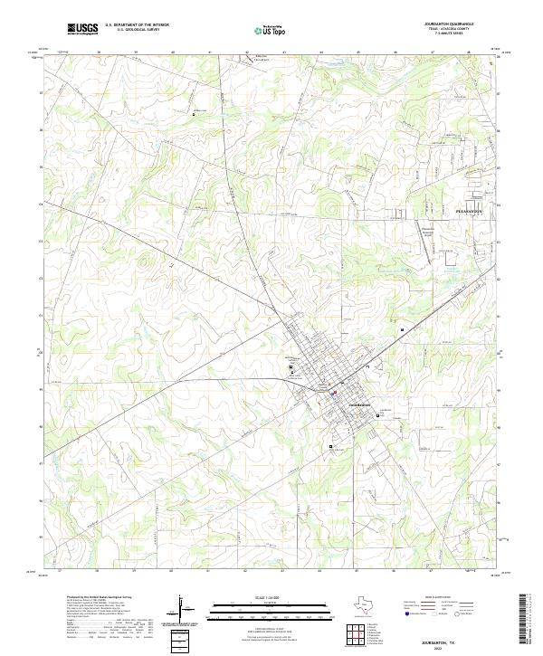 2022 Jourdanton2022 Print · USGSJourdanton and Pleasanton sit at the heart of this Atascosa County landscape during its recent period of growth. Genealogists and historians can locate family burial plots at Jourdanton City Cem or San Jose Cem and trace the civic hub near the Atascosa County Courthouse.
 - 2022 Map of Pleasanton, 2022 Print
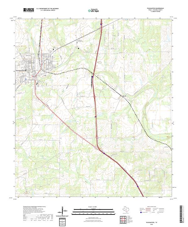 2022 Pleasanton2022 Print · USGSPleasanton and the Atascosa River valley appear here in the early 2020s, showcasing a landscape shaped by both modern growth and deep-rooted Texas history. Genealogists can locate numerous local burial sites including Sotelo Cem, San Ysidro Cem, and Saint Andrews Cem.
 - 2022 Map of Leming, 2022 Print
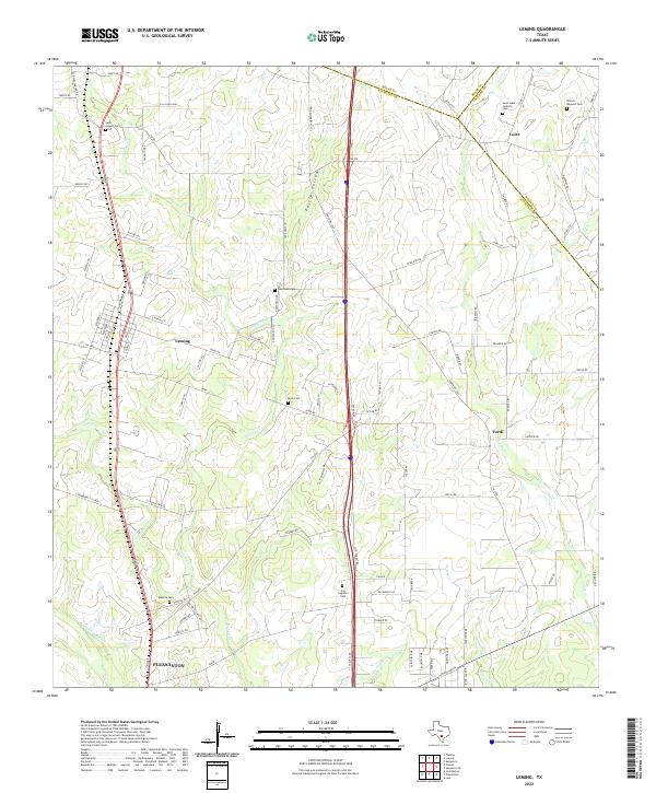 2022 Leming2022 Print · USGSAtascosa County ranching country is mapped in the modern era, showing the enduring footprints of small communities and family landholdings. Researchers can locate numerous local landmarks such as Saint Luke Catholic Cem, Purtle Hollow, and the settlement of Verdi.
End of results
Showing maps 1-3 of 3
Top cities near Pleasanton
- San Antonio historical maps
- Jourdanton historical maps
- Poteet historical maps
- Charlotte historical maps
- Leming historical maps
- Christine historical maps
Frequently asked questions
- What are the different types of historical maps available for Pleasanton?
- What is the oldest map of Pleasanton?
- Where can I purchase historical maps of Pleasanton for my home or office?
- Where can I download high-res historical maps of Pleasanton?
- Are there historical topographic maps available for Pleasanton?
- Is there historical aerial imagery available for Pleasanton?
- Where are historical maps of Pleasanton sourced from?