Old Maps of Borden County, Texas for Metal Detecting
Plan your next treasure hunt with 123 historic maps of Borden County. Find old homesites, ghost towns, trails, and gathering spots that may be lost to time — perfect for identifying promising metal detecting locations.
- Locate forgotten sites: Uncover places like long-lost settlements, abandoned rail lines, or gathering spots.
- Plan better hunts: Use map overlays combined with LiDAR or satellite views to narrow in on historically rich areas.
- Made for detectorists: Thousands of hobbyists use these maps to discover relics, coins, and hidden history.
Use these historic maps to boost your research and find new opportunities beneath the surface of Borden County.
Borden County, TX maps
(123)- 1951 Map of Ira SW
 1951 Ira SW1951 Print · USGSTexas ranching and early petroleum development meet in the early 1950s where four counties converge. Trace the landscape of the Conrad Ranch, find the Colorado River, and locate industrial markers like the Oil Well and Oil Tanks.2 unique versions available
 - 1951 Map of Ira NW, 1953 Print
 1951 Ira NW1953 Print · USGSBorden and Scurry counties were at the height of a mid-century energy boom when this survey was completed. Researchers can trace the extensive early infrastructure of the Diamond M Oil Field or locate local landmarks like the Union Sch and the 9R Ranch.2 unique versions available
 - 1954 Map of Big Spring, 1965 Print
 1954 Big Spring1965 Print · USGSWest Texas in the mid-1950s shows a landscape of growing oil towns and vital rail links along the Texas and Pacific RR. Researchers can trace the development of Big Spring, find smaller settlements like Knott and Lomax, or locate landmarks such as Boyds Chapel and Signal Mountain.4 unique versions available
 - 1958 Map of Big Spring
 1958 Big Spring1958 Print · USGSThe West Texas oil boom was in full swing during the late fifties, transforming the landscape around Howard and Mitchell counties. Genealogists and historians can trace the growth of Big Spring and Snyder alongside industrial landmarks like the Kelly-Snyder Oil Field and the Santa Fe rail lines.
 - 1969 Map of Gail NE, 1971 Print
 1969 Gail NE1971 Print · USGSBorden and Garza counties in the late sixties show a landscape defined by the oil industry and ranching along the Double Mountain Fork Brazos River. Genealogists and historians can locate the Miller Ranch and trace Pipeline corridors near Sand Creek.2 unique versions available
 - 1969 Map of Arah, 1971 Print
 1969 Arah1971 Print · USGSThe borderlands of Borden and Scurry Counties are captured here in the late sixties, showing a landscape of ranching and early oil exploration. Genealogists can trace the Fluvanna Cem and York Cem or locate the small settlement of Arah.
 - 1969 Map of Beal Hollow, 1971 Print
 1969 Beal Hollow1971 Print · USGSBorden and Garza counties at the close of the 1960s show a landscape shaped by petroleum and ranching. Trace mid-century infrastructure like the Pumping Sta and pipelines alongside family-named landmarks like Beal Hollow and White Tank.
 - 1969 Map of Fluvanna, 1971 Print
 1969 Fluvanna1971 Print · USGSFluvanna and the high plains of Scurry and Borden counties are captured here in the late sixties as the local oil industry flourished. Researchers can trace the legacy of the Atchison Topeka and Santa Fe and locate the Fluvanna Cem near the Old Railroad Grade.
 - 1969 Map of Indian Canyon NE, 1971 Print
 1969 Indian Canyon NE1971 Print · USGSThe High Plains plateau gives way to the deep canyon breaks of Borden and Garza counties in the late sixties. Trace the ranching landscape around Dennis Ranch or follow the paths of Bull Creek and Salt Draw past early oil wells.
 - 1969 Map of Gail, 1972 Print
 1969 Gail1972 Print · USGSBorden County ranching and civic life come into focus in the late sixties as the community of Town sits at the foot of Gail Mountain. Researchers can trace local roots through the Gail Sch, Cem, and the ranching culture of the Flying D Ranch.
 - 1969 Map of Indian Canyon, 1972 Print
 1969 Indian Canyon1972 Print · USGSThe rugged canyons of the West Texas caprock are captured here in the late sixties as the oil industry expanded across the county line. Researchers can trace the winding Outlaw Road and locate remote sites like Mesquite or the Oil Wells tucked into Indian Canyon.
 - 1969 Map of Holloway Canyon, 1972 Print
 1969 Holloway Canyon1972 Print · USGSBorden County in the late sixties shows a landscape adapted for petroleum and cattle ranching during a period of steady industrial expansion. Genealogists and historians can trace local land use through features like Johnson Tank, the remote Landing Strip, and numerous Oil Wells.
 - 1969 Map of Fivemile Creek, 1972 Print
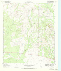 1969 Fivemile Creek1972 Print · USGSBorden County rangeland meets the mid-century oil patch in this late 1960s survey of the Texas plains. Trace the early industrial footprint of Oil Wells and Gravel Pits alongside natural landmarks like Five Mile and Bull Creek.
 - 1970 Map of Indian Canyon NW, 1971 Print
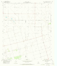 1970 Indian Canyon NW1971 Print · USGSTexas High Plains life in the early seventies centered on remote county line junctions and deep water wells. Genealogists and local historians can trace the rural landscape through Plain View Cem, the community at Plains, and Berry Flat Ch.
 - 1970 Map of Vealmoor, 1973 Print
 1970 Vealmoor1973 Print · USGSVealmoor sat at the heart of the Permian Basin's oil country in the 1970s, where Borden and Howard counties meet. Genealogists and researchers can trace local family landmarks and industrial sites from Vealmoor Cem to the sprawling Jo Mill Oil Field and the distinctive Outlaw Road.
 - 1970 Map of Mushaway Peak, 1973 Print
 1970 Mushaway Peak1973 Print · USGSBorden County ranching and water management are the focus of this West Texas study from the early seventies. Trace the livestock infrastructure of family-named landmarks like Cunningham Tank and Coats Tank or the high ground at Mushaway Peak.
 - 1970 Map of Ackerly, 1973 Print
 1970 Ackerly1973 Print · USGSAckerly and the surrounding High Plains are captured here in the early seventies, at the intersection of four Texas counties. Researchers can trace the layout of the Sands Sch, locate the Fairhaven Cem, and see the extent of the local Oil Field.
 - 1970 Map of Gunsight Draw, 1973 Print
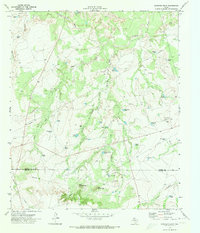 1970 Gunsight Draw1973 Print · USGSThis West Texas landscape at the start of the 1970s shows the ranching and energy infrastructure straddling the Borden and Howard County line. Researchers can trace land use through numerous named stock tanks like Bombsight Tank and the prominence of West Gunsight Mtn.
 - 1970 Map of Sand Creek, 1974 Print
 1970 Sand Creek1974 Print · USGSBorden County in the early seventies shows the footprint of the petroleum industry across the high plains breaks. Genealogists and researchers can locate remote sites like Wasson and Southard 2 while tracing the Colorado River and the winding Outlaw Road.
 - 1970 Map of Gunsight Draw NE, 1974 Print
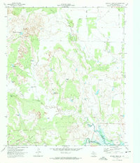 1970 Gunsight Draw NE1974 Print · USGSBorden County ranch lands and the upper reaches of the Colorado River are captured here in the early seventies. Genealogists and local historians can locate Durham Cem and trace livestock water sources like High Wide and Handsome Tank and Sams Tank.
 - 1970 Map of Gunsight Draw SE, 1974 Print
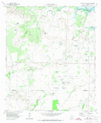 1970 Gunsight Draw SE1974 Print · USGSBorden and Howard Counties were defined by the intersection of the petroleum industry and cattle ranching in the early 1970s. Trace the growth of the Hobo Oil Field and Vincent Oil Field or locate rural landmarks like Fairview Cem and Cedar Point.
 - 1970 Map of Long Draw, 1974 Print
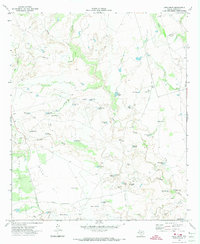 1970 Long Draw1974 Print · USGSBorden County ranching and petroleum production are at their peak in this early 1970s survey. Researchers can trace the water-dependent landscape of Muleshoe Ranch and the industrial layout of the Good Oil Field.
 - 1986 Map of Lamesa
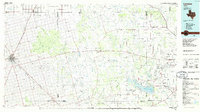 1986 Lamesa1986 Print · USGSWest Texas in the mid-eighties reveals a landscape of massive oil fields and cattle country where the High Plains drop off toward the Colorado River. Genealogists and historians can trace rail-side towns like O'Donnell and Fluvanna, or locate petroleum landmarks such as the Diamond M Oil Field and Jo Mill Oil Field.2 unique versions available
 - 2010 Map of Gunsight Draw SE, 2010 Print
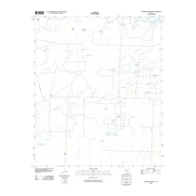 2010 Gunsight Draw SE2010 Print · USGSHoward County ranching and oil production are at the forefront of this early twenty-first-century survey near the Colorado River. Researchers can locate remote family-named landmarks and industrial sites like Fairview Cemetery, the Hobo Oil Field, and Mother-in-Law Tank.
 - 2010 Map of Mushaway Peak, 2010 Print
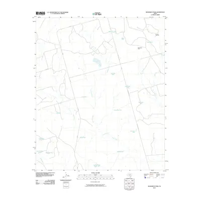 2010 Mushaway Peak2010 Print · USGSBorden County ranching country is documented in detail during the early 2000s, showing a landscape shaped by water and wire. Genealogists and historians can trace family-named water features and landmarks like Mushaway Peak, Edwards Lake Dam, and Bombsight Tank.
Showing maps 1-25 of 123
Top cities of Borden County
Frequently asked questions
- What are the different types of historical maps available for Borden County?
- What is the oldest map of Borden County?
- Where can I purchase historical maps of Borden County for my home or office?
- Where can I download high-res historical maps of Borden County?
- Are there historical topographic maps available for Borden County?
- Is there historical aerial imagery available for Borden County?
- Where are historical maps of Borden County sourced from?