1980s Maps of Briscoe County, Texas
Explore 10 historic maps of Briscoe County from the 1980s. These maps offer a rare glimpse into what life looked like during the 1980s — showing old roads, neighborhoods, homes, and landmarks that have changed or disappeared over time.
Whether you're researching your family's past, planning a metal detecting trip, or studying how Briscoe County's landscape evolved across the 1980s, these high-resolution maps are a powerful tool for exploring the history of this region.
- Focus on a specific era: All maps on this page are from the 1980s, giving you a focused view of this time period.
- See what’s changed: Compare century-old streets, trails, and buildings to today's modern landscape using overlays and satellite layers.
- Research with precision: Use these maps for genealogy, historical research, land use analysis, or educational projects.
- View, download, or print: Maps are fully viewable online in high resolution, and can be downloaded or printed for your own records.
Start exploring Briscoe County's history through authentic maps from the 1980s. This is your window into the past.
Briscoe County, TX maps
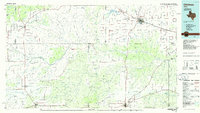
(10)- 1985 Map of Willow Arroyo
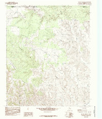 1985 Willow Arroyo1985 Print · USGSBriscoe County ranching lands in the mid-1980s show a landscape of deep arroyos and cattle corrals where Armstrong and Donley counties meet. Trace the rugged drainage of Willow Arroyo and Stinkhole Divide to locate old water sources like Lone Tree Creek.
 - 1985 Map of Hughes Canyon
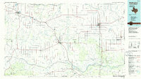
 1985 Hughes Canyon1985 Print · USGSThe Texas Panhandle breaks at the Briscoe and Hall county line are captured here in the mid-1980s. Researchers can trace ranching landmarks from the level Antelope Flats to the deep cuts of Hughes Canyon and Palo Duro Canyon.
 - 1985 Map of Hardscrabble Creek
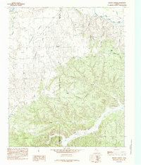
 1985 Hardscrabble Creek1985 Print · USGSThe High Plains of the Texas Panhandle meet the deep cuts of the Caprock during the mid-eighties. Researchers can trace the braided path of the Prairie Dog Town Fork Red River and find family-named landmarks like Mitchell Park and Hardscrabble Creek.
 - 1985 Map of Brice
 1985 Brice1985 Print · USGSThe Texas Panhandle at the edge of the Caprock is captured here in the mid-1980s, where the high plains meet the breaks of the Red River. Genealogists and local historians can trace the rural layout of Brice and South Brice or locate Sink Lake and Battle Creek.
 - 1985 Map of Indian Peak
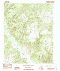
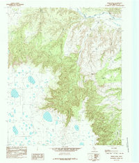 1985 Indian Peak1985 Print · USGSBriscoe County ranch lands meet the dramatic Caprock Escarpment in the mid-1980s. Local researchers can trace the intricate drainages of Indian Creek and Comanche Creek, or locate landmarks like Indian Peak and Folley Park among the canyons.
 - 1985 Map of Plainview
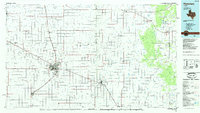 1985 Plainview1985 Print · USGSThe Texas Panhandle's agricultural heartland and the dramatic escarpment are captured here in the mid-eighties. Genealogists and local historians can trace the rail-side growth of Lockney, the layout of Plainview, and the rugged breaks of Caprock Canyon State Park.2 unique versions available
 - 1985 Map of Tulia
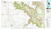 1985 Tulia1985 Print · USGSThe Texas Panhandle in the mid-1980s displays a stark landscape where industrial agriculture meets the deep breaks of Palo Duro Canyon. Genealogists and researchers can trace rural life near Tulia or find old community centers like Vigo Park, Wayside, and Cleta.2 unique versions available
 - 1985 Map of Schott Mountain
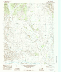
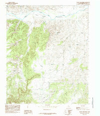 1985 Schott Mountain1985 Print · USGSBriscoe County in the mid-1980s reveals a ranching landscape centered on the Prairie Dog Town Fork Red River. Researchers can trace old water infrastructure and terrain landmarks like Wagon Wheel Tank, Schott Mountain, and Minnow Spring.
 - 1986 Map of Childress
 1986 Childress1986 Print · USGSTexas ranching and conservation lands come to life in this mid-eighties survey of the Pease River country. Genealogists and historians can trace family roots through Matador, find the Matador Cem, or locate the Burlington Northern line through Childress.2 unique versions available
 - 1986 Map of Wellington
 1986 Wellington1986 Print · USGSThe Texas Panhandle in the 1980s shows a landscape of cattle ranching and rail-dependent towns along the Burlington Northern. Trace family history and local industry through locations like the Citizens Cem, Greenbelt Reservoir, and Mc Knight.2 unique versions available
End of results
Showing maps 1-10 of 10
Top cities of Briscoe County
Frequently asked questions
- What are the different types of historical maps available for Briscoe County?
- What is the oldest map of Briscoe County?
- Where can I purchase historical maps of Briscoe County for my home or office?
- Where can I download high-res historical maps of Briscoe County?
- Are there historical topographic maps available for Briscoe County?
- Is there historical aerial imagery available for Briscoe County?
- Where are historical maps of Briscoe County sourced from?