1970s Maps of Briscoe County, Texas
Explore 6 historic maps of Briscoe County from the 1970s. These maps offer a rare glimpse into what life looked like during the 1970s — showing old roads, neighborhoods, homes, and landmarks that have changed or disappeared over time.
Whether you're researching your family's past, planning a metal detecting trip, or studying how Briscoe County's landscape evolved across the 1970s, these high-resolution maps are a powerful tool for exploring the history of this region.
- Focus on a specific era: All maps on this page are from the 1970s, giving you a focused view of this time period.
- See what’s changed: Compare century-old streets, trails, and buildings to today's modern landscape using overlays and satellite layers.
- Research with precision: Use these maps for genealogy, historical research, land use analysis, or educational projects.
- View, download, or print: Maps are fully viewable online in high resolution, and can be downloaded or printed for your own records.
Start exploring Briscoe County's history through authentic maps from the 1970s. This is your window into the past.
Briscoe County, TX maps
(6)- 1976 Map of Indian Peak SW, 1978 Print
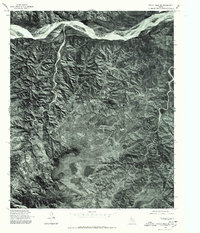
 1976 Indian Peak SW1978 Print · USGSBriscoe County terrain appears in high detail in the mid-seventies, showing the transition from level plains to the river breaks. You can trace the winding course of the Prairie Dog Town Fork Red River and find the landmark at Indian Peak.
 - 1976 Map of Brice NW, 1978 Print
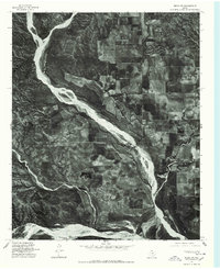 1976 Brice NW1978 Print · USGSHall County land patterns are captured in the mid-seventies, showing the intersection of high-plains farming and river breaks. Trace the winding paths of Mulberry Creek and Battle Creek as they flow toward the Prairie Dog Town Fork Red River.
 - 1976 Map of Indian Peak NW, 1978 Print
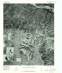
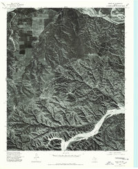
 1976 Indian Peak NW1978 Print · USGSIn the mid-1970s, the canyons of Briscoe County remained a landscape defined by natural erosion and the path of the Prairie Dog Town Fork Red River. Researchers can study the unpaved terrain and plateau features like Mitchell Park as they appeared decades ago.
 - 1976 Map of Indian Peak NE, 1978 Print
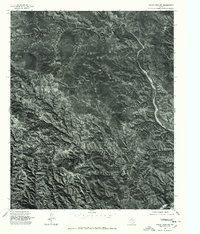 1976 Indian Peak NE1978 Print · USGSThe Texas panhandle near Briscoe is captured during the mid-seventies in this detailed orthophotograph. Researchers can trace the exact 1976 drainage patterns of Battle Creek and the winding course of Willow Arroyo.
 - 1976 Map of Indian Peak SE, 1978 Print
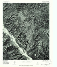
 1976 Indian Peak SE1978 Print · USGSThe Texas Panhandle breaks and river canyons come to life in this mid-seventies aerial study of the Red River valley. Researchers can trace the winding course of the Prairie Dog Town Fork Red River and the rugged path of Cherokee Creek through the terrain.
 - 1976 Map of Brice SW, 1978 Print
 1976 Brice SW1978 Print · USGSHall County land patterns are frozen in time during the mid-seventies, showing the intersection of agricultural plateaus and deep canyon breaks. Researchers can trace the braided channels of the Little Red River and the Prairie Dog Town Fork Red River.
End of results
Showing maps 1-6 of 6
Top cities of Briscoe County
Frequently asked questions
- What are the different types of historical maps available for Briscoe County?
- What is the oldest map of Briscoe County?
- Where can I purchase historical maps of Briscoe County for my home or office?
- Where can I download high-res historical maps of Briscoe County?
- Are there historical topographic maps available for Briscoe County?
- Is there historical aerial imagery available for Briscoe County?
- Where are historical maps of Briscoe County sourced from?