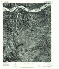
1976 Map of Indian Peak SE
USGS Topo · Published 1978About this map
Prairie Dog Town Fork Red River dominates the northern reaches of this orthophotograph, winding through the sharp breaks and dissected plateaus of the Texas Panhandle. Produced from 1976 aerial photography, this document provides a visual record of the land surface as it appeared in the mid-1970s, long before modern digital mapping. The terrain is characterized by a complex network of canyons and drainage systems, most notably Cherokee Creek flowing through the eastern section. This specific view captures the stark contrast between the wide, sandy riverbed and the intricate erosion patterns of the surrounding Escarpment. Unlike traditional line-drawn maps, this format emphasizes the actual vegetation patterns and ranching roads that defined the local landscape during this era, offering a direct look at the physical geography without the abstraction of contour lines.
Find a feature on this map
2 named features on this map. Tap any name to fly to it.
Don’t see what you’re looking for? This feature index may not catch every label — zoom into the map to look around manually.
Map Details
Editions of this 1976 Indian Peak SE Map
This is the sole edition of this map. No revisions or reprints were ever made.
Other maps of this area

1954 · Plainview
USGS Topo · 1:250,000

1958 · Plainview
USGS Topo · 1:250,000

1960 · Indian Peak
USGS Topo · 1:62,500

1960 · Brice
USGS Topo · 1:62,500

1967 · Hay Lake
USGS Topo · 1:24,000

1967 · Turkey
USGS Topo · 1:24,000

1967 · Lake Theo
USGS Topo · 1:24,000
1976 · Indian Peak SW
USGS Topo · 1:24,000

1976 · Brice NW
USGS Topo · 1:24,000
1976 · Indian Peak NW
USGS Topo · 1:24,000