
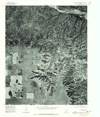
1967 Map of Hay Lake
USGS Topo · Published 1969About this map
Hay Lake serves as a central landmark in this West Texas survey, where the flat plains of the Llano Estacado meet the dramatic escarpment of the Caprock. The transition in terrain is starkly defined, as the level high plains are cut by the headwaters of the South Prong Little Red River and Holmes Creek. These drainages create a complex network of canyons and draws that provide a sharp contrast to the open ranchland above.
Find a feature on this map
14 named features on this map. Tap any name to fly to it.
Don’t see what you’re looking for? This feature index may not catch every label — zoom into the map to look around manually.
Map Details
Editions of this 1967 Hay Lake Map
This is the sole edition of this map. No revisions or reprints were ever made.
Other maps of this area

1954 · Plainview
USGS Topo · 1:250,000

1958 · Plainview
USGS Topo · 1:250,000

1960 · Indian Peak
USGS Topo · 1:62,500

1965 · Ross Canyon
USGS Topo · 1:24,000

1965 · Whiteley
USGS Topo · 1:24,000

1965 · Silverton
USGS Topo · 1:24,000

1967 · Quitaque
USGS Topo · 1:24,000

1967 · Edgemon Lake
USGS Topo · 1:24,000

1967 · Lake Theo
USGS Topo · 1:24,000
1976 · Indian Peak SW
USGS Topo · 1:24,000