
1965 Map of Whiteley
USGS Topo · Published 1967About this map
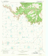
Whiteley and Howard anchor this High Plains landscape in the mid-1960s, a region defined by agricultural expanse and a network of ephemeral water features. The Fort Worth and Denver railroad cuts a straight line through the northern half of the quadrangle, serving the small siding at Whiteley. The southern reaches are marked by the winding course of Quitaque Creek, which provides a sharp topographic contrast to the surrounding level terrain. An Indefinite Boundary runs through the center of the sheet, separating the jurisdictional reaches of Briscoe and Floyd Counties. The presence of a Quarry near the center of the map suggests localized industrial activity amidst the vast ranching and farming operations characteristic of the Texas Panhandle during this era.
Find a feature on this map
7 named features on this map. Tap any name to fly to it.
Don’t see what you’re looking for? This feature index may not catch every label — zoom into the map to look around manually.
Map Details
Editions of this 1965 Whiteley Map
This is the sole edition of this map. No revisions or reprints were ever made.
Other maps of this area

1954 · Plainview
USGS Topo · 1:250,000

1958 · Plainview
USGS Topo · 1:250,000

1965 · Silverton
USGS Topo · 1:24,000

1965 · Rock Creek
USGS Topo · 1:24,000

1965 · Silverton SW
USGS Topo · 1:24,000

1966 · Sterley
USGS Topo · 1:24,000

1966 · South Plains
USGS Topo · 1:24,000

1967 · Edgemon Lake
USGS Topo · 1:24,000

1967 · Hay Lake
USGS Topo · 1:24,000
1967 · Wilson Creek
USGS Topo · 1:24,000