Old Maps of Castro County, Texas for Genealogy
Trace your family roots with 152 historic maps of Castro County. These high-res maps reveal old neighborhoods, homesites, landmarks, and streets — helping you uncover where your ancestors lived and how the area evolved over time.
- Explore historic neighborhoods: Identify where your relatives may have lived in the 1800s or 1900s.
- Compare maps over time: Trace the changes in streets, buildings, and landmarks for multi-generational research.
- Perfect for genealogy & ancestry research: Used by family historians and researchers to map out lineage and migration.
These maps are an incredible resource for exploring your personal connection to Castro County's past.
Castro County, TX maps
(152)- 1954 Map of Plainview, 1966 Print
 1954 Plainview1966 Print · USGSThe Texas Panhandle and the rugged Caprock Escarpment appear in detail as the region's agricultural and rail networks reached their mid-century peak. Trace family roots and old land patterns through the canyons and plains near Plainview, Palo Duro State Park, and Childress.3 unique versions available
 - 1954 Map of Clovis, 1966 Print
 1954 Clovis1966 Print · USGSThe High Plains of the Texas-New Mexico borderland come alive in this mid-century survey as the region's agricultural and rail networks reached their peak. Trace family roots and local history through features like Cannon AFB, the massive Sand Hills, and busy rail towns such as Friona and Littlefield.4 unique versions available
 - 1958 Map of Clovis
 1958 Clovis1958 Print · USGSThe High Plains of the New Mexico-Texas borderlands are captured here in the late fifties, during a period of significant military and agricultural expansion. Genealogists and historians can trace the rail-side growth of Clovis, the operations at Clovis Air Force Base, and the rural layout of communities like Muleshoe and Hereford.
 - 1958 Map of Plainview
 1958 Plainview1958 Print · USGSThe High Plains and Caprock Escarpment meet in the late fifties, showcasing the ranching and rail networks of the Texas Panhandle. Trace family roots and vanished stops along the Panhandle and Santa Fe railroad through Plainview, Silverton, and Matador.
 - 1962 Map of Dodd NE, 1965 Print
 1962 Dodd NE1965 Print · USGSAgricultural life in Castro County during the early sixties is centered on the natural drainage of the North Fork Running Water Draw. Genealogists and local historians can locate the Flagg Cem or trace the path of the FT W & D railroad.
 - 1963 Map of Flagg, 1965 Print
 1963 Flagg1965 Print · USGSCastro County agriculture and hydrology are the focus of this mid-sixties survey of the Texas High Plains. Genealogists and researchers can trace the locations of rural settlements like Flagg and Big Square alongside a dense network of vital resources like Well 3822.2 unique versions available
 - 1963 Map of Hart NW, 1965 Print
 1963 Hart NW1965 Print · USGSThe High Plains of Castro County come into focus in the early sixties, showing an agricultural landscape dominated by the railroad. Researchers can trace the path of the FORT WORTH AND DENVER rail line and locate Hart Cem or the small siding at Mulkey.2 unique versions available
 - 1963 Map of Lazbuddie, 1965 Print
 1963 Lazbuddie1965 Print · USGSParmer County at the start of the 1960s shows a landscape transformed by intensive irrigation and the growth of High Plains agriculture. Researchers can trace local landmarks like Lazbuddie Cem, the Athletic Field, and the winding Running Water Draw.2 unique versions available
 - 1963 Map of Dodd SE, 1965 Print
 1963 Dodd SE1965 Print · USGSThe High Plains near the Castro and Lamb county line are shown in the early sixties as a landscape of intensive groundwater irrigation. Researchers can trace local landmarks like Sunnyside, the Springlake Cemetery, and the Springlake School campus.
 - 1963 Map of Dodd, 1965 Print
 1963 Dodd1965 Print · USGSLife on the High Plains during the early sixties centered on the small settlement of Dodd and the intensive irrigation of the surrounding fields. Researchers can trace land ownership through fence lines and locate rural landmarks like the Primitive Ch and Running Water Draw.2 unique versions available
 - 1963 Map of Hart SW, 1965 Print
 1963 Hart SW1965 Print · USGSThe High Plains along the border of Castro and Lamb counties in the early sixties reveal a landscape transformed by irrigation and industry. Genealogists and historians can trace local landmarks like Thompson Gin, the Corral, and the meandering North Fork Running Water Draw.2 unique versions available
 - 1963 Map of Lazbuddie SE, 1965 Print
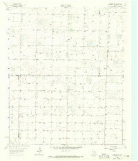 1963 Lazbuddie SE1965 Print · USGSThe High Plains at the intersection of Lamb and Parmer counties were defined by groundwater development in the early sixties. Researchers can trace the agricultural footprint of the era through Pleasant Valley, a remote Airstrip, and dozens of numbered water wells like Well 3912.
 - 1965 Map of Dimmitt, 1968 Print
 1965 Dimmitt1968 Print · USGSDimmitt and the surrounding Castro County plains are captured here in the mid-1960s as a thriving agricultural and transit hub. Genealogists and researchers can locate the Dimmitt Cemetery, Castro Memorial Gardens, and landmarks like the Drive-in Theater.2 unique versions available
 - 1965 Map of Hart, 1968 Print
 1965 Hart1968 Print · USGSThe settlement of Hart stands as a rail-centered community in the mid-1960s, surrounded by the distinctive playas of Castro County. Researchers can trace the local infrastructure of the day, from the High Sch to the many points marked Well and the prominent PIPELINE.
 - 1965 Map of Edmonson, 1968 Print
 1965 Edmonson1968 Print · USGSThe Texas Panhandle comes into focus during the mid-sixties as agricultural and rail networks expanded across the plains. Genealogists and local historians can trace the footprint of Edmonson and Center Plains alongside the Fort Worth and Denver line.
 - 1965 Map of Lakeview, 1968 Print
 1965 Lakeview1968 Print · USGSThe Texas Panhandle plains near the Swisher and Castro County line come into focus during the mid-sixties. Researchers can trace the local landscape around Lakeview, from the seasonal path of Middle Tule Draw to a regional Gravel Pit and dozens of individual wells.
 - 1965 Map of Dimmitt SW, 1968 Print
 1965 Dimmitt SW1968 Print · USGSCastro County agriculture and irrigation define this mid-sixties survey of the Texas High Plains. Genealogists and researchers can locate landmarks like Bethel Ch, the Substation, and the localized Gravel Pit among dozens of irrigation wells.
 - 1965 Map of Tam Anne, 1968 Print
 1965 Tam Anne1968 Print · USGSThe Texas Panhandle borderlands of Parmer and Castro counties come into focus during the mid-sixties. Local historians can locate the agricultural heart of Tam Anne, identifying the Grain Elevator and Cotton Gin that anchored this rural High Plains community.
 - 1965 Map of Nazareth SW, 1968 Print
 1965 Nazareth SW1968 Print · USGSCastro County's High Plains are shown here in the mid-1960s, documenting a landscape of playa lakes and agricultural expansion. Researchers can trace early irrigation through numerous Well sites and locate specific landmarks like Schmucker and a rural Storage Bin.
 - 1965 Map of Hilburn, 1968 Print
 1965 Hilburn1968 Print · USGSThe High Plains of West Texas are captured here in the mid-1960s, showing a landscape shaped by the Fort Worth and Denver rail line. Genealogists and local historians can locate the Valley View Ch and early settlements at Hilburn and Grisham.2 unique versions available
 - 1965 Map of Nazareth, 1968 Print
 1965 Nazareth1968 Print · USGSNazareth and the surrounding Castro County plains are captured in the mid-1960s, showing a landscape defined by agriculture and water infrastructure. Researchers can locate the Holy Family Cem and trace the local economy through the Cotton Gin and Grain Elevators.
 - 1965 Map of Center Plains School, 1968 Print
 1965 Center Plains School1968 Print · USGSThe High Plains of the Texas Panhandle come into focus during the mid-sixties, showing a landscape defined by industrial agriculture and cattle ranching. Trace local history through the Center Plains Sch, the Cripple T Farm, and the regional Grain Elevator.
 - 1966 Map of Jumbo, 1968 Print
 1966 Jumbo1968 Print · USGSThe Texas Panhandle's High Plains are captured here in the mid-1960s at the height of its deep-well irrigation era. Genealogists and local historians can trace the rural infrastructure around Jumbo or locate family-named landmarks like Lambert and the winding Middle Tule Draw.2 unique versions available
 - 1966 Map of Tulia NW, 1968 Print
 1966 Tulia NW1968 Print · USGSSwisher County in the mid-sixties shows a quiet Panhandle landscape shaped by the natural carving of North Tule Draw. Local historians can trace the paths of early energy infrastructure like the Pipeline or locate the site of the Radio Tower.
 - 1966 Map of Nazareth NW, 1968 Print
 1966 Nazareth NW1968 Print · USGSThe High Plains of the Texas Panhandle appear in the mid-1960s as a landscape of rural ranching and infrastructure. Researchers can trace the intersection of three counties and locate local landmarks like the Hendrix settlement and several Gravel Pit sites.2 unique versions available
Showing maps 1-25 of 152
Top cities of Castro County
Frequently asked questions
- What are the different types of historical maps available for Castro County?
- What is the oldest map of Castro County?
- Where can I purchase historical maps of Castro County for my home or office?
- Where can I download high-res historical maps of Castro County?
- Are there historical topographic maps available for Castro County?
- Is there historical aerial imagery available for Castro County?
- Where are historical maps of Castro County sourced from?