Old Maps of Hankamer, Texas for Metal Detecting
Plan your next treasure hunt with 13 historic maps of Hankamer. Find old homesites, ghost towns, trails, and gathering spots that may be lost to time — perfect for identifying promising metal detecting locations.
- Locate forgotten sites: Uncover places like long-lost settlements, abandoned rail lines, or gathering spots.
- Plan better hunts: Use map overlays combined with LiDAR or satellite views to narrow in on historically rich areas.
- Made for detectorists: Thousands of hobbyists use these maps to discover relics, coins, and hidden history.
Use these historic maps to boost your research and find new opportunities beneath the surface of Hankamer.
Hankamer, TX maps
(13)- 1942 Map of Anahuac, 1958 Print
 1942 Anahuac1958 Print · USGSThe mouth of the Trinity River and the shores of Turtle Bay are captured here in the early 1940s. Genealogists can trace family landmarks like Wallisville Cem and Old Fort Anahuac or locate the schools and oil wells of Wallisville and Eminence.
 - 1950 Map of Houston, 1953 Print
 1950 Houston1953 Print · USGSCoastal Texas in the early fifties reveals a landscape of massive civil engineering and industrial transit. Genealogists and researchers can trace the growth of the Houston suburbs and the maritime infrastructure of Galveston Bay, including the Gulf Freeway and the Texas City Dike.
 - 1956 Map of Houston, 1963 Print
 1956 Houston1963 Print · USGSSoutheast Texas in the mid-fifties is captured here as a powerhouse of oil and maritime trade. Genealogists and historians can trace the foundations of Houston and its ports, alongside landmarks like the Rice Institute and the Spindletop Oil Field.2 unique versions available
 - 1961 Map of Anahuac, 1964 Print
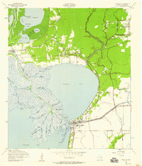
 1961 Anahuac1964 Print · USGSThe Trinity River delta and the coastal prairies of Chambers County are captured here in the early sixties. Genealogists and historians can trace family sites at Wallisville Cem and Eminence, or locate the Davis Sch near Hankamer.3 unique versions available
 - 1975 Map of Houston, 1977 Print
 1975 Houston1977 Print · USGSThe Texas Gulf Coast in the mid-seventies shows a sprawling Houston metropolis linked to the sea by the massive Houston Ship Channel. Researchers can trace the mid-century industrial landscape from the Astrodome to the Lyndon B. Johnson Space Center.2 unique versions available
 - 1983 Map of Anahuac
 1983 Anahuac1983 Print · USGSThe Upper Texas Coast and its energy-driven landscape are detailed here in the early eighties. Genealogists and historians can trace coastal settlements like Anahuac and Winnie alongside the storied Spindletop Oil Field and the Anahuac National Wildlife Refuge.2 unique versions available
 - 1993 Map of Anahuac
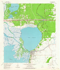
 1993 Anahuac1993 Print · USGSThe Trinity River meets the Gulf coast in the early nineties, revealing a landscape defined by the Trinity River Delta and the town of Anahuac. Genealogists and local historians can trace family legacy through numerous sites like the Benjamin Barrow Cem, Wallisville Cem, and St Mary Ch.
 - 2010 Map of Anahuac, 2010 Print
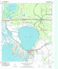
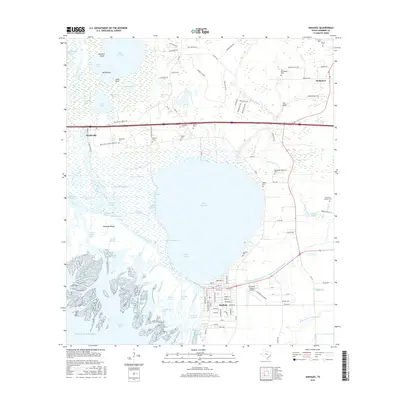
 2010 Anahuac2010 Print · USGSCovers Hankamer, including Anahuac, Wallisville, and other nearby areas
 - 2013 Map of Anahuac, 2013 Print
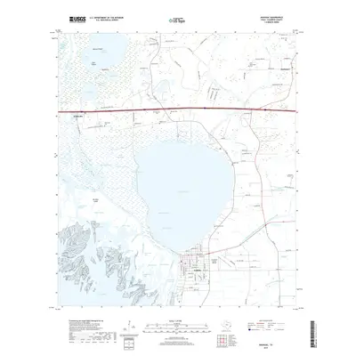
 2013 Anahuac2013 Print · USGSCovers Hankamer, including Anahuac, Wallisville, and other nearby areas
 - 2016 Map of Anahuac, 2016 Print
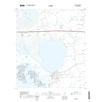
 2016 Anahuac2016 Print · USGSCovers Hankamer, including Anahuac, Wallisville, and other nearby areas
 - 2019 Map of Anahuac, 2019 Print
 2019 Anahuac2019 Print · USGSCovers Hankamer, including Anahuac, Wallisville, and other nearby areas
 - 2022 Map of Anahuac, 2022 Print
 2022 Anahuac2022 Print · USGSCovers Hankamer, including Anahuac, Wallisville, and other nearby areas
 - 2025 Map of Anahuac, 2025 Print
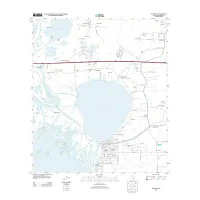
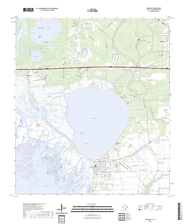 2025 Anahuac2025 Print · USGSThe Texas coast near the Trinity River delta comes into focus here during the early twenty-first century. Genealogists and local historians can locate numerous family burial sites like Benjamin Barrow Cem and Wallis Hill Cem alongside the Chambers County Courthouse.
End of results
Showing maps 1-13 of 13
Top cities near Hankamer
- Baytown historical maps
- Liberty historical maps
- Mont Belvieu historical maps
- Beach City historical maps
- Anahuac historical maps
- Old River-Winfree historical maps
See more
Frequently asked questions
- What are the different types of historical maps available for Hankamer?
- What is the oldest map of Hankamer?
- Where can I purchase historical maps of Hankamer for my home or office?
- Where can I download high-res historical maps of Hankamer?
- Are there historical topographic maps available for Hankamer?
- Is there historical aerial imagery available for Hankamer?
- Where are historical maps of Hankamer sourced from?