Old Maps of Comal County, Texas for Hiking & Exploration
Hike through history with 166 historic maps of Comal County. Explore old trails, ghost towns, and forgotten backroads — perfect for outdoor adventurers and local explorers.
- Rediscover forgotten places: Map out old mining camps, roads, and footpaths that no longer exist on modern maps.
- Layer with modern tools: Combine with LiDAR or satellite views to plan hikes through historical terrain.
- Made for exploration: Popular among hikers, overlanders, and local history lovers.
Use these maps to find adventure and explore the hidden past of Comal County.
Comal County, TX maps
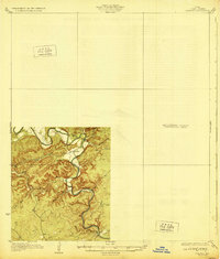
(166)- 1887 Map of Blanco
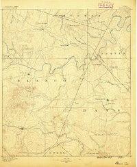 1887 Blanco1887 Print · USGSCentral Texas at the dawn of the Hill Country's development, when early ranching life centered on river fords and spring-fed creeks. Trace the paths between Johnson City, Blanco, and Dripping Springs, or locate landmarks like Jacob's Well and Dead Mans Hole.
 - 1894 Map of Blanco
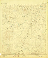 1894 Blanco1894 Print · USGSThe Texas Hill Country comes into focus during the late frontier era, centered on the newly established Johnson City and Blanco. Genealogists can trace early homesteads and communities near Jacobs Well, Dripping Springs, and the isolated Cypress Mill.5 unique versions available
 - 1911 Map of San Marcos
 1911 San Marcos1911 Print · USGSCentral Texas at the peak of the railroad era shows a landscape of small farming communities and country schools. Genealogists can trace family footprints across Comanche Flat or locate long-gone sites like Highpoint School and Bethany Church.2 unique versions available
 - 1919 Map of San Marcos
 1919 San Marcos1919 Print · USGSTexas at the close of the Great War was a landscape of river-fed farms and emerging rail corridors between San Marcos and Lockhart. Genealogists can trace family footprints through numerous rural landmarks like Clark Chapel, High Prairie School, and Larremore.
 - 1920 Map of Smithsons Valley
 1920 Smithsons Valley1920 Print · USGSThe Texas Hill Country comes alive in this 1920s-era survey of the Guadalupe River valley. Genealogists and local historians can trace early family outposts and commerce at Fischers Store, Cranes Mill, and Wesson P.O.
 - 1925 Map of New Braunfels No 1
 1925 New Braunfels No 11925 Print · USGSCentral Texas farming communities thrive along the river as the mid-twenties approach. Researchers can trace rural lineages through numerous country schoolhouses like Austin Hill School and local landmarks such as HORTONTOWN CEMETERY and Gruene.
 - 1925 Map of Hunter No 3
 1925 Hunter No 31925 Print · USGSThe Comal County backcountry comes into focus during the mid-twenties as the Guadalupe River winds through a complex network of creeks. Researchers can locate early homesteading landmarks such as Sattler, Fischer Store, and the route of the Blanco New Braunfels Road.
 - 1925 Map of Smithson Valley No. 1
 1925 Smithson Valley No. 11925 Print · USGSTexas Hill Country life in the mid-twenties centers on the meandering Guadalupe River valley before major modern alterations. Genealogists and local historians can trace legacy sites like Fischer Store, Cranes Mill, and the Rebecca Creek School.
 - 1927 Map of New Braunfels
 1927 New Braunfels1927 Print · USGSNew Braunfels and the surrounding river valleys are captured here during the mid-twenties, when the regional rail and school networks were at their peak. Genealogists and historians can trace family locations near landmarks like Gaudalupe College, Hortontown Cemetery, and dozens of rural schoolhouses like Austin Hill School.3 unique versions available
 - 1927 Map of Smithson Valley
 1927 Smithson Valley1927 Print · USGSThe Texas Hill Country comes to life in the mid-1920s, showing the Guadalupe River valley decades before it was altered by Canyon Lake. Researchers can trace rural landmarks like Fischer Store, the Rebecca Creek School, and Cranes Mill.
 - 1929 Map of Hunter
 1929 Hunter1929 Print · USGSComal County was a landscape of deep limestone valleys and winding river bends in the late twenties. Genealogists and local historians can trace the early layout of Sattler or locate family landmarks near Waco Spring and Mountain Creek.2 unique versions available
 - 1929 Map of Smithson Valley, 1958 Print
 1929 Smithson Valley1958 Print · USGSCentral Texas Hill Country life in the late 1920s centered on the river and the road. Genealogists can trace early homesteads near Fischer Store, Anhalt, and rural schoolhouses like Smithson Valley School.
 - 1940 Map of Smithson Valley
 1940 Smithson Valley1940 Print · USGSComal County's Hill Country comes into focus during the late twenties and thirties, showing a landscape of family ranches and rural schoolhouses. Researchers can trace ancestral tracts belonging to Alex Scheel or G. Krause and locate landmarks like Anhalt or Fischer Store.2 unique versions available
 - 1953 Map of Otis Ridge, 1959 Print
 1953 Otis Ridge1959 Print · USGSBexar County ranching and military life intersect in the early fifties among the ridges north of San Antonio. Researchers can trace historic property lines like the Oppenheimer Ranch and military landmarks including Camp Stanley and the Landing Field.
 - 1953 Map of Schertz, 1959 Print
 1953 Schertz1959 Print · USGSThe Texas countryside between San Antonio and Seguin comes alive in the mid-fifties as the rail-and-road network expanded around Randolph Field. Genealogists and historians can trace family-named sites like Davenport Cem, explore the early footprint of Schertz, and locate landmarks such as the Radio Tower (WOAI).
 - 1953 Map of Bulverde, 1959 Print
 1953 Bulverde1959 Print · USGSDeep in the Texas Hill Country during the mid-fifties, this area shows a landscape of family-named peaks and small-scale rural life. Genealogists can trace early local sites like St Pauls Cem and St Pauls Ch near the banks of Cibolo Creek.
 - 1953 Map of Bat Cave, 1959 Print
 1953 Bat Cave1959 Print · USGSComal and Bexar counties meet in this mid-century Texas Hill Country survey where railroads and creeks define the landscape. Trace early family landmarks like the Weilbacher Cem, visit the Bracken Ch, or locate the namesake Bat Cave.
 - 1953 Map of Van Raub, 1959 Print
 1953 Van Raub1959 Print · USGSBexar County ranch land and military outposts are detailed here in the early fifties. Genealogists can locate the Lower Balcones Sch, trace the Southern Pacific line near Van Raub, and find family sites near Leon Springs.
 - 1953 Map of Seguin, 1965 Print
 1953 Seguin1965 Print · USGSSouth Texas in the early fifties shows a thriving river-and-rail economy across the Guadalupe and Colorado basins. Genealogists and historians can trace rail routes like the Southern Pacific through Seguin, locate oil wells, or find the Gary AAF near San Marcos.4 unique versions available
 - 1954 Map of Llano, 1964 Print
 1954 Llano1964 Print · USGSThe Texas Hill Country and Highland Lakes appear in the mid-fifties, just as new reservoirs began reshaping the landscape. Trace ranching history and river routes from Mason to Llano, or follow the Gulf Colorado and Santa Fe RR past Buchanan Lake.2 unique versions available
 - 1954 Map of San Antonio, 1964 Print
 1954 San Antonio1964 Print · USGSSan Antonio and the Texas Hill Country are captured here in the mid-fifties, showing a landscape defined by massive military air bases and the rising Canyon Reservoir. Trace family ties through historic rail towns like D'Hanis and Castroville or explore the Cold War footprint of Lackland AFB and Randolph AFB.3 unique versions available
 - 1955 Map of Llano
 1955 Llano1955 Print · USGSCentral Texas and the Hill Country are seen here during the mid-1950s growth of the Highland Lakes. Trace old settlements and geologic landmarks from Enchanted Rock and Longhorn Cavern to the small community of Luckenbach.
 - 1956 Map of Llano, 1976 Print
 1956 Llano1976 Print · USGSThe Texas Hill Country comes alive in this mid-seventies survey of the Llano Uplift and Colorado River lakes. Genealogists and historians can trace family roots through settlements like Luckenbach and Castell or locate the famed L B J Ranch and Enchanted Rock.
 - 1957 Map of Boerne
 1957 Boerne1957 Print · USGSThe Texas Hill Country around the mid-century shows a network of family ranch-lands and rural schoolhouses. Genealogists can trace family homesteads like E Fischer or Zoeller and locate historic sites such as Cascade Cavern and Bergheim Cemetery.
 - 1957 Map of San Antonio
 1957 San Antonio1957 Print · USGSSan Antonio and the Texas Hill Country are shown here during the mid-fifties, capturing the region's expanding post-war military and transportation footprint. Genealogists and local historians can trace the early residential boundaries of Alamo Heights or locate rural landmarks like St Hedwig and Medina Lake.
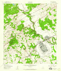
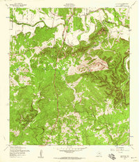
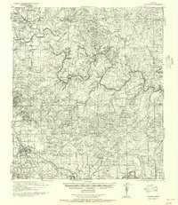
Showing maps 1-25 of 166
Top cities of Comal County
Frequently asked questions
- What are the different types of historical maps available for Comal County?
- What is the oldest map of Comal County?
- Where can I purchase historical maps of Comal County for my home or office?
- Where can I download high-res historical maps of Comal County?
- Are there historical topographic maps available for Comal County?
- Is there historical aerial imagery available for Comal County?
- Where are historical maps of Comal County sourced from?