Old Maps of Concho County, Texas for Hiking & Exploration
Hike through history with 173 historic maps of Concho County. Explore old trails, ghost towns, and forgotten backroads — perfect for outdoor adventurers and local explorers.
- Rediscover forgotten places: Map out old mining camps, roads, and footpaths that no longer exist on modern maps.
- Layer with modern tools: Combine with LiDAR or satellite views to plan hikes through historical terrain.
- Made for exploration: Popular among hikers, overlanders, and local history lovers.
Use these maps to find adventure and explore the hidden past of Concho County.
Concho County, TX maps
(173)- 1891 Map of Hayrick
 1891 Hayrick1891 Print · USGSTexas ranching country and the arrival of the iron horse meet in the 1890s as the Colorado River divides emerging frontier counties. Genealogists and historians can trace the early foundations of Hayrick and Rowena, or locate remote landmarks like Harris Ranch and the Rock Spring School House.
 - 1892 Map of San Angelo
 1892 San Angelo1892 Print · USGSSan Angelo and the surrounding West Texas ranch lands appear here in the early 1890s as a vital junction for the river and rail. Researchers can trace early water sources and settlements like Christoval, Lipan Spring, and the G. C. & S. F. Ry. line.3 unique versions available
 - 1892 Map of Eden
 1892 Eden1892 Print · USGSCentral Texas ranching country in the late eighteen-hundreds is defined by the early development of Eden and the surrounding rangeland. Researchers can trace historic drainage and terrain features like Salt Gap, the Brady Mountains, and Kickapoo Creek.
 - 1892 Map of Ballinger
 1892 Ballinger1892 Print · USGSCentral West Texas was a landscape of budding rail towns and winding river valleys in the early 1890s. Genealogists can trace the early footprints of Ballinger and Paintrock or locate smaller vanished points like Norwood and Trap Crossing.5 unique versions available
 - 1894 Map of Hayrick
 1894 Hayrick1894 Print · USGSWest Texas ranching and rail life come into focus in the 1890s as the frontier gives way to established counties and communities. Researchers can trace early family outposts like Harris Ranch, rural education at Rock Spring School House, and the arrival of the Gulf Colorado and Santa Fe Railway.5 unique versions available
 - 1896 Map of Eden
 1896 Eden1896 Print · USGSWest Texas ranching country was still largely open range in the late nineteenth century. Genealogists and historians can trace early land use around Eden and follow the rugged escarpment of the Brady Mountains toward Salt Gap.4 unique versions available
 - 1921 Map of Lowake
 1921 Lowake1921 Print · USGSLowake and the Concho County ranchlands are captured here in the early 1920s as the railroad drove local commerce. Genealogists and historians can trace the locations of rural schoolhouses like Sweet Home School and Green Wall School near the banks of Little Concho Creek.
 - 1924 Map of Eden 1-a
 1924 Eden 1-a1924 Print · USGSThe Concho and Colorado River confluence area was a landscape of river crossings and small schoolhouse districts in the mid-1920s. Genealogists can trace early homesteads near Stacy and Doole, or locate landmarks like Bethel Church and the Hardin School.
 - 1925 Map of Ballinger 3-d
 1925 Ballinger 3-d1925 Print · USGSThe convergence of the Colorado and Concho Rivers is captured here in the mid-1920s as ranching life centered on the water. Local historians can locate river crossings like Hall Ford and rural educational sites such as Mapes School and Currie School.
 - 1925 Map of Ballinger 4-c
 1925 Ballinger 4-c1925 Print · USGSCentral West Texas river valleys are surveyed in the mid-1920s at the junction of three counties. Researchers can locate early rural landmarks like Liberty School and historic river crossings such as Coffee Ford and Trap Crossing.
 - 1931 Map of Stacy
 1931 Stacy1931 Print · USGSCentral Texas ranching country comes into focus during the 1920s as the river defines three county lines. Genealogists can locate rural schoolhouses like Hardin Sch and Williams Sch or trace old river fords at Crane Crossing.2 unique versions available
 - 1932 Map of Voss
 1932 Voss1932 Print · USGSCentral Texas river life in the mid-1920s is documented here along the winding banks of the Concho River. Genealogists and local historians can trace the community of Leaday and several rural schoolhouses like Liberty Sch and Redwire Sch.2 unique versions available
 - 1932 Map of Paint Rock
 1932 Paint Rock1932 Print · USGSThe northern edge of the Edwards Plateau comes into focus in the early 1930s as the rail lines reached into Concho County. Genealogists and historians can trace the rural school districts of the day, including Dry Ridge Sch and Mapes Sch, or locate the family-named bluffs along the Concho River.2 unique versions available
 - 1954 Map of Brownwood, 1955 Print
 1954 Brownwood1955 Print · USGSCentral Texas in the early fifties shows a landscape of rail-linked cattle towns and winding river valleys before modern highway expansion. Genealogists and historians can trace family-named peaks and vanished rail stops like Trickham, Santa Anna, and the Brady Mountains.3 unique versions available
 - 1954 Map of San Angelo, 1967 Print
 1954 San Angelo1967 Print · USGSThe Concho Valley and eastern Permian Basin transition from ranching to a burgeoning oil economy during the mid-twentieth century. Trace the expansion of San Angelo near Goodfellow AFB and locate old crossroads like Stiles, Texon, and Barnhart along the SANTA FE railroad.2 unique versions available
 - 1957 Map of Eola, 1958 Print
 1957 Eola1958 Print · USGSThe rural landscapes of Tom Green and Concho counties are captured here in the late fifties, during a period of steady oil and ranching activity. Genealogists can trace family footprints through the Lakeview Community Cem, the old Dry Hollow Sch (Aband), and early settlements like Mereta and Vancourt.
 - 1957 Map of Miles, 1958 Print
 1957 Miles1958 Print · USGSRunnels and Tom Green Counties are shown in the late fifties as the regional economy balanced between rail-side agriculture and a growing oil industry. Genealogists can locate several burial sites including Evergreen Cem and Protestant Cem, or trace early river crossings like 10 Mile Crossing.
 - 1958 Map of San Angelo
 1958 San Angelo1958 Print · USGSWest Texas in the late fifties centers on the growing hub of San Angelo and its vital river confluences. Genealogists and historians can trace the paths of the Santa Fe railroad to outposts like Fort Chadbourne, Big Lake, and the specialized community of Sanatorium.
 - 1960 Map of Melvin, 1961 Print
 1960 Melvin1961 Print · USGSMcCulloch County in the early sixties centers on the rail-side community of Melvin as it navigates the landscape of the BRADY MOUNTAINS. Researchers can trace the path of the GULF COLORADO AND SANTA FE railroad through Whiteland and Homer Junction or locate family plots at Melvin Cem.2 unique versions available
 - 1965 Map of San Angelo
 1965 San Angelo1965 Print · USGSWest Texas in the mid-sixties reveals a landscape shaped by the petroleum industry and strategic water management. Genealogists and historians can trace the rail corridor through Texon and Big Lake, or locate military landmarks like Goodfellow AFB and Broome Air Force Auxiliary Airfield.
 - 1967 Map of Millersview SE, 1969 Print
 1967 Millersview SE1969 Print · USGSCentral Texas during the late sixties shows a landscape shaped by water management and resource extraction. Trace the network of reservoirs and spillways along Duck Creek or locate local industrial sites like the various Gravel Pits.2 unique versions available
 - 1967 Map of Concho, 1969 Print
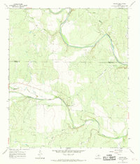 1967 Concho1969 Print · USGSThe Texas ranchlands at the Concho and Colorado River confluence appear in high detail during the late sixties. Local researchers can trace the rural settlement of Concho, locate the community Cem, and explore the riverfront near Deadmans Bluff and Fuzzy.3 unique versions available
 - 1967 Map of Doole, 1969 Print
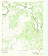 1967 Doole1969 Print · USGSCentral Texas ranching country comes into focus in the late sixties along the winding Colorado River. Local historians can trace family roots around Stacy and Doole, or locate the rural Cem and isolated landmarks like Wallooppe.
 - 1967 Map of Salt Gap, 1969 Print
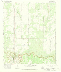 1967 Salt Gap1969 Print · USGSThe border of Concho and McCulloch counties comes alive in the late sixties as the ranching country meets the Brady Mountains. Genealogists and researchers can trace the roads around Salt Gap and locate family landmarks like Rattlesnake Point or Little Saddle Creek.2 unique versions available
 - 1967 Map of Millersview, 1969 Print
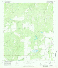 1967 Millersview1969 Print · USGSIn the late 1960s, the ranching and resource lands of Concho County centered on the small crossroads of Millersview. Researchers can trace the development of local water projects near North Fork Mustang Creek or locate numerous early Oil Wells and Gas Wells.2 unique versions available
Showing maps 1-25 of 173
Top cities of Concho County
Frequently asked questions
- What are the different types of historical maps available for Concho County?
- What is the oldest map of Concho County?
- Where can I purchase historical maps of Concho County for my home or office?
- Where can I download high-res historical maps of Concho County?
- Are there historical topographic maps available for Concho County?
- Is there historical aerial imagery available for Concho County?
- Where are historical maps of Concho County sourced from?