1960s Maps of Cooke County, Texas
Explore 20 historic maps of Cooke County from the 1960s. These maps offer a rare glimpse into what life looked like during the 1960s — showing old roads, neighborhoods, homes, and landmarks that have changed or disappeared over time.
Whether you're researching your family's past, planning a metal detecting trip, or studying how Cooke County's landscape evolved across the 1960s, these high-resolution maps are a powerful tool for exploring the history of this region.
- Focus on a specific era: All maps on this page are from the 1960s, giving you a focused view of this time period.
- See what’s changed: Compare century-old streets, trails, and buildings to today's modern landscape using overlays and satellite layers.
- Research with precision: Use these maps for genealogy, historical research, land use analysis, or educational projects.
- View, download, or print: Maps are fully viewable online in high resolution, and can be downloaded or printed for your own records.
Start exploring Cooke County's history through authentic maps from the 1960s. This is your window into the past.
Cooke County, TX maps
(20)- 1960 Map of Callisburg, 1963 Print
 1960 Callisburg1963 Print · USGSCooke County and the Oklahoma border are documented here in the early sixties as the regional oil industry thrived. Researchers can locate family landmarks like Center Hill Cem, the Gainesville State School For Girls, and the extensive Walnut Bend Oil Field.2 unique versions available
 - 1960 Map of Gainesville South, 1963 Print
 1960 Gainesville South1963 Print · USGSGainesville and the surrounding Texas countryside are captured here in the early sixties as a center of rail commerce and educational growth. Genealogists and local historians can trace family-named sites like Spring Creek Cem or locate early landmarks including Gainesville Jr College and the Refinery.2 unique versions available
 - 1960 Map of Gainesville North, 1964 Print
 1960 Gainesville North1964 Print · USGSGainesville and the surrounding Texas-Oklahoma borderlands are captured here in the early sixties as the regional rail and air infrastructure expanded. Trace local family roots at Rest Haven Memorial Cemetery or explore the rail junction of the Missouri Kansas Texas and Gulf Colorado and Santa Fe lines.2 unique versions available
 - 1960 Map of Woodbine, 1964 Print
 1960 Woodbine1964 Print · USGSCooke County at the start of the 1960s shows a landscape balancing oil production and deep-rooted rural settlements. Genealogists can trace family sites like Dervin Cem or Rad Ware Sch, while historians can locate the Site of Fort Fitzhugh.2 unique versions available
 - 1961 Map of Muenster West, 1963 Print
 1961 Muenster West1963 Print · USGSThe Cooke and Montague county line comes alive in the early sixties, showing the agricultural prairie and the western outskirts of Muenster. Trace the diagonal route of the Missouri Kansas Texas railroad and locate early petroleum activity at numerous Oil Wells.2 unique versions available
 - 1961 Map of Pilot Point, 1963 Print
 1961 Pilot Point1963 Print · USGSDenton and Grayson Counties are seen here in the early sixties, centered on the railroad corridor through the Texas prairie. Local historians can trace the foundations of Tioga and Pilot Point, locating sites like Gee High Sch, the Masonic Cem, and Tipton Chapel.3 unique versions available
 - 1961 Map of Freemound, 1963 Print
 1961 Freemound1963 Print · USGSNorth Texas ranch land and the rising petroleum industry meet in the early sixties along the Cooke County line. Researchers can trace rural life and energy development through local landmarks like Freemound, the Gatewood oil field, and Bingham Creek.
 - 1961 Map of Era, 1963 Print
 1961 Era1963 Print · USGSThe border of Cooke and Denton counties is captured here in the early sixties as a landscape of rural cemeteries and active oil fields. Genealogists and historians can locate Cogburn Cem, the ridge of The Backbone, and the crossroads at Era.2 unique versions available
 - 1961 Map of Hood, 1963 Print
 1961 Hood1963 Print · USGSCooke County petroleum and ranching lands are captured in detail during the early sixties. Researchers can trace family history through sites like Hood Cem or follow the Missouri Kansas Texas line through Myra and the Gruber Oil Field.2 unique versions available
 - 1961 Map of Muenster East, 1963 Print
 1961 Muenster East1963 Print · USGSThe rural landscape of Cooke County is captured here in the early sixties, showing the vital rail-and-creek geography of North Texas. Researchers can locate the Hayes Cem and Van Slyke Cem or trace the Missouri-Kansas-Texas line through Muenster.2 unique versions available
 - 1961 Map of Mountain Springs, 1963 Print
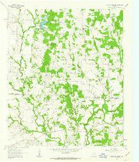 1961 Mountain Springs1963 Print · USGSCooke and Denton counties come into focus during the early sixties, showing a landscape of rural communities and rising oil production. Genealogists can locate several family cemeteries like Jones Cem and Tyson Cem or trace the early footprint of the Jacobs Oil Field.3 unique versions available
 - 1961 Map of Valley View, 1963 Print
 1961 Valley View1963 Print · USGSNorth Texas ranching and rail history come alive in this early 1960s survey of the Cooke and Denton county line. Trace the steam-era path of the Gulf Colorado and Santa Fe through Valley View and locate the quiet settlement of Lois.2 unique versions available
 - 1961 Map of Greenwood, 1964 Print
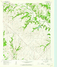 1961 Greenwood1964 Print · USGSThe rural landscape of Wise County in the early sixties is detailed here, showing a network of small settlements and creek-side farms. Genealogists can trace family roots at Beasley Cem and visit the community centers at Greenwood and Dixon Creek Church.2 unique versions available
 - 1968 Map of Thackerville, 1971 Print
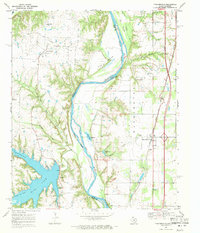 1968 Thackerville1971 Print · USGSThe Red River border between Oklahoma and Texas is shown here in the late sixties, highlighting the intersection of rail and river commerce. Researchers can trace the Atchison Topeka and Santa Fe tracks through Thackerville and locate the Sivells Bend Sch near the oil fields.2 unique versions available
 - 1968 Map of Burneyville, 1971 Print
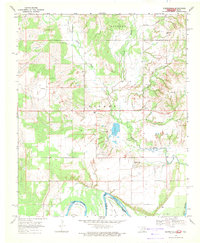 1968 Burneyville1971 Print · USGSLove County, Oklahoma, is documented here in the late sixties as a landscape of river bends and rural settlements. Genealogists and historians can locate family burial sites at Box Cem or Parker Cem and trace the paths of Simon Creek and Bone Creek.2 unique versions available
 - 1968 Map of Leon North, 1971 Print
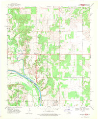 1968 Leon North1971 Print · USGSThe Red River frontier comes into focus during the late 1960s as it weaves between Oklahoma and Texas. Researchers can trace family roots at Courtney Cem or explore the river loops at Illinois Bend and the small settlements of Leon and Rubottom.2 unique versions available
 - 1968 Map of Horseshoe Bend, 1971 Print
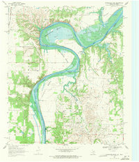 1968 Horseshoe Bend1971 Print · USGSThe Red River border between Texas and Oklahoma was defined by a heavy petroleum economy and winding river bends in the late sixties. Genealogists and historians can trace the rural infrastructure of the day, from the Walnut Bend Sch and Black Cem to the sprawling Walnut Bend Oil Field.2 unique versions available
 - 1968 Map of Marysville, 1971 Print
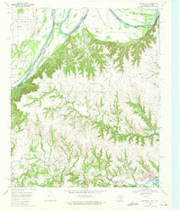 1968 Marysville1971 Print · USGSThe Red River frontier in the late sixties reveals a landscape of winding river bends and rural Texas settlements. Genealogists and researchers can locate the Weaver Cem, the small community of Marysville, and the Olsen Ranch Landing Strip.2 unique versions available
 - 1968 Map of Leon South, 1971 Print
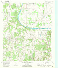 1968 Leon South1971 Print · USGSThe Red River frontier in the late sixties reveals a landscape of oil production and scattered prairie settlements along the Oklahoma-Texas line. Researchers can trace family history through numerous rural landmarks like Brushy Mound Cemetery, Bulcher, and Shiloh Ch Cem.
 - 1968 Map of Marietta West, 1971 Print
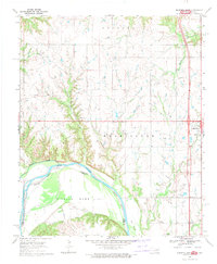 1968 Marietta West1971 Print · USGSThe Oklahoma-Texas borderlands are captured here in the late sixties as the Red River winds through Sivells Bend. Local historians can trace the Indian Meridian and locate landmarks like Bowles Ch, Gunter Cem, and the streets of Marietta.
End of results
Showing maps 1-20 of 20
Top cities of Cooke County
- Gainesville historical maps
- Muenster historical maps
- Lindsay historical maps
- Valley View historical maps
- Callisburg historical maps
- Oak Ridge historical maps
Frequently asked questions
- What are the different types of historical maps available for Cooke County?
- What is the oldest map of Cooke County?
- Where can I purchase historical maps of Cooke County for my home or office?
- Where can I download high-res historical maps of Cooke County?
- Are there historical topographic maps available for Cooke County?
- Is there historical aerial imagery available for Cooke County?
- Where are historical maps of Cooke County sourced from?