Old Maps of Osage, Texas for Hiking & Exploration
Hike through history with 12 historic maps of Osage. Explore old trails, ghost towns, and forgotten backroads — perfect for outdoor adventurers and local explorers.
- Rediscover forgotten places: Map out old mining camps, roads, and footpaths that no longer exist on modern maps.
- Layer with modern tools: Combine with LiDAR or satellite views to plan hikes through historical terrain.
- Made for exploration: Popular among hikers, overlanders, and local history lovers.
Use these maps to find adventure and explore the hidden past of Osage.
Osage, TX maps
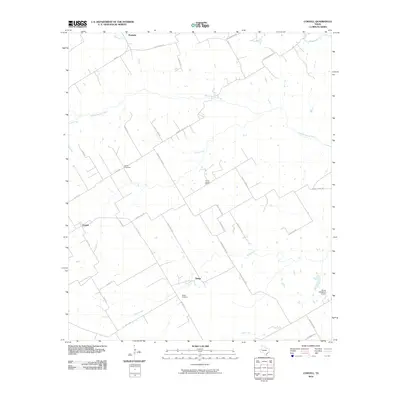
(12)- 1888 Map of Meridian
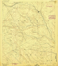 1888 Meridian1888 Print · USGSBosque and Coryell counties are shown here in the 1880s as the rail lines began to redefine the frontier landscape. Genealogists can locate early settlements like Turnersville, Cranfills Gap, and the rail junction at Meridian.
 - 1894 Map of Meridian
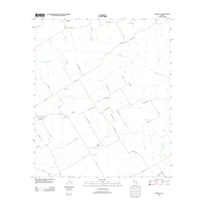
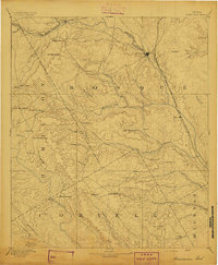 1894 Meridian1894 Print · USGSBosque and Coryell counties are shown in the late nineteenth century as the railroads began to reshape the cattle frontier. Genealogists and local historians can trace early settlements and community landmarks like Norse, Cranfills Gap, and Turnersville.3 unique versions available
 - 1954 Map of Waco, 1964 Print
 1954 Waco1964 Print · USGSCentral Texas during the mid-fifties shows a landscape defined by the expansion of Fort Hood Military Reservation and the Brazos river system. Trace the rail lines and early airfields like James Connally Air Force Base and settlements like Temple or McGregor.2 unique versions available
 - 1955 Map of Waco
 1955 Waco1955 Print · USGSCentral Texas at the peak of the Cold War reveals a landscape defined by military expansion and major water projects. Researchers can trace the footprints of Fort Hood, the waters of Lake Waco, and regional hubs like Temple or Mexia.
 - 1955 Map of Coryell, 1956 Print
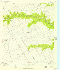 1955 Coryell1956 Print · USGSCentral Texas ranching country comes into focus in the mid-1950s where three counties meet along the Middle Bosque River. Researchers can trace old family sites near Osage Sch, find the Sadler Cem, or locate the Prairie Chapel Sch.2 unique versions available
 - 1956 Map of Mosheim, 1957 Print
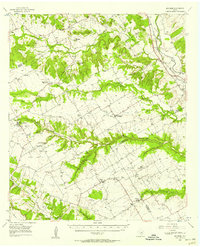 1956 Mosheim1957 Print · USGSCentral Texas rural life in the mid-fifties is captured here across the Bosque, Coryell, and McLennan county lines. Genealogists can trace legacy sites from the Norway Mill to numerous local landmarks like Lanes Chapel and the Crossroad Store.
 - 1985 Map of Waco
 1985 Waco1985 Print · USGSCentral Texas in the mid-eighties shows a landscape of river-fed lakes and bustling transit hubs as the region expanded. Genealogists and historians can trace rail lines like the Missouri Kansas Texas or locate sites such as Rosemound Cem and Meridian State Park.2 unique versions available
 - 2010 Map of Coryell, 2010 Print
 2010 Coryell2010 Print · USGSCovers Osage, including Coryell, McLennan County, and other nearby areas
 - 2012 Map of Coryell, 2012 Print
 2012 Coryell2012 Print · USGSCovers Osage, including Coryell, McLennan County, and other nearby areas
 - 2016 Map of Coryell, 2016 Print
 2016 Coryell2016 Print · USGSCovers Osage, including Coryell, McLennan County, and other nearby areas
 - 2019 Map of Coryell, 2019 Print
 2019 Coryell2019 Print · USGSCovers Osage, including Coryell, McLennan County, and other nearby areas
 - 2022 Map of Coryell, 2022 Print
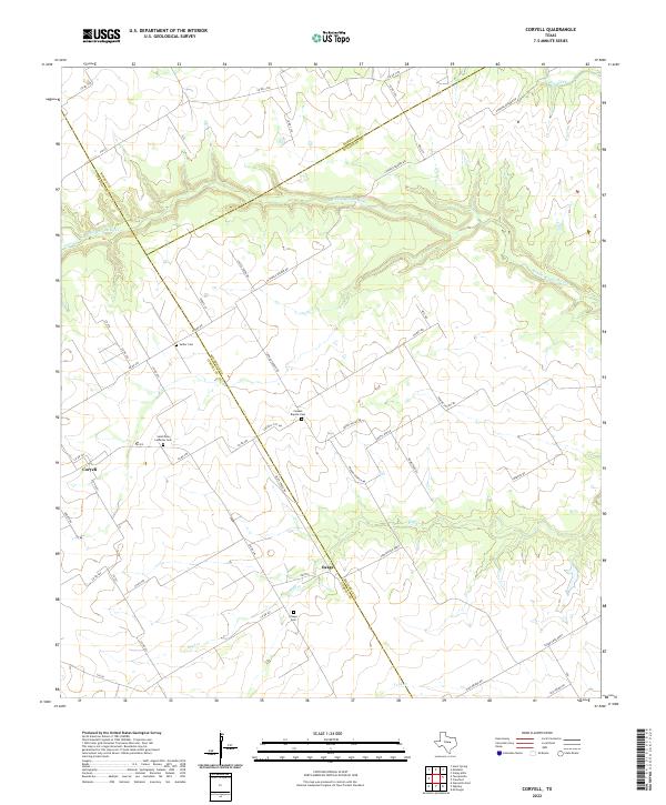 2022 Coryell2022 Print · USGSThe McLennan and Coryell county line comes alive in this modern survey of the river valleys and rural settlements west of Waco. Researchers can trace family history at Sadler Cem, follow the winding Middle Bosque River, or locate the historic community of Osage.
End of results
Showing maps 1-12 of 12
Top cities near Osage
- Gatesville historical maps
- McGregor historical maps
- Moody historical maps
- Valley Mills historical maps
- Crawford historical maps
- Oglesby historical maps
See more
Frequently asked questions
- What are the different types of historical maps available for Osage?
- What is the oldest map of Osage?
- Where can I purchase historical maps of Osage for my home or office?
- Where can I download high-res historical maps of Osage?
- Are there historical topographic maps available for Osage?
- Is there historical aerial imagery available for Osage?
- Where are historical maps of Osage sourced from?