2020s Maps of Duncanville, Texas
Explore 2 historic maps of Duncanville from the 2020s. These maps offer a rare glimpse into what life looked like during the 2020s — showing old roads, neighborhoods, homes, and landmarks that have changed or disappeared over time.
Whether you're researching your family's past, planning a metal detecting trip, or studying how Duncanville's landscape evolved across the 2020s, these high-resolution maps are a powerful tool for exploring the history of this region.
- Focus on a specific era: All maps on this page are from the 2020s, giving you a focused view of this time period.
- See what’s changed: Compare century-old streets, trails, and buildings to today's modern landscape using overlays and satellite layers.
- Research with precision: Use these maps for genealogy, historical research, land use analysis, or educational projects.
- View, download, or print: Maps are fully viewable online in high resolution, and can be downloaded or printed for your own records.
Start exploring Duncanville's history through authentic maps from the 2020s. This is your window into the past.
Duncanville, TX maps
(2)- 2022 Map of Duncanville, 2022 Print
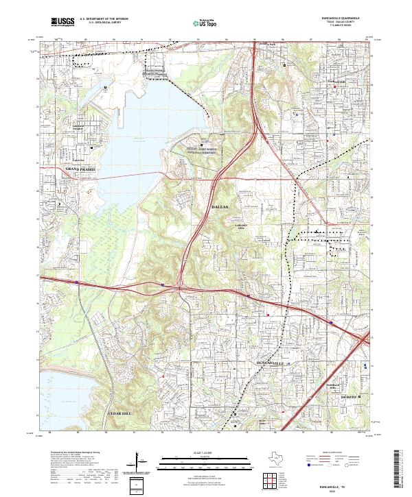 2022 Duncanville2022 Print · USGSThe Duncanville and Grand Prairie corridor is shown here during a period of dense suburban growth between the local lakes. Genealogists and historians can trace family sites like Fugitt Cem and Daniel Cem near the historic Chalk Hill and the Dallas Naval Air Station.
 - 2022 Map of Cedar Hill, 2022 Print
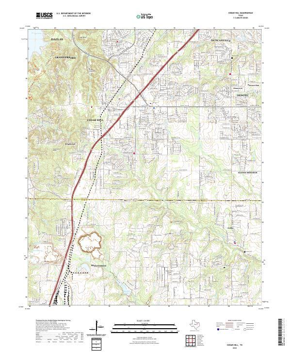 2022 Cedar Hill2022 Print · USGSThe suburbs south of Dallas were undergoing rapid growth in the early 2020s as residential tracts filled in the spaces between established towns. Genealogists and local historians can trace modern landmarks alongside historic sites like Shiloh Cem, Ovilla Cem, and Inspiration Point.
End of results
Showing maps 1-2 of 2
Top cities near Duncanville
- Dallas historical maps
- Fort Worth historical maps
- Arlington historical maps
- Irving historical maps
- Garland historical maps
- Grand Prairie historical maps
See more
Top neighborhoods of Duncanville
- Red Bird Addition historical maps
- River Oaks historical maps
- Woodland Hills historical maps
- The Greene historical maps
Frequently asked questions
- What are the different types of historical maps available for Duncanville?
- What is the oldest map of Duncanville?
- Where can I purchase historical maps of Duncanville for my home or office?
- Where can I download high-res historical maps of Duncanville?
- Are there historical topographic maps available for Duncanville?
- Is there historical aerial imagery available for Duncanville?
- Where are historical maps of Duncanville sourced from?