Old Maps of Dallas County, Texas for Genealogy
Trace your family roots with 149 historic maps of Dallas County. These high-res maps reveal old neighborhoods, homesites, landmarks, and streets — helping you uncover where your ancestors lived and how the area evolved over time.
- Explore historic neighborhoods: Identify where your relatives may have lived in the 1800s or 1900s.
- Compare maps over time: Trace the changes in streets, buildings, and landmarks for multi-generational research.
- Perfect for genealogy & ancestry research: Used by family historians and researchers to map out lineage and migration.
These maps are an incredible resource for exploring your personal connection to Dallas County's past.
Dallas County, TX maps
(149)- 1891 Map of Dallas
 1891 Dallas1891 Print · USGSThe Dallas area during the late nineteenth century was a rapidly growing rail hub still defined by its river crossings and rural outposts. Genealogists and historians can trace the foundations of the metroplex through early landmarks like Oak Cliff, Doddy's Ferry, and Haughts Store.
 - 1893 Map of Dallas
 1893 Dallas1893 Print · USGSDallas was a rising railroad power in the 1890s, when iron rails and river crossings dictated the growth of North Texas. Genealogists can locate vanished landmarks and rural hubs like Oak Cliff, Doddy's Ferry, and Haught's Store before the city's modern sprawl.5 unique versions available
 - 1894 Map of Fort Worth, 1918 Print
 1894 Fort Worth1918 Print · USGSNorth Texas at the end of the nineteenth century centers on a burgeoning Fort Worth and its strategic rail junctions. Researchers can locate early township sites like Johnson Station and Birdville or trace the military footprint of Camp Bowie.3 unique versions available
 - 1925 Map of Dallas 2-b
 1925 Dallas 2-b1925 Print · USGSNorth Texas in the mid-twenties shows a landscape of river-bottom farms and emerging rail towns along the Dallas-Denton line. Trace the early footprints of Carrollton and Farmers Branch or locate rural landmarks like Gentry School and the Texas Electric line.
 - 1931 Map of Carrollton
 1931 Carrollton1931 Print · USGSCarrollton and the Elm Fork valley are captured here in the mid-twenties, when interurban rail and steam lines defined the North Texas corridor. Genealogists can trace family landmarks like Bethel Ch, Bear Creek Sch, and the rural community at Trinity Mills.3 unique versions available
 - 1931 Map of Grapevine
 1931 Grapevine1931 Print · USGSTarrant and Dallas Counties appear in the early thirties as a network of rural settlements and rail-bound transit. Genealogists can locate family landmarks like Randalls Mill, the Bedford Bridge, and early school sites including Shady Grove Sch.2 unique versions available
 - 1954 Map of Dallas, 1963 Print
 1954 Dallas1963 Print · USGSNorth Texas in the mid-fifties and early sixties reveals a landscape of rapid urban growth and water management. Genealogists and historians can trace the evolution of the metroplex through landmarks like Hensley Field, Boles Orphan Home, and the Texas & Pacific RR.4 unique versions available
 - 1957 Map of White Rock Lake, 1959 Print
 1957 White Rock Lake1959 Print · USGSEast Dallas and the surrounding suburban reaches are shown in this late fifties survey as the urban grid expands toward White Rock Lake. Genealogists and local historians can trace the early footprints of Reinhardt, the grounds of the Buckner Orphans Home, and regional hubs like White Rock Airport.3 unique versions available
 - 1958 Map of Dallas
 1958 Dallas1958 Print · USGSNorth Texas in the late fifties shows the dramatic expansion of the Metroplex as it absorbs surrounding farm towns. Genealogists and historians can trace old rail lines like the Missouri-Kansas-Texas and locate early lakefront developments at Eagle Mountain Lake and Lake Worth Village.
 - 1958 Map of Hutchins, 1959 Print
 1958 Hutchins1959 Print · USGSSoutheast Dallas and the Trinity River valley are captured here in the late fifties as suburban expansion begins to reach into the river-bottom sporting clubs. Genealogists can trace family landmarks like the Morning School, Carver Cemetery, and the Hutchins Boys Industrial School.5 unique versions available
 - 1958 Map of Oak Cliff, 1959 Print
 1958 Oak Cliff1959 Print · USGSIn the late 1950s, Oak Cliff and South Dallas were undergoing rapid suburbanization around the Trinity River bottomlands. Researchers can trace mid-century institutional growth at the Veterans Hospital or locate historic family plots at Lisbon Cem and Wheatland Cem.5 unique versions available
 - 1958 Map of Dallas, 1959 Print
 1958 Dallas1959 Print · USGSMid-century Dallas is seen here at a peak of expansion, as new turnpikes and expressways began to encircle the historic core. Local historians can trace the foundations of the city through landmarks like Fair Park, Love Field, and the Cotton Bowl.7 unique versions available
 - 1958 Map of White Rock Lake, 1974 Print
 1958 White Rock Lake1974 Print · USGSEast Dallas and the surrounding suburban reaches are shown here during a mid-century period of intense residential growth. Researchers can trace the development of local schools like Adams High Sch, find the Buckner Orphans Home, or locate the former sites of White Rock Airport and Garland Airport.2 unique versions available
 - 1959 Map of Arlington, 1960 Print
 1959 Arlington1960 Print · USGSArlington and Grand Prairie were undergoing massive post-war growth when this survey recorded their expanding neighborhoods and industrial hubs. Researchers can trace the early footprints of Arlington State College, the Automobile Assembly Plant, and dozens of local churches like St Maria Goretti.6 unique versions available
 - 1959 Map of Lancaster, 1960 Print
 1959 Lancaster1960 Print · USGSSouthern Dallas County and northern Ellis County are shown here in the late fifties, as traditional farming communities began to expand. You can locate family history at Rawlins Cem, trace the Missouri Kansas Texas Railroad corridor, and find old landmarks like Camp Pinkston or Beckley City Chapel.5 unique versions available
 - 1959 Map of Mesquite, 1960 Print
 1959 Mesquite1960 Print · USGSMesquite and Sunnyvale are documented during a period of rapid suburbanization as residential grids began to meet rural bottomlands. Genealogists can trace family footprints at Macedonia Ch, Tripp, and the Florence Black Sch.4 unique versions available
 - 1959 Map of Garland, 1960 Print
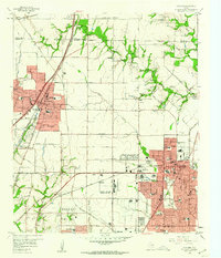 1959 Garland1960 Print · USGSNortheast Dallas County is shown here in the late fifties, just as the postwar suburban boom began to reshape the countryside. Genealogists and historians can trace family-named sites like Blewett Cem and early communities such as Audelia and Shiloh.5 unique versions available
 - 1959 Map of Euless, 1960 Print
 1959 Euless1960 Print · USGSMid-century Tarrant County is captured here during a period of rapid transit and aviation expansion. Genealogists can find numerous burial sites and rural landmarks like Bear Creek Cem, White Chapel, and the Terminal Control Tower at Amon Carter Field.7 unique versions available
 - 1959 Map of Grapevine, 1960 Print
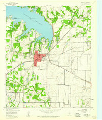 1959 Grapevine1960 Print · USGSGrapevine and its neighboring towns appear here in the late fifties, just as the region began its transition from a rail-centered agricultural hub to a modern suburb. Genealogists and local historians can locate Minters Chapel, the Parker Memorial Cem, and the old St Louis Southwestern rail line.5 unique versions available
 - 1959 Map of Seagoville, 1960 Print
 1959 Seagoville1960 Print · USGSSoutheast of Dallas in the late fifties, this area shows the growth of Seagoville and Balch Springs near the East Fork Trinity River. Genealogists can locate several family burial grounds like Potter Cem and community landmarks such as the Seagoville Federal Correctional Institution.4 unique versions available
 - 1959 Map of Irving, 1960 Print
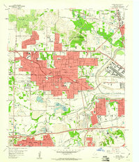 1959 Irving1960 Print · USGSIrving was rapidly transforming from a rural Dallas County landscape into a bustling suburban and industrial hub in the late fifties. Genealogists and historians can trace the foundations of the University of Dallas, locate the Sowers Cem, and find the Jap Lee Airstrip.5 unique versions available
 - 1959 Map of Addison, 1960 Print
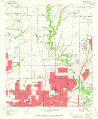 1959 Addison1960 Print · USGSThe northern fringes of Dallas were transforming from rural farmsteads to suburban hubs during the late fifties. Genealogists and historians can trace the growth of local institutions like Ursuline Academy, the Addison Sch, and the historic White Rock Cem.6 unique versions available
 - 1959 Map of Cedar Hill, 1960 Print
 1959 Cedar Hill1960 Print · USGSDuring the late fifties, the Dallas and Ellis county line remained a mix of rural encampments and developing suburbs like Cedar Hill and De Soto. Researchers can trace old family sites at Rhodes Cemetery or find historic community hubs like Shiloh Cemetery and the True Vine Church.6 unique versions available
 - 1959 Map of Ferris, 1960 Print
 1959 Ferris1960 Print · USGSThe northern Ellis County borderlands and southern Dallas County come alive in the late fifties, showing the rail-centered growth of Ferris and Wilmer. Researchers can trace old family sites near Bluff Springs Cemetery or the Dunbar High School.3 unique versions available
 - 1959 Map of Carrollton, 1960 Print
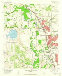 1959 Carrollton1960 Print · USGSThe Dallas-Denton county line area was transitioning from rural ranching to suburban centers in the late fifties. Genealogists and researchers can trace family landmarks like the Perry Cem, Bethel Ch, and the grounds of the Hackberry Ranch.8 unique versions available
Showing maps 1-25 of 149
Top cities of Dallas County
- Dallas historical maps
- Irving historical maps
- Garland historical maps
- Mesquite historical maps
- Rowlett historical maps
- DeSoto historical maps
See more
Frequently asked questions
- What are the different types of historical maps available for Dallas County?
- What is the oldest map of Dallas County?
- Where can I purchase historical maps of Dallas County for my home or office?
- Where can I download high-res historical maps of Dallas County?
- Are there historical topographic maps available for Dallas County?
- Is there historical aerial imagery available for Dallas County?
- Where are historical maps of Dallas County sourced from?