Old Maps of Lewisville, Texas for Academic Research
Study the evolution of Lewisville with 49 high-resolution historic maps. Whether you're teaching, researching, or modeling changes in land use, these maps provide essential visual documentation of urban, environmental, and geographic change.
- Analyze long-term change: Track patterns in development, transportation, and natural features.
- Ideal for environmental or urban studies: Support academic projects with primary historical map data.
- Use in the classroom or lab: Educators and researchers rely on these maps to bring historical context to life.
These maps are a powerful tool for teaching, research, and visualizing how Lewisville has changed over the decades.
Lewisville, TX maps
(49)- 1891 Map of Dallas
 1891 Dallas1891 Print · USGSThe Dallas area during the late nineteenth century was a rapidly growing rail hub still defined by its river crossings and rural outposts. Genealogists and historians can trace the foundations of the metroplex through early landmarks like Oak Cliff, Doddy's Ferry, and Haughts Store.
 - 1893 Map of Dallas
 1893 Dallas1893 Print · USGSDallas was a rising railroad power in the 1890s, when iron rails and river crossings dictated the growth of North Texas. Genealogists can locate vanished landmarks and rural hubs like Oak Cliff, Doddy's Ferry, and Haught's Store before the city's modern sprawl.5 unique versions available
 - 1894 Map of Fort Worth, 1918 Print
 1894 Fort Worth1918 Print · USGSNorth Texas at the end of the nineteenth century centers on a burgeoning Fort Worth and its strategic rail junctions. Researchers can locate early township sites like Johnson Station and Birdville or trace the military footprint of Camp Bowie.3 unique versions available
 - 1925 Map of Mc Kinney 3-c
 1925 Mc Kinney 3-c1925 Print · USGSDenton County in the mid-twenties shows a landscape of rural schools and early infrastructure just as the region began major water projects. Genealogists can locate family landmarks like Hackberry School, the Wire Bridge, and the community of Rector.
 - 1925 Map of Dallas 2-b
 1925 Dallas 2-b1925 Print · USGSNorth Texas in the mid-twenties shows a landscape of river-bottom farms and emerging rail towns along the Dallas-Denton line. Trace the early footprints of Carrollton and Farmers Branch or locate rural landmarks like Gentry School and the Texas Electric line.
 - 1929 Map of Frisco
 1929 Frisco1929 Print · USGSDenton and Collin counties appear in the mid-1920s as a landscape of rural school districts and emerging transit lines before the era of major reservoirs. Researchers can trace family-named landmarks and old transport routes like the Dallas-Denton Electric line and Hackberry Sch.2 unique versions available
 - 1931 Map of Carrollton
 1931 Carrollton1931 Print · USGSCarrollton and the Elm Fork valley are captured here in the mid-twenties, when interurban rail and steam lines defined the North Texas corridor. Genealogists can trace family landmarks like Bethel Ch, Bear Creek Sch, and the rural community at Trinity Mills.3 unique versions available
 - 1931 Map of Grapevine
 1931 Grapevine1931 Print · USGSTarrant and Dallas Counties appear in the early thirties as a network of rural settlements and rail-bound transit. Genealogists can locate family landmarks like Randalls Mill, the Bedford Bridge, and early school sites including Shady Grove Sch.2 unique versions available
 - 1954 Map of Dallas, 1963 Print
 1954 Dallas1963 Print · USGSNorth Texas in the mid-fifties and early sixties reveals a landscape of rapid urban growth and water management. Genealogists and historians can trace the evolution of the metroplex through landmarks like Hensley Field, Boles Orphan Home, and the Texas & Pacific RR.4 unique versions available
 - 1954 Map of Sherman, 1964 Print
 1954 Sherman1964 Print · USGSThe Red River valley and North Texas plains are captured here in the mid-fifties, showing the region as new reservoirs like Lake Texoma and Lavon Reservoir reshaped the land. Genealogists can trace family roots through specific local landmarks like Courtney P O, Pilot Grove Sch, and New Hope Ch.2 unique versions available
 - 1958 Map of Dallas
 1958 Dallas1958 Print · USGSNorth Texas in the late fifties shows the dramatic expansion of the Metroplex as it absorbs surrounding farm towns. Genealogists and historians can trace old rail lines like the Missouri-Kansas-Texas and locate early lakefront developments at Eagle Mountain Lake and Lake Worth Village.
 - 1958 Map of Sherman, 1959 Print
 1958 Sherman1959 Print · USGSNorth Texas and Southern Oklahoma were undergoing significant development in the late fifties as the Red River Valley transit networks matured. Researchers can trace historic family-named locations such as Saddler Bend, the grounds of Perrin AFB, and early shoreline developments at Lake Texoma.
 - 1959 Map of Grapevine, 1960 Print
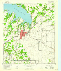 1959 Grapevine1960 Print · USGSGrapevine and its neighboring towns appear here in the late fifties, just as the region began its transition from a rail-centered agricultural hub to a modern suburb. Genealogists and local historians can locate Minters Chapel, the Parker Memorial Cem, and the old St Louis Southwestern rail line.5 unique versions available
 - 1959 Map of Carrollton, 1960 Print
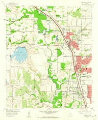 1959 Carrollton1960 Print · USGSThe Dallas-Denton county line area was transitioning from rural ranching to suburban centers in the late fifties. Genealogists and researchers can trace family landmarks like the Perry Cem, Bethel Ch, and the grounds of the Hackberry Ranch.8 unique versions available
 - 1959 Map of Carrollton, 1963 Print
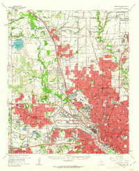 1959 Carrollton1963 Print · USGSNorth Dallas and its surrounding suburbs are captured during a period of massive suburban growth in the late fifties. Genealogists can trace family sites near Trinity Mills, while researchers can locate mid-century landmarks like Love Field Municipal Airport and Calvary Hill Cemetery.
 - 1959 Map of Grapevine, 1964 Print
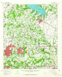 1959 Grapevine1964 Print · USGSTarrant County at the close of the fifties shows the transition from rural prairie to a major aviation and suburban hub. Trace family roots at the Lonesome Dove Ch or Medlin Cem while seeing early footprints of the Greater Southwest International Airport.
 - 1960 Map of Lewisville East, 1962 Print
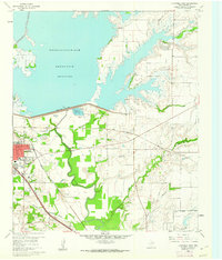 1960 Lewisville East1962 Print · USGSDenton County at the start of the 1960s shows a landscape transformed by the Garza-Little Elm Reservoir and heavy rail. Local historians can trace old settlements like Midway and Round Grove alongside Ritter Cem and the Lewisville Hatchery.5 unique versions available
 - 1960 Map of Hebron, 1962 Print
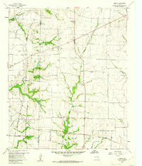 1960 Hebron1962 Print · USGSBefore the suburban sprawl of the late twentieth century, the borderlands of Denton and Collin County remained a landscape of rural schoolhouses and family cemeteries. Trace the early footprints of Hebron and Shepton or locate landmarks like Baccus Cem and the Liberty Ch.6 unique versions available
 - 1960 Map of Lewisville West, 1962 Print
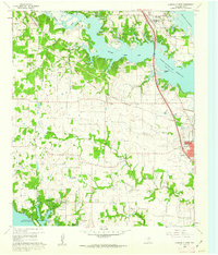 1960 Lewisville West1962 Print · USGSDenton County at the start of the sixties reveals a landscape shaped by large-scale water projects and rural community life. Genealogists and local historians can trace family landmarks like Chinn Cem, Old Hall Cem, and Chinn Chapel across the rolling terrain.6 unique versions available
 - 1985 Map of Fort Worth
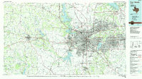 1985 Fort Worth1985 Print · USGSMid-1980s Tarrant County and Parker County emerge from a transition between urban sprawl and rural cattle country. Researchers can trace the expansion of Fort Worth and Arlington alongside older landmarks like Nebo Mtn and Kikapoo Falls.2 unique versions available
 - 1985 Map of McKinney
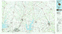 1985 McKinney1985 Print · USGSNorth Texas in the mid-1980s was a landscape of rural communities connected by a complex web of railroads and creek systems. Researchers can trace family roots through settlements like Westminster, find local landmarks like Henslee Chapel, or map the industrial activity at various Gravel Pits.2 unique versions available
 - 1985 Map of Denton
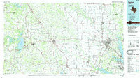 1985 Denton1985 Print · USGSNorth Texas in the mid-eighties shows a region of growing towns and established rail lines. Trace family roots and local history through Wizard Wells, the old Oaklawn Cem, and the tracks of the Burlington Northern.
 - 1986 Map of Dallas
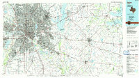 1986 Dallas1986 Print · USGSThe North Texas metropolitan landscape comes into focus during the mid-eighties as urban growth expands toward the eastern reservoirs. Researchers can trace historic cemeteries like Oak Cliff Cem, rail corridors of the Texas & Pacific RR, and landmarks such as Southern Methodist University.3 unique versions available
 - 1991 Map of Denton
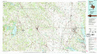 1991 Denton1991 Print · USGSNorth Texas in the early nineties shows a region transitioning between rural heritage and modern infrastructure across several counties. Genealogists and historians can trace rail lines like the Missouri Pacific or find established settlements such as Sanger, Bolivar, and Greenwood.2 unique versions available
 - 2010 Map of Grapevine, 2010 Print
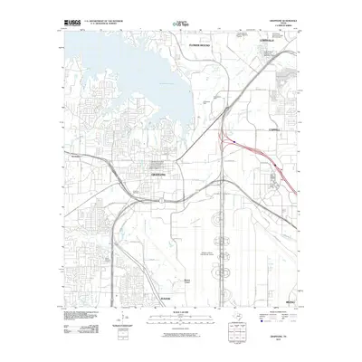 2010 Grapevine2010 Print · USGSThe Grapevine area in the early 2010s reveals a landscape of historic town centers alongside massive infrastructure projects like the DFW airport. Genealogists and local historians can trace legacy sites like Parker Memorial Cemetery and Minters Chapel.
Showing maps 1-25 of 49
Top cities near Lewisville
- Dallas historical maps
- Fort Worth historical maps
- Plano historical maps
- Irving historical maps
- Frisco historical maps
- McKinney historical maps
See more
Top neighborhoods of Lewisville
- Reserve at Timber Creek historical maps
- Vista Villas historical maps
- Britian Estates historical maps
- Hedrick Estates historical maps
- Normandy Homes historical maps
- Oak Creek Estates historical maps
See more
Frequently asked questions
- What are the different types of historical maps available for Lewisville?
- What is the oldest map of Lewisville?
- Where can I purchase historical maps of Lewisville for my home or office?
- Where can I download high-res historical maps of Lewisville?
- Are there historical topographic maps available for Lewisville?
- Is there historical aerial imagery available for Lewisville?
- Where are historical maps of Lewisville sourced from?