Old Maps of Dickens County, Texas
Explore 125 old maps of Dickens County, spanning from 1954 to today. These high-resolution historic maps reveal how streets, neighborhoods, landmarks, and natural features evolved over time — perfect for genealogy, metal detecting, research, and local history exploration.
What you can do with these maps:
- See how Dickens County changed over time: Compare historical maps to modern-day views to trace roads, homesites, rail lines & more.
- View detailed metadata: Each map includes creators, publishers, year, scale, and archive source.
- Overlay maps with satellite & LiDAR: Visualize the past alongside modern tools to explore terrain & human change.
- Trusted historical sources: Maps sourced from the USGS, Library of Congress, and other archives.
- Access maps your way: View online, download high-res files, or order prints for personal or research use.
Start exploring old maps of Dickens County to uncover forgotten places, hidden landmarks, and the deep history beneath your feet.
Dickens County, TX maps
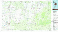
(125)- 1954 Map of Lubbock, 1958 Print
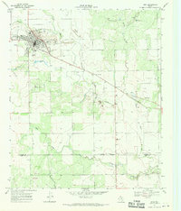
 1954 Lubbock1958 Print · USGSThe High Plains and Caprock region of West Texas come alive in the mid-1950s, showing a landscape defined by oil discovery and the Brazos River headwaters. Genealogists and historians can trace rail-connected towns like Roaring Springs, find the Pleasant Valley church, or locate family-named landmarks such as Soldier Mound.4 unique versions available
 - 1958 Map of Pursley House, 1959 Print
 1958 Pursley House1959 Print · USGSThe West Texas ranchlands at the junction of four counties are captured here in the late fifties. Researchers can trace remote homesteads and cattle operations like Pursley House, Beggs Ranch, and Kellar Field Camp.2 unique versions available
 - 1959 Map of Gilpin
 1959 Gilpin1959 Print · USGSThe West Texas ranchlands of Dickens and Kent counties are captured here in the late fifties, centered on the railroad siding of Gilpin. Researchers can trace the path of the Fort Worth and Denver line through the breaks of Duck Creek and Red Hill.
 - 1961 Map of Bunker Hill, 1963 Print
 1961 Bunker Hill1963 Print · USGSCrosby County and Dickens County were largely open rangeland in the early sixties, defined by the deep winding cuts of the White River. Local historians can trace cattle-country landmarks like Snow Tank, Poe Hollow, and the prominent Bunker Hill.
 - 1962 Map of Smith Tank, 1963 Print
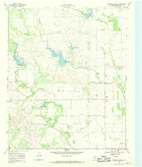
 1962 Smith Tank1963 Print · USGSThe High Plains of West Texas are captured here in the early sixties during a period of major hydrological change. Researchers can trace the new shoreline of the White River Reservoir and locate landmarks like the White River Dam and Smith Tank.2 unique versions available
 - 1965 Map of Wake, 1968 Print
 1965 Wake1968 Print · USGSCrosby County and its neighbors meet on the edge of the Caprock in the mid-1960s, showing a landscape defined by ranching and groundwater. Genealogists and local historians can locate the Wake settlement, trace the Rustler Creek breaks, and find Antelope Cem.
 - 1966 Map of McAdoo, 1968 Print
 1966 McAdoo1968 Print · USGSThe West Texas caprock meets the canyon breaks in the mid-1960s near the Crosby and Dickens County line. Genealogists and researchers can trace local landmarks like Pansy Ch, McAdoo Cem, and the small settlement of Broadway.
 - 1967 Map of Dickens North, 1970 Print
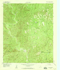
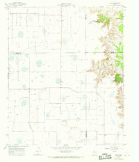
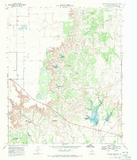
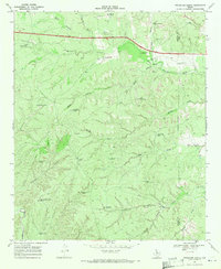
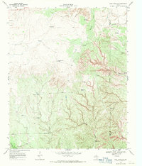
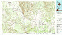
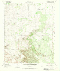 1967 Dickens North1970 Print · USGSThe broken country of West Texas comes into focus in the late sixties, showing the transition from the high plains to the canyonlands. Genealogists and local historians can trace family ties at Amity Cem or locate old landmarks like Elton, Dickens, and Mackenzie Peak.2 unique versions available
 - 1967 Map of Dickens South, 1970 Print
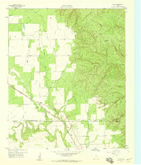
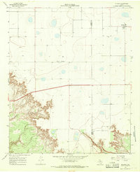
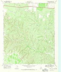
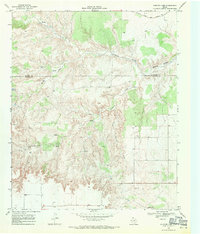
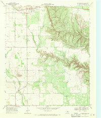 1967 Dickens South1970 Print · USGSDickens sits on the edge of the Caprock in the late 1960s, where the high plains meet the intricate erosional canyons of the Croton Breaks. Researchers can trace the local landscape through landmarks like Soldier Mound, the town Cem, and a mid-century Drive-in Theater.2 unique versions available
 - 1967 Map of Spur, 1970 Print
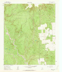
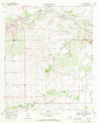
 1967 Spur1970 Print · USGSSpur was a thriving West Texas hub in the late 1960s, showing its fully developed town grid and infrastructure. Researchers can trace local landmarks like Swenson Park, the town Cem, and the path of the Aqueduct crossing Spade Draw.
 - 1967 Map of Haystack Mountain, 1971 Print
 1967 Haystack Mountain1971 Print · USGSThe Texas Rolling Plains in the late sixties are captured here in high detail, showing the drainage of Cottonwood Creek and the heights of Haystack Mountain. Researchers can trace the water sources essential for local ranching, from a natural Spring to numerous scattered Wells.2 unique versions available
 - 1967 Map of Spur NW, 1971 Print
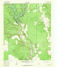
 1967 Spur NW1971 Print · USGSThe West Texas landscape at the Dickens and Kent County line reveals a sophisticated network of 1960s water infrastructure. Researchers can trace the path of an AQUEDUCT near the Rolling Plains Research Station and locate landmarks like Red Mud Creek.
 - 1968 Map of East Afton, 1970 Print
 1968 East Afton1970 Print · USGSThe Texas Rolling Plains of the late sixties are captured here in a transition between cattle ranching and early resource extraction. Researchers can trace the original footprints of East Afton and Croton or locate specific family landmarks like Riley and Duncan Tank.2 unique versions available
 - 1968 Map of Pitchfork Ranch, 1970 Print
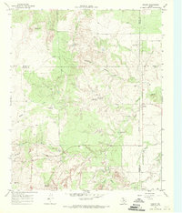
 1968 Pitchfork Ranch1970 Print · USGSRanching life on the Rolling Plains is captured here in the late sixties along the Dickens and King County border. Researchers can trace the water sources and outposts critical to the Pitchfork Ranch, including Humble Windmill and Devils Playground Windmill.2 unique versions available
 - 1968 Map of Foreman Chapel, 1970 Print
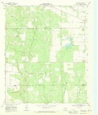
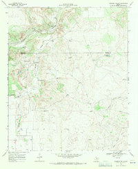
 1968 Foreman Chapel1970 Print · USGSDickens County in the late sixties reveals a rural landscape defined by ranching and water management. Genealogists and local historians can locate Foreman Chapel, the Espuela Cem, and numerous Wells along Duck Creek.2 unique versions available
 - 1968 Map of Dumont, 1970 Print
 1968 Dumont1970 Print · USGSThe West Texas ranching country near the Dickens and King county line was a network of seasonal draws and vital water sources in the late sixties. Trace the distribution of livestock windmills like Threeway Windmill and the settlement at Dumont near the North Wichita River.2 unique versions available
 - 1968 Map of Croton Camp, 1971 Print
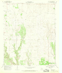
 1968 Croton Camp1971 Print · USGSThe Dickens County ranchlands were defined by the complex drainage of the Croton Breaks in the late sixties. Researchers can trace historic property boundaries and water infrastructure through family-named landmarks like the Jake Rains Windmill and Floyd Smith Windmill.2 unique versions available
 - 1968 Map of East Afton NE, 1971 Print
 1968 East Afton NE1971 Print · USGSThe High Plains ranching country of Dickens and King counties is captured in the late sixties, showing a landscape shaped by the South Wichita River. Researchers can trace old family ranching landmarks and water points like Scoggins, Gene Williams Windmill, and Dripping Springs.
 - 1968 Map of Rustler Camp, 1971 Print
 1968 Rustler Camp1971 Print · USGSDickens and Motley Counties were still primarily ranching territory in the late 1960s, marked by intermittent creeks and cattle camps. Genealogists and historians can trace the Quanah Acme and Pacific rail line and local landmarks like Rustler Camp or Wolf Springs.2 unique versions available
 - 1968 Map of Sanders Hollow, 1971 Print
 1968 Sanders Hollow1971 Print · USGSRanching life on the Motley and Dickens county line is captured in the late sixties, where water is the primary currency of the landscape. Researchers can trace family-named landmarks and infrastructure like Red Lake Ranch, Hoyle Windmill, and the Red Lake Ranch Airfield.2 unique versions available
 - 1968 Map of Afton, 1971 Print
 1968 Afton1971 Print · USGSDickens County ranching country is captured here in the late sixties, showing the rural landscape around the South Pease River. Researchers can locate the Patton Springs Sch, the small settlement of Glenn, and the waters of Roaring Spring.
 - 1985 Map of Dickens
 1985 Dickens1985 Print · USGSThe West Texas ranchlands near the Dickens and King County lines are shown here in the mid-eighties as a network of rural settlements and canyon terrain. Trace family roots or land boundaries near Roaring Springs, Soldier Mound, or the Fort Worth and Denver Railroad.2 unique versions available
 - 1985 Map of Aspermont, 1994 Print
 1985 Aspermont1994 Print · USGSStonewall and Kent counties are shown in the mid-1980s as the river-cut plains of West Texas supported scattered ranching and oil communities. Genealogists and historians can trace the Railroad Grade and locate smaller locales like Old Glory and Girard.
 - 1986 Map of Slaton
 1986 Slaton1986 Print · USGSThe Llano Estacado meets the rolling breaks of the Brazos River in the mid-1980s as the region's ranching and rail roots remain visible. Trace the path of the Atchison Topeka and Santa Fe through Post or locate Guthrie Lake and Wilson.2 unique versions available
 - 1986 Map of Lubbock
 1986 Lubbock1986 Print · USGSLubbock and the surrounding High Plains are documented in the mid-eighties as a structured grid of agricultural tracts and growing urban centers. Genealogists and local historians can trace family-named areas like Heckville, old rail stops on the Atchison Topeka and Santa Fe, and the winding path of Yellow House Canyon.2 unique versions available
Showing maps 1-25 of 125
Top cities of Dickens County
Frequently asked questions
- What are the different types of historical maps available for Dickens County?
- What is the oldest map of Dickens County?
- Where can I purchase historical maps of Dickens County for my home or office?
- Where can I download high-res historical maps of Dickens County?
- Are there historical topographic maps available for Dickens County?
- Is there historical aerial imagery available for Dickens County?
- Where are historical maps of Dickens County sourced from?