2020s Maps of Dickens County, Texas
Explore 20 historic maps of Dickens County from the 2020s. These maps offer a rare glimpse into what life looked like during the 2020s — showing old roads, neighborhoods, homes, and landmarks that have changed or disappeared over time.
Whether you're researching your family's past, planning a metal detecting trip, or studying how Dickens County's landscape evolved across the 2020s, these high-resolution maps are a powerful tool for exploring the history of this region.
- Focus on a specific era: All maps on this page are from the 2020s, giving you a focused view of this time period.
- See what’s changed: Compare century-old streets, trails, and buildings to today's modern landscape using overlays and satellite layers.
- Research with precision: Use these maps for genealogy, historical research, land use analysis, or educational projects.
- View, download, or print: Maps are fully viewable online in high resolution, and can be downloaded or printed for your own records.
Start exploring Dickens County's history through authentic maps from the 2020s. This is your window into the past.
Dickens County, TX maps
(20)- 2022 Map of Haystack Mountain, 2022 Print
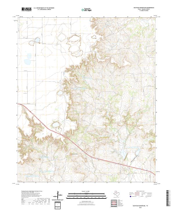 2022 Haystack Mountain2022 Print · USGSDickens County is defined by its dramatic erosion and water management systems in this recent survey. Local historians and land researchers can trace the rugged topography of Hobble Scobble Canyon or locate land-use markers like Haystack Mtn and the Duck Creek drainage.
 - 2022 Map of Sanders Hollow, 2022 Print
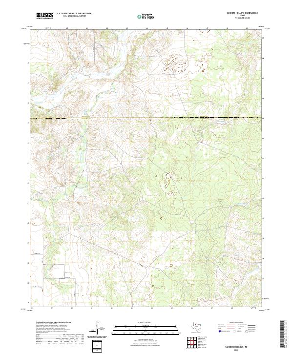 2022 Sanders Hollow2022 Print · USGSModern ranching life and drainage patterns intersect at the Motley and Dickens county line in the early 2020s. Researchers can trace seasonal water features like Fishhole Cr and the N Wichita River or locate landmarks such as County Line Tank.
 - 2022 Map of Foreman Chapel, 2022 Print
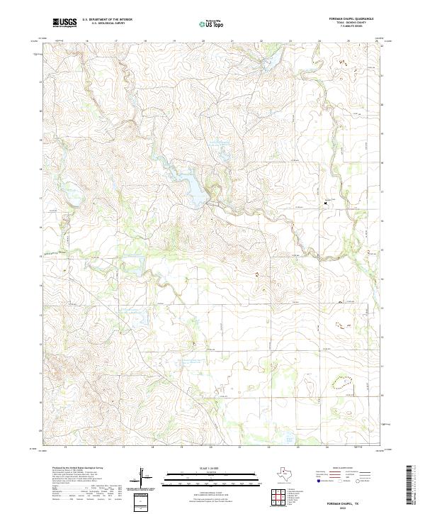 2022 Foreman Chapel2022 Print · USGSDickens County at the start of the 2020s shows a landscape deeply defined by water management and rural transit. Researchers can find Espuela Cem and trace the paths of Cottonwood Creek and Duck Creek through several large soil conservation reservoirs.
 - 2022 Map of Spur, 2022 Print
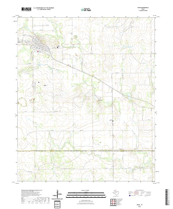 2022 Spur2022 Print · USGSThe West Texas cattle and cotton lands near the Dickens and Kent county line are shown here in the contemporary era. Researchers can trace the layout of Spur or locate rural landmarks like Steele Hill Cem, Travis Field, and the banks of Duck Cr.
 - 2022 Map of East Afton, 2022 Print
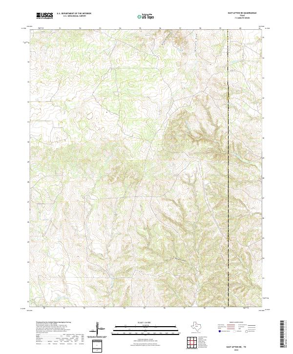
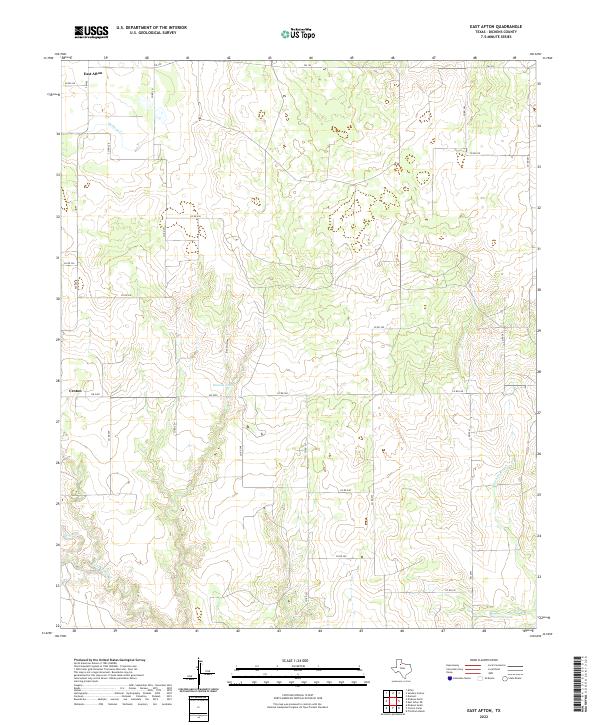 2022 East Afton2022 Print · USGSDickens County ranching country is shown here in the early 2020s, centered on the rural settlements of East Afton and Croton. Researchers can trace the local drainage system from Beef Hollow down to the S Wichita River and locate water sources like Duncan Tank.
 - 2022 Map of Croton Camp, 2022 Print
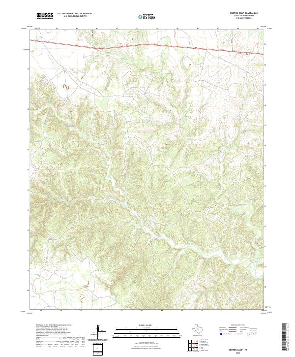 2022 Croton Camp2022 Print · USGSDickens County in the early twenty-first century reveals a landscape defined by the winding drainages of the Texas Panhandle. Trace the complex terrain of the Croton Breaks and follow the paths of Little Croton Cr and Beef Hollow.
 - 2022 Map of Dickens North, 2022 Print
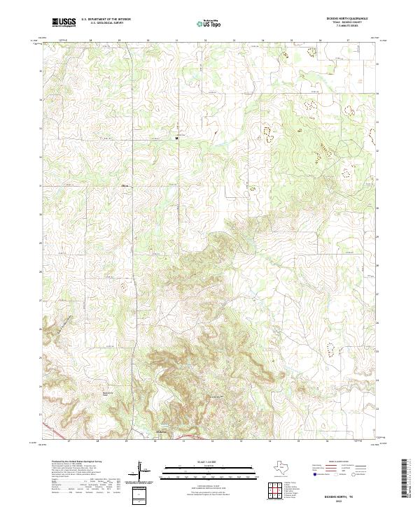 2022 Dickens North2022 Print · USGSThe broken country north of Dickens, Texas, is captured here in the early twenty-first century as a network of cattle country and creek-fed canyons. Researchers can locate Amity Cem, the landmark Mackenzie Peak, and the water at Dickens Spring.
 - 2022 Map of Gilpin, 2022 Print
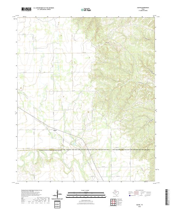 2022 Gilpin2022 Print · USGSGilpin and the surrounding Dickens County ranchlands are documented here in the early twenty-first century. Researchers can trace the rugged topography of Red Hill and the deep cuts of John Bell Canyon, Dark Canyon, and Sage Draw.
 - 2022 Map of Rustler Camp, 2022 Print
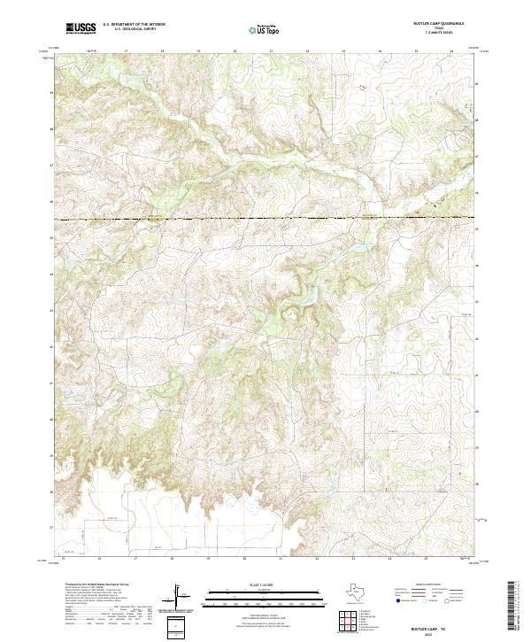 2022 Rustler Camp2022 Print · USGSThe border of Motley and Dickens Counties is mapped here in the early 2020s, showing a landscape defined by ranching roads and canyon breaks. Trace the paths of Wolf Cr and Grapevine Cr or locate Wolf Springs and Roaring Springs.
 - 2022 Map of Pitchfork Ranch, 2022 Print
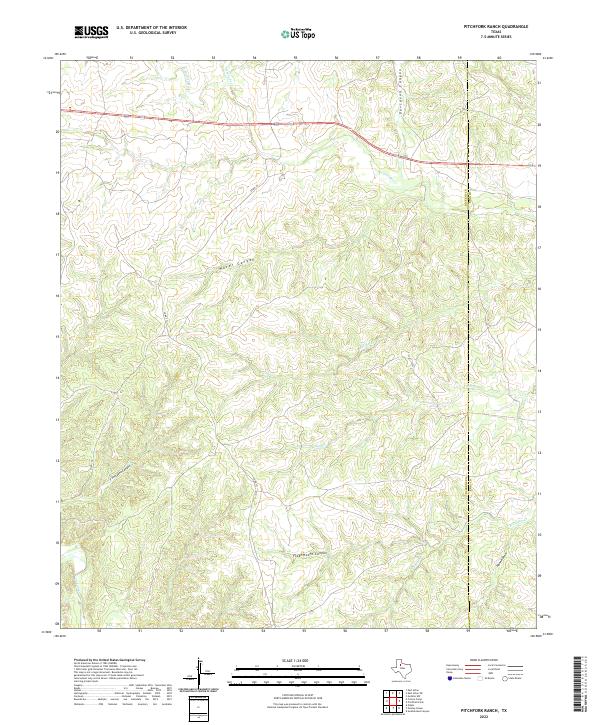 2022 Pitchfork Ranch2022 Print · USGSTexas ranchlands on the Dickens and King county line are documented here in the early twenty-first century. Researchers can trace the winding paths of S Wichita River and Salt Cr through deep breaks like Flakemoore Canyon and Davidson Canyon.
 - 2022 Map of Pursley House, 2022 Print
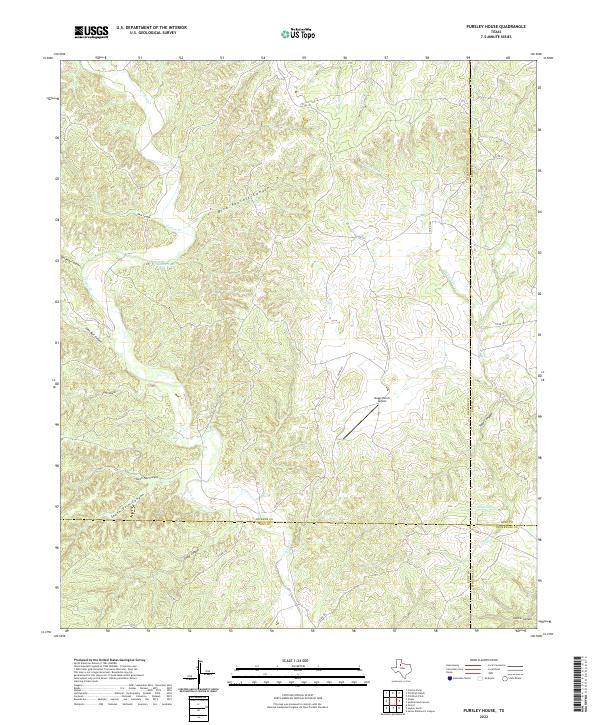 2022 Pursley House2022 Print · USGSThe West Texas breaks at the intersection of Dickens, King, Kent, and Stonewall counties are revealed in this modern survey. Researchers can trace ranching landmarks like the Beggs Ranch Airport and remote features like Bird Pouroff Canyon and Getaway Tank.
 - 2022 Map of Dumont, 2022 Print
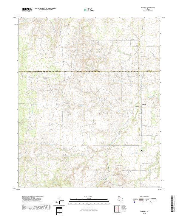 2022 Dumont2022 Print · USGSDumont and its surrounding ranchlands are documented here at a unique four-county corner where Dickens, Motley, Cottle, and King meet. Researchers can trace family sites near the Dumont Cem and follow the rugged paths of the N Wichita River and Shinnery Draw.
 - 2022 Map of East Afton NE, 2022 Print
 2022 East Afton NE2022 Print · USGSThe West Texas ranchlands on the Dickens and King county line are captured here in the early twenty-first century. Researchers can trace the rugged drainages of the S Wichita River and locate remote natural landmarks like Dripping Spring and Long Canyon.
 - 2022 Map of Spur NW, 2022 Print
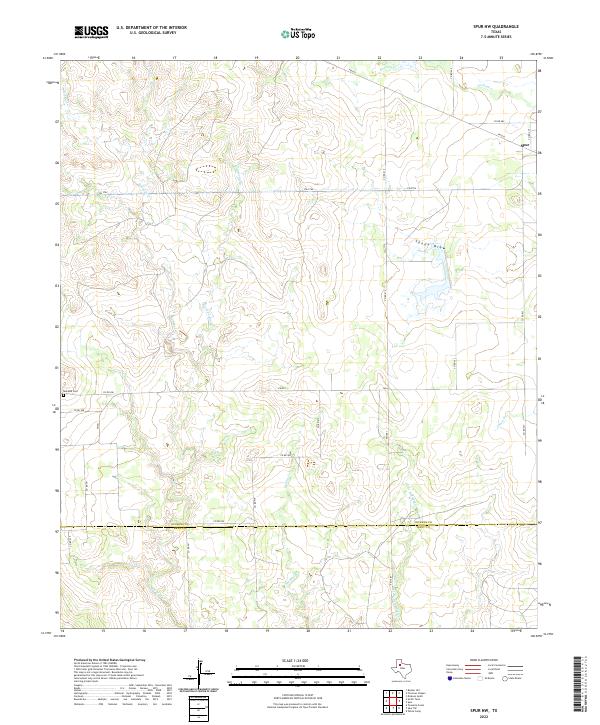 2022 Spur NW2022 Print · USGSThe town of Spur and the surrounding ranchlands of Dickens and Kent counties are captured in this modern survey. Researchers can trace land boundaries along Red Mud Cr or locate family sites near the Red Mud Cem.
 - 2022 Map of Afton, 2022 Print
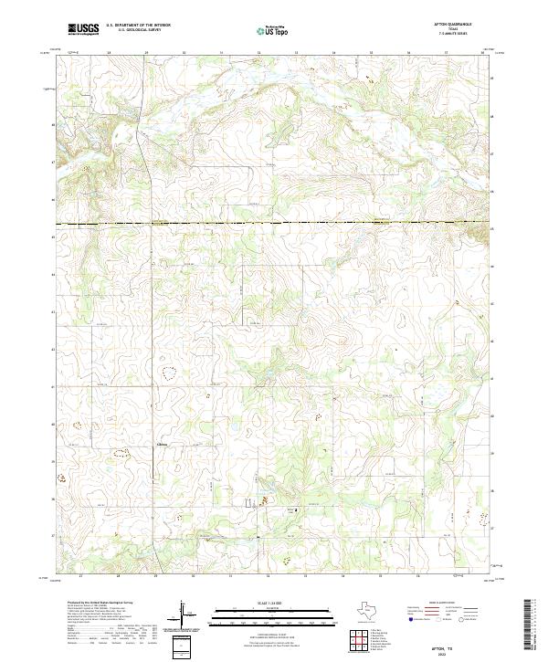 2022 Afton2022 Print · USGSDickens and Motley counties at the start of the 2020s are captured here as ranching lands centered on local springs. Genealogists can trace family connections at Afton Cem or locate the old crossroads at Glenn and Patton Springs.
 - 2022 Map of McAdoo, 2022 Print
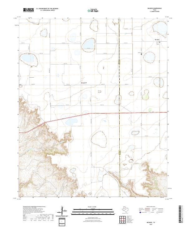 2022 McAdoo2022 Print · USGSCrosby and Dickens counties meet here on the edge of the Caprock during the early twenty-first century. Genealogists and local historians can trace family plots at McAdoo Cem or locate the rural hubs of McAdoo and Broadway.
 - 2022 Map of Wake, 2022 Print
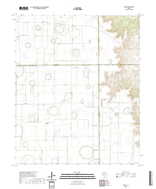 2022 Wake2022 Print · USGSThis High Plains landscape near the edge of the Caprock shows the agricultural layout of Crosby County and its neighbors in the early 2020s. Genealogists and local historians can locate Wake and Antelope Cem, or trace the rugged draws of Rustler Cr.
 - 2022 Map of Bunker Hill, 2022 Print
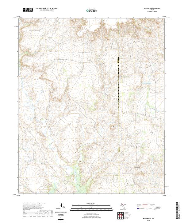 2022 Bunker Hill2022 Print · USGSThe Caprock escarpment on the border of Crosby and Dickens counties is captured in the early 2020s, showing a landscape defined by deep draws and ranching infrastructure. Trace the drainages of the White River and locate local landmarks like Bunker Hill, Negro Hill, and the Soil Conservation Service Site 6 Reservoir.
 - 2022 Map of Dickens South, 2022 Print
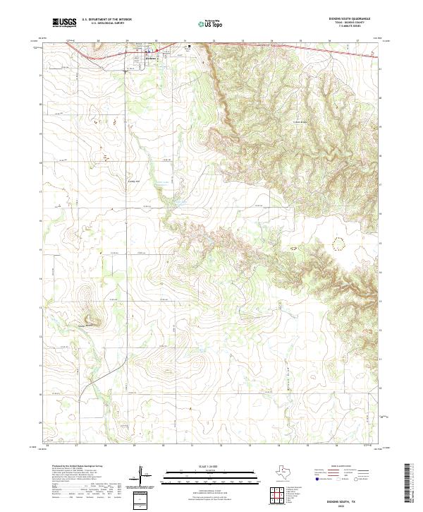 2022 Dickens South2022 Print · USGSThe community of Dickens and the surrounding Rolling Plains are captured here in the early twenty-first century. Genealogists and historians can locate the Dickens County Courthouse and Dickens Cem while tracing drainage patterns through the Croton Breaks.
 - 2022 Map of Smith Tank, 2022 Print
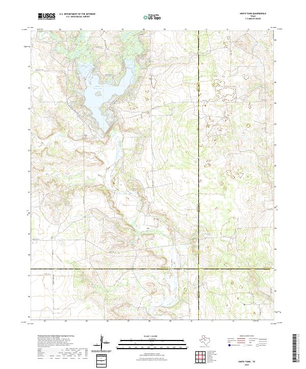 2022 Smith Tank2022 Print · USGSCrosby County and the surrounding ranchlands are documented here at the edge of the Llano Estacado in the early 2020s. Researchers can trace the shoreline of White River Lake and locate rural landmarks like Smith Tank and the Comanche Trl.
End of results
Showing maps 1-20 of 20
Top cities of Dickens County
Frequently asked questions
- What are the different types of historical maps available for Dickens County?
- What is the oldest map of Dickens County?
- Where can I purchase historical maps of Dickens County for my home or office?
- Where can I download high-res historical maps of Dickens County?
- Are there historical topographic maps available for Dickens County?
- Is there historical aerial imagery available for Dickens County?
- Where are historical maps of Dickens County sourced from?