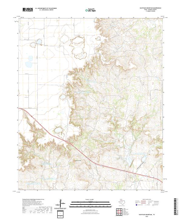
2022 Map of Haystack Mountain
USGS Topo · Published 2022About this map
Haystack Mtn rises above a highly dissected landscape of canyons and creek beds in this Dickens County survey. The terrain is defined by the winding course of Duck Creek and the deep incision of Hobble Scobble Canyon, showcasing the erosional patterns of the Texas Rolling Plains. The map reveals an extensive system of land management and water control, marked by numerous reservoirs such as Soil Conservation Service Site 2 Reservoir and a series of grade stabilization structures from Grade Stabilization Structure Ca-1 Reservoir to Grade Stabilization Structure Ca-5 Reservoir. These features, along with named drainage ways like Cottonwood Cr and Washout Cr, illustrate the ongoing efforts to manage soil erosion and runoff in this cattle-ranching and agricultural region.
Find a feature on this map
28 named features on this map. Tap any name to fly to it.
Don’t see what you’re looking for? This feature index may not catch every label — zoom into the map to look around manually.
Map Details
Editions of this 2022 Haystack Mountain Map
This is the sole edition of this map. No revisions or reprints were ever made.
Other maps of this area

1954 · Lubbock
USGS Topo · 1:250,000

1961 · Bunker Hill
USGS Topo · 1:24,000

1965 · Wake
USGS Topo · 1:24,000

1966 · McAdoo
USGS Topo · 1:24,000

1967 · Dickens North
USGS Topo · 1:24,000

1967 · Dickens South
USGS Topo · 1:24,000

1967 · Haystack Mountain
USGS Topo · 1:24,000

1968 · Foreman Chapel
USGS Topo · 1:24,000

1968 · Rustler Camp
USGS Topo · 1:24,000

1968 · Afton
USGS Topo · 1:24,000