
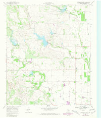
1968 Map of Foreman Chapel
USGS Topo · Published 1970About this map
Cottonwood Creek and Duck Creek carve through this Dickens County landscape, which by the late 1960s was defined by agricultural water management and sparse rural settlements. The map shows a series of earthen works and spillways, including Riser 2513 and Riser 2511, reflecting the region's efforts to control seasonal runoff. Local history is anchored by the Foreman Chapel and the nearby Espuela Cem, which serve as quiet markers of the community's social and spiritual roots in this West Texas terrain. Numerous Wells are scattered across the quadrangle, illustrating the critical reliance on groundwater for the ranching and farming operations that dominate the area between Dockum Creek and Red Mud Creek.
Find a feature on this map
18 named features on this map. Tap any name to fly to it.
Don’t see what you’re looking for? This feature index may not catch every label — zoom into the map to look around manually.
Map Details
Editions of this 1968 Foreman Chapel Map
2 editions found
Other maps of this area

1954 · Lubbock
USGS Topo · 1:250,000

1961 · Bunker Hill
USGS Topo · 1:24,000

1962 · Smith Tank
USGS Topo · 1:24,000

1966 · McAdoo
USGS Topo · 1:24,000

1967 · Dickens North
USGS Topo · 1:24,000

1967 · Dickens South
USGS Topo · 1:24,000

1967 · Spur
USGS Topo · 1:24,000

1967 · Haystack Mountain
USGS Topo · 1:24,000

1967 · Spur NW
USGS Topo · 1:24,000

1985 · Dickens
USGS Topo · 1:100,000