2020s Maps of Odessa, Texas
Explore 5 historic maps of Odessa from the 2020s. These maps offer a rare glimpse into what life looked like during the 2020s — showing old roads, neighborhoods, homes, and landmarks that have changed or disappeared over time.
Whether you're researching your family's past, planning a metal detecting trip, or studying how Odessa's landscape evolved across the 2020s, these high-resolution maps are a powerful tool for exploring the history of this region.
- Focus on a specific era: All maps on this page are from the 2020s, giving you a focused view of this time period.
- See what’s changed: Compare century-old streets, trails, and buildings to today's modern landscape using overlays and satellite layers.
- Research with precision: Use these maps for genealogy, historical research, land use analysis, or educational projects.
- View, download, or print: Maps are fully viewable online in high resolution, and can be downloaded or printed for your own records.
Start exploring Odessa's history through authentic maps from the 2020s. This is your window into the past.
Odessa, TX maps
(5)- 2022 Map of Odessa NW, 2022 Print
 2022 Odessa NW2022 Print · USGSThe northwestern outskirts of Odessa show a landscape in transition during the early 2020s, where new residential blocks meet established Texas ranch land. Researchers can trace the modern suburban grid against older landmarks like Odessa-Schlemeyer Field and Chesnut Playa.
 - 2022 Map of Odessa NE, 2022 Print
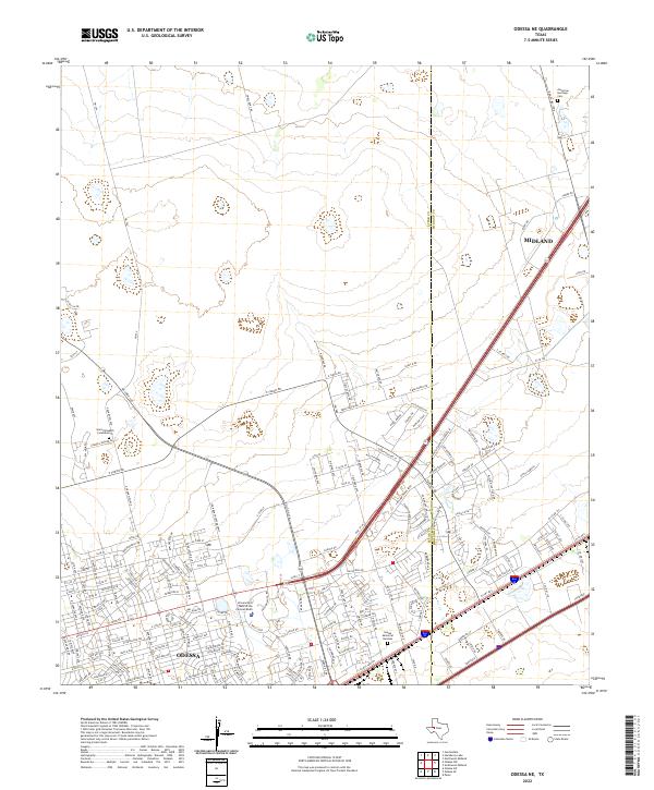 2022 Odessa NE2022 Print · USGSThe Permian Basin corridor shows its modern growth as the Ector and Midland county lines meet. Researchers can trace the development of Odessa and the University of Texas of the Permian Basin alongside landmarks like Sunset Memorial Gardens.
 - 2022 Map of Southwest Midland, 2022 Print
 2022 Southwest Midland2022 Print · USGSMidland and Odessa expand toward one another in this contemporary West Texas survey of the Permian Basin corridor. Genealogists and local historians can trace the growth of new residential districts near Nolan Ryan Dr or locate the established facilities at Midland International Air and Space Port.
 - 2022 Map of Odessa SW, 2022 Print
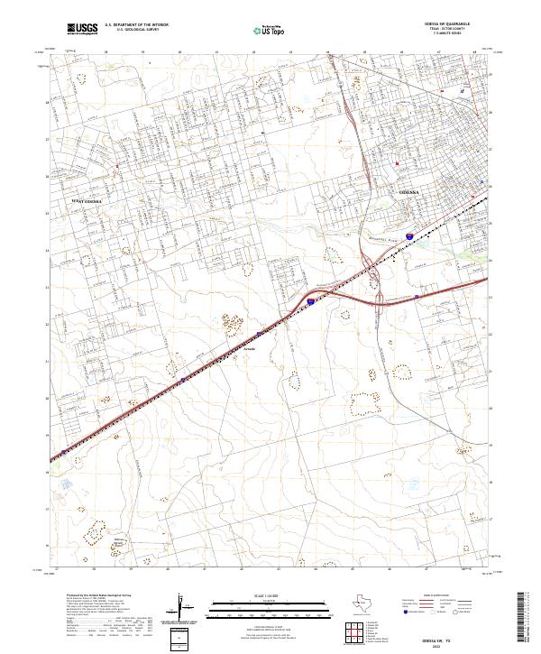 2022 Odessa SW2022 Print · USGSWest Texas in the early 2020s shows the convergence of rare geology and suburban growth at the edge of the Permian Basin. Trace the site of the Odessa Meteor Crater and the modern residential layout of West Odessa and Odessa College.
 - 2022 Map of Odessa SE, 2022 Print
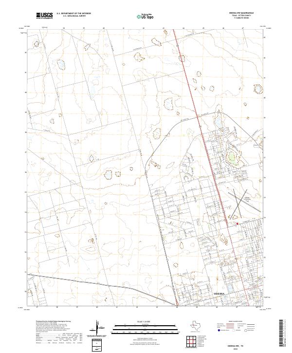
 2022 Odessa SE2022 Print · USGSOdessa during the early twenty-first century shows a bustling regional hub expanding into the West Texas plains. Researchers can locate civic landmarks like the Ector County Courthouse and numerous burial grounds including Rose Hill Cem and Los Angeles Gardens Cem.
End of results
Showing maps 1-5 of 5
Top cities near Odessa
Top neighborhoods of Odessa
- Headlee Oil Field historical maps
- Westside historical maps
- Mission historical maps
- Lawndale historical maps
- Parks Bell Ranch North historical maps
- Parks Legado Town Center historical maps
See more
Frequently asked questions
- What are the different types of historical maps available for Odessa?
- What is the oldest map of Odessa?
- Where can I purchase historical maps of Odessa for my home or office?
- Where can I download high-res historical maps of Odessa?
- Are there historical topographic maps available for Odessa?
- Is there historical aerial imagery available for Odessa?
- Where are historical maps of Odessa sourced from?