1900s (20th Century) Maps of Yarbrough & Allen Oil Field, Texas
Explore 5 historic maps of Yarbrough & Allen Oil Field from the 1900s (20th Century). These maps offer a rare glimpse into what life looked like during the 1900s — showing old roads, neighborhoods, homes, and landmarks that have changed or disappeared over time.
Whether you're researching your family's past, planning a metal detecting trip, or studying how Yarbrough & Allen Oil Field's landscape evolved across the 1900s, these high-resolution maps are a powerful tool for exploring the history of this region.
- Focus on a specific era: All maps on this page are from the 1900s, giving you a focused view of this time period.
- See what’s changed: Compare century-old streets, trails, and buildings to today's modern landscape using overlays and satellite layers.
- Research with precision: Use these maps for genealogy, historical research, land use analysis, or educational projects.
- View, download, or print: Maps are fully viewable online in high resolution, and can be downloaded or printed for your own records.
Start exploring Yarbrough & Allen Oil Field's history through authentic maps from the 1900s. This is your window into the past.
Yarbrough & Allen Oil Field, TX maps
(5)- 1954 Map of Pecos, 1964 Print
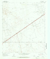
 1954 Pecos1964 Print · USGSMid-century West Texas reveals a landscape of expanding oil fields and cattle ranching along the winding Pecos River. Local historians can trace family ranch lands like Goodrich Ranch, follow the Texas and Pacific rails, or locate the historic Horsehead Crossing.3 unique versions available
 - 1957 Map of Pecos
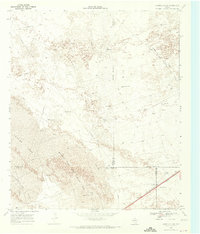
 1957 Pecos1957 Print · USGSWest Texas in the mid-fifties is a landscape of desert oil fields and vital rail corridors. Researchers can trace the sprawling Pyote Air Force Base, the historic Horsehead Crossing, and the rail stops at Mentone and Saragosa.
 - 1964 Map of Metz, 1967 Print
 1964 Metz1967 Print · USGSThe West Texas oil country of Ector and Crane counties is documented here during the mid-1960s. Genealogists and historians can trace the Texas and Pacific line through Metz and Judkins, or locate named water sources like the Old Headquarters Windmills.2 unique versions available
 - 1968 Map of Cowden Place, 1971 Print
 1968 Cowden Place1971 Print · USGSThe West Texas dunes and oil fields come into focus in the late sixties at the borders of Winkler, Ector, and Ward Counties. Researchers can trace the water and oil infrastructure of the era through sites like Cowden Place, Little Diamond Windmill, and Williams Ranch.
 - 1986 Map of Odessa
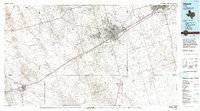 1986 Odessa1986 Print · USGSThe Permian Basin’s oil-driven landscape is revealed in the mid-eighties, showing the sprawl of Odessa and Midland. Trace the growth of energy infrastructure at the South Cowden Oil Field or explore the unique Sand Dunes of Monahans Sand Hills State Park.2 unique versions available
End of results
Showing maps 1-5 of 5
Top cities near Yarbrough & Allen Oil Field
Frequently asked questions
- What are the different types of historical maps available for Yarbrough & Allen Oil Field?
- What is the oldest map of Yarbrough & Allen Oil Field?
- Where can I purchase historical maps of Yarbrough & Allen Oil Field for my home or office?
- Where can I download high-res historical maps of Yarbrough & Allen Oil Field?
- Are there historical topographic maps available for Yarbrough & Allen Oil Field?
- Is there historical aerial imagery available for Yarbrough & Allen Oil Field?
- Where are historical maps of Yarbrough & Allen Oil Field sourced from?