Old Maps of Cattleman's North Ranchos Number 3 Colonia, Texas for Metal Detecting
Plan your next treasure hunt with 16 historic maps of Cattleman's North Ranchos Number 3 Colonia. Find old homesites, ghost towns, trails, and gathering spots that may be lost to time — perfect for identifying promising metal detecting locations.
- Locate forgotten sites: Uncover places like long-lost settlements, abandoned rail lines, or gathering spots.
- Plan better hunts: Use map overlays combined with LiDAR or satellite views to narrow in on historically rich areas.
- Made for detectorists: Thousands of hobbyists use these maps to discover relics, coins, and hidden history.
Use these historic maps to boost your research and find new opportunities beneath the surface of Cattleman's North Ranchos Number 3 Colonia.
Cattleman's North Ranchos Number 3 Colonia, TX maps
(16)- 1896 Map of El Paso
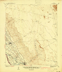
 1896 El Paso1896 Print · USGSThe El Paso borderlands were a nexus of rail and river commerce in the 1890s, where international boundaries met the western frontier. Researchers can trace the early layout of El Paso, the military presence at Fort Bliss, and historic valley settlements like Ysleta and San Elizario.2 unique versions available
 - 1908 Map of El Paso
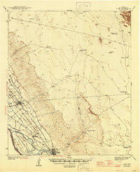
 1908 El Paso1908 Print · USGSEl Paso and the lower Rio Grande valley are seen here in the first decade of the century as the railroad and military presence transformed the borderlands. Genealogists can trace family footprints in historic river towns like San Elizario, Ysleta, and Socorro, or find early ranch sites like Newman's Ranch.2 unique versions available
 - 1941 Map of Clint
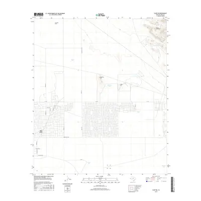
 1941 Clint1941 Print · USGSThe Rio Grande valley southeast of El Paso comes alive in the early 1940s, showing a landscape defined by irrigation and iron rails. Researchers can trace the development of Clint, Fabens, and Cuadrilla along the Texas and Pacific railroad.
 - 1945 Map of Clint
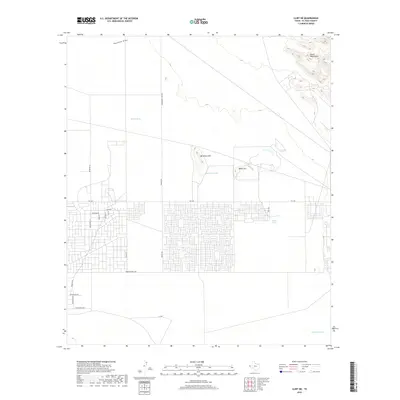
 1945 Clint1945 Print · USGSThe irrigated valley of the Rio Grande near El Paso comes alive in this mid-century survey of the West Texas borderlands. Genealogists and historians can trace the rail lines through Clint and Fabens or locate remote outposts like Roberts Ranch and the San Felipe Ranch.
 - 1953 Map of El Paso
 1953 El Paso1953 Print · USGSEl Paso and the border region are shown here in the early fifties, documenting a landscape of shared river life and rising military presence. Genealogists and historians can trace rail-tied communities like Smeltertown, San Elizario, and the grounds of Fort Bliss.
 - 1955 Map of Clint NE, 1959 Print
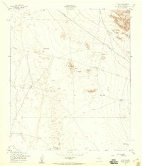 1955 Clint NE1959 Print · USGSThe El Paso County desert landscape in the mid-1950s is defined by critical water infrastructure and the rising peaks of the Hueco Mountains. Researchers can trace the era's land use through a network of named sites like Gentleman Well, Backbone Hill, and Skunk Tank.2 unique versions available
 - 1959 Map of El Paso, 1968 Print
 1959 El Paso1968 Print · USGSEl Paso and the international borderlands come alive in this mid-century survey of the Chihuahuan Desert. Genealogists and historians can trace rail-side settlements like Columbus and Fabens, locate the sprawling Fort Bliss, and explore the geologically unique Kilbourne Hole.2 unique versions available
 - 1964 Map of El Paso
 1964 El Paso1964 Print · USGSThe El Paso and Juarez borderlands are shown in detail during the mid-sixties, from the urban center to the remote volcanic craters of the West Potrillo Mountains. Trace the rail-and-river network through Asarco Smeltertown, the Fort Bliss Military Reservation, and Columbus.
 - 1965 Map of El Paso
 1965 El Paso1965 Print · USGSEl Paso and the Mesilla Valley are shown in the mid-1960s as the region's military and transport infrastructure expanded. Researchers can trace the irrigation network along the Rio Grande, find old border stations like Columbus, and locate Hueco Tanks.
 - 1983 Map of El Paso
 1983 El Paso1983 Print · USGSThe Chihuahuan Desert borderlands come into sharp focus in the early eighties as the binational metro area of El Paso and Ciudad Juarez expands. Genealogists and historians can trace rail lines like the Santa Fe, military grounds at Fort Bliss, and rural valley settlements including Canutillo and Zaragoza.2 unique versions available
 - 1995 Map of Clint NE
 1995 Clint NE1995 Print · USGSThe desert landscape east of El Paso was undergoing a period of infrastructure growth and recreational development in the 1990s. Researchers can trace land use through features like Mountain Shadow Lake, the Hueco Mountains foothills, and Rentleman Well.
 - 2010 Map of Clint NE, 2010 Print
 2010 Clint NE2010 Print · USGSCovers Cattleman's North Ranchos Number 3 Colonia, including El Paso County, United States, and other nearby areas
 - 2012 Map of Clint NE, 2012 Print
 2012 Clint NE2012 Print · USGSCovers Cattleman's North Ranchos Number 3 Colonia, including El Paso County, United States, and other nearby areas
 - 2016 Map of Clint NE, 2016 Print
 2016 Clint NE2016 Print · USGSCovers Cattleman's North Ranchos Number 3 Colonia, including El Paso County, United States, and other nearby areas
 - 2019 Map of Clint NE, 2019 Print
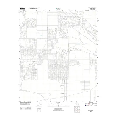
 2019 Clint NE2019 Print · USGSCovers Cattleman's North Ranchos Number 3 Colonia, including El Paso County, United States, and other nearby areas
 - 2022 Map of Clint NE, 2022 Print
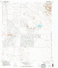
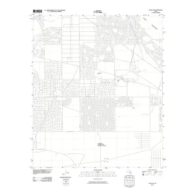
 2022 Clint NE2022 Print · USGSEl Paso County's high desert plateau comes into focus in this modern era, where the ranching landscape meets residential growth. Researchers can trace the transition from open range marked by Skunk Tank to the street grids near Fm 1281 and the Hueco Mountains.
End of results
Showing maps 1-16 of 16
Top cities near Cattleman's North Ranchos Number 3 Colonia
- El Paso historical maps
- Socorro historical maps
- Horizon City historical maps
- San Elizario historical maps
- Fabens historical maps
- Tornillo historical maps
See more
Frequently asked questions
- What are the different types of historical maps available for Cattleman's North Ranchos Number 3 Colonia?
- What is the oldest map of Cattleman's North Ranchos Number 3 Colonia?
- Where can I purchase historical maps of Cattleman's North Ranchos Number 3 Colonia for my home or office?
- Where can I download high-res historical maps of Cattleman's North Ranchos Number 3 Colonia?
- Are there historical topographic maps available for Cattleman's North Ranchos Number 3 Colonia?
- Is there historical aerial imagery available for Cattleman's North Ranchos Number 3 Colonia?
- Where are historical maps of Cattleman's North Ranchos Number 3 Colonia sourced from?