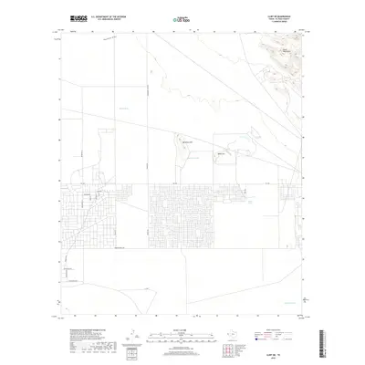
2019 Map of Clint NE
USGS Topo · Published 2019About this map
The Hueco Mountains anchor the northeast corner of this high desert landscape, giving way to a developing residential grid in El Paso County. The sprawling street network south of FM 1281 reflects the characteristic growth of colonias in this region, with named thoroughfares like Tigard St and Roberts Ranch Rd carving through the open terrain. North of the developed blocks, the land remains largely defined by its natural drainage and ranching infrastructure. Isolated landmarks such as Backbone Hill and Horse Hill rise above the flatlands, while numerous water catchment features, including Backbone Tank, Skunk Tank, and Sand Tank, highlight the critical importance of water management in this arid environment. These scattered tanks and the northern Fourmile Draw serve as primary identifiers for the area's rural history prior to modern suburban expansion.
Find a feature on this map
26 named features on this map. Tap any name to fly to it.
Don’t see what you’re looking for? This feature index may not catch every label — zoom into the map to look around manually.
Map Details
Editions of this 2019 Clint NE Map
This is the sole edition of this map. No revisions or reprints were ever made.
Other maps of this area

1896 · El Paso
USGS Topo · 1:125,000

1903 · Cerro Alto
USGS Topo · 1:125,000

1908 · El Paso
USGS Topo · 1:125,000

1939 · Heuco Tanks
USGS Topo · 1:62,500

1940 · Heuco Tanks
USGS Topo · 1:62,500

1941 · Clint
USGS Topo · 1:62,500

1941 · Heuco Mountains
USGS Topo · 1:62,500

1942 · Borrego
USGS Topo · 1:62,500

1943 · Heuco Mountains
USGS Topo · 1:62,500

1944 · Heuco Tanks
USGS Topo · 1:62,500