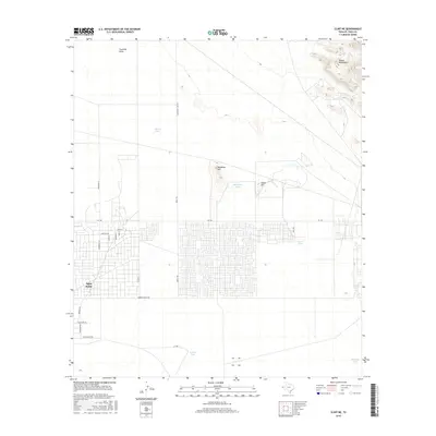
2016 Map of Clint NE
USGS Topo · Published 2016About this map
Agua Dulce stands as a focal point of residential development in this arid El Paso County landscape, where an extensive grid of streets contrasts with the open desert. The settlement is organized around routes such as FM 1281, Tigard St, and Roberts Ranch Rd, showing the rapid suburban expansion characteristic of the region in the early 21st century. Beyond the residential clusters, the terrain rises toward the northeast into the Hueco Mountains, marked by prominent landmarks including Backbone Hill and Horse Hill. This environment is defined by its water management strategy, evidenced by numerous tanks used for livestock or irrigation. Features like Skunk Tank, Backbone Tank, and Dugout Tank are scattered across the flats, while Fourmile Draw provides a natural drainage route through the northern reaches of the quadrangle.
Find a feature on this map
30 named features on this map. Tap any name to fly to it.
Don’t see what you’re looking for? This feature index may not catch every label — zoom into the map to look around manually.
Map Details
Editions of this 2016 Clint NE Map
This is the sole edition of this map. No revisions or reprints were ever made.
Other maps of this area

1896 · El Paso
USGS Topo · 1:125,000

1903 · Cerro Alto
USGS Topo · 1:125,000

1908 · El Paso
USGS Topo · 1:125,000

1939 · Heuco Tanks
USGS Topo · 1:62,500

1940 · Heuco Tanks
USGS Topo · 1:62,500

1941 · Clint
USGS Topo · 1:62,500

1941 · Heuco Mountains
USGS Topo · 1:62,500

1942 · Borrego
USGS Topo · 1:62,500

1943 · Heuco Mountains
USGS Topo · 1:62,500

1944 · Heuco Tanks
USGS Topo · 1:62,500