1960s Maps of Falls County, Texas
Explore 16 historic maps of Falls County from the 1960s. These maps offer a rare glimpse into what life looked like during the 1960s — showing old roads, neighborhoods, homes, and landmarks that have changed or disappeared over time.
Whether you're researching your family's past, planning a metal detecting trip, or studying how Falls County's landscape evolved across the 1960s, these high-resolution maps are a powerful tool for exploring the history of this region.
- Focus on a specific era: All maps on this page are from the 1960s, giving you a focused view of this time period.
- See what’s changed: Compare century-old streets, trails, and buildings to today's modern landscape using overlays and satellite layers.
- Research with precision: Use these maps for genealogy, historical research, land use analysis, or educational projects.
- View, download, or print: Maps are fully viewable online in high resolution, and can be downloaded or printed for your own records.
Start exploring Falls County's history through authentic maps from the 1960s. This is your window into the past.
Falls County, TX maps
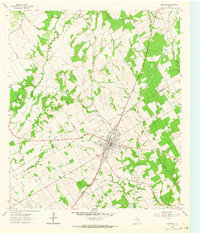
(16)- 1961 Map of Baileyville, 1964 Print
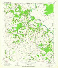
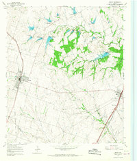
 1961 Baileyville1964 Print · USGSIn the early sixties, this rural intersection of Milam, Falls, and Robertson Counties was defined by its winding river bottomlands and family farmsteads. Researchers can locate family landmarks like Bozeman Cem, Morning Star Ch, and the Hooper Ranch.2 unique versions available
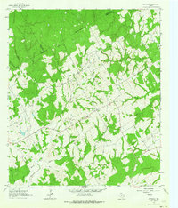
 - 1962 Map of Rosebud, 1964 Print
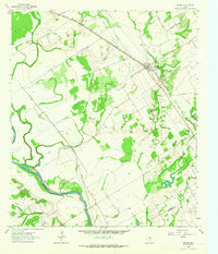
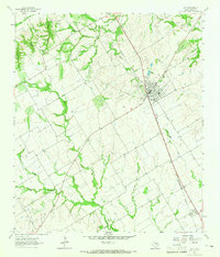
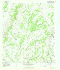
 1962 Rosebud1964 Print · USGSCentral Texas farming and rail life are captured here in the early sixties, centered on the Rosebud area. Researchers can trace family sites at Powers Chapel, Burlington Cem, and St Michaels Cem, or locate the historic Southern Pacific rail line.2 unique versions available
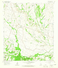
 - 1962 Map of Reagan, 1964 Print
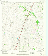
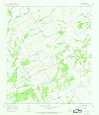
 1962 Reagan1964 Print · USGSThe Brazos River valley in the early sixties remains a landscape of rail-side settlements and rural congregations. Researchers can trace family history through Washington Cem, Bowman Chapel, and the communities of Highbank and Reagan.2 unique versions available
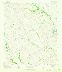
 - 1962 Map of Cedar Springs, 1964 Print
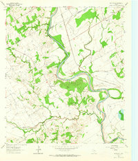
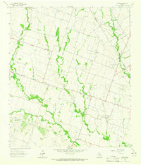
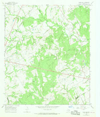
 1962 Cedar Springs1964 Print · USGSThe Brazos River lowlands of Falls County appear here in the early sixties, centered on the community of Cedar Springs. Researchers can locate significant sites like Fort Milam, the ruins at The Falls, and old family cemeteries such as Gravel Hill Cem.2 unique versions available
 - 1962 Map of Bremond, 1964 Print
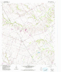
 1962 Bremond1964 Print · USGSBremond was a bustling railroad town in the early sixties, anchored by the Southern Pacific line and a tight-knit community of schools and churches. Genealogists can trace family names through several rural burial grounds including St Mary Cem and Cloverleaf Rest Cem.2 unique versions available
 - 1962 Map of Petteway, 1964 Print
 1962 Petteway1964 Print · USGSThe rural borderlands of Robertson and Limestone counties come into focus in the early sixties. Genealogists and local historians can trace family-named watercourses and community landmarks like Post Oak Sch, Petteway Ch, and the waters of Hurricane Creek.2 unique versions available
 - 1963 Map of Yarrelton, 1965 Print
 1963 Yarrelton1965 Print · USGSCentral Texas farmland near the Milam and Bell county lines is captured here in the early sixties. Genealogists and local historians can trace family homesteads near Yarrelton, Marak, and the Cem at North Elm.2 unique versions available
 - 1963 Map of Westphalia, 1965 Print
 1963 Westphalia1965 Print · USGSTexas farming communities at the Falls and Bell County line come to life in this mid-century portrait of a rural landscape. Genealogists and researchers can trace local roots at St Marys Cem, the settlement of Zipperlandville, and St Joseph Cem.2 unique versions available
 - 1963 Map of Seaton, 1965 Print
 1963 Seaton1965 Print · USGSBell County farmland in the early sixties was a landscape of close-knit communities connected by winding creek beds and narrow prairie roads. Genealogists and historians can trace the foundations of Seaton and Zabcikville, locating the National Cem and the Lost Prairie Sch.3 unique versions available
 - 1963 Map of Lott, 1965 Print
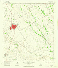
 1963 Lott1965 Print · USGSThe town of Lott and the settlement of Travis are captured in the early sixties as they developed along the Southern Pacific line. Researchers can trace family sites at Union Cem and Phillips Cem or locate old landmarks like the Rodeo Ground.2 unique versions available
 - 1963 Map of Belfalls, 1993 Print
 1963 Belfalls1993 Print · USGSThe rural borders of Falls and Bell Counties come alive in this mid-century survey of the Texas countryside. Genealogists and local historians can trace the foundations of Belfalls, locate family plots at Lena Cem, and follow the path of Old Blevins Road.
 - 1965 Map of Troy, 1967 Print
 1965 Troy1967 Print · USGSBell County's agricultural heartland in the mid-sixties reveals a landscape shaped by competing rail lines and rural community centers. Genealogists can locate family names at Old Troy Cem, Pleasant View Cem, and the Willow Grove Ch.3 unique versions available
 - 1965 Map of Moody, 1967 Print
 1965 Moody1967 Print · USGSCentral Texas prairie life in the mid-sixties is captured here along the busy rail lines of the Santa Fe and M-K-T railroads. Genealogists can locate family landmarks like Perry Cem, Naler Cem, and the rural Liberty Hill Ch.3 unique versions available
 - 1965 Map of Kosse West, 1969 Print
 1965 Kosse West1969 Print · USGSThe rural border of Falls and Limestone counties comes to life in the mid-1960s, showing a landscape of small farming communities and country roads. Genealogists can trace old family sites near Antioch Cem, Alto Springs, and the Southern Pacific rail line.
 - 1966 Map of Odds, 1969 Print
 1966 Odds1969 Print · USGSThe Limestone and Falls county line in the late sixties reveals a network of winding creeks and small cattle-ranching outposts. Researchers can trace rural cemeteries like Clifton Cem, local landmarks such as Buffalo Mop, and the path of the Little Brazos River.
 - 1966 Map of Kosse East, 1969 Print
 1966 Kosse East1969 Print · USGSThe community of Kosse and the Southern Pacific rail line define this central Texas landscape during the mid-1960s. Genealogists and local historians can trace numerous rural burial grounds and sanctuaries, including Eutaw Cem, Shady Grove Ch, and Buttrill Cem.2 unique versions available
End of results
Showing maps 1-16 of 16
Top cities of Falls County
Frequently asked questions
- What are the different types of historical maps available for Falls County?
- What is the oldest map of Falls County?
- Where can I purchase historical maps of Falls County for my home or office?
- Where can I download high-res historical maps of Falls County?
- Are there historical topographic maps available for Falls County?
- Is there historical aerial imagery available for Falls County?
- Where are historical maps of Falls County sourced from?