Old Maps of Falls County, Texas for Genealogy
Trace your family roots with 158 historic maps of Falls County. These high-res maps reveal old neighborhoods, homesites, landmarks, and streets — helping you uncover where your ancestors lived and how the area evolved over time.
- Explore historic neighborhoods: Identify where your relatives may have lived in the 1800s or 1900s.
- Compare maps over time: Trace the changes in streets, buildings, and landmarks for multi-generational research.
- Perfect for genealogy & ancestry research: Used by family historians and researchers to map out lineage and migration.
These maps are an incredible resource for exploring your personal connection to Falls County's past.
Falls County, TX maps
(158)- 1885 Map of Taylor
 1885 Taylor1885 Print · USGSCentral Texas in the late nineteenth century was a landscape in transition as railroads redefined the old cotton frontier. Genealogists and historians can trace the early growth of rail towns like Taylor and Granger, or find vanished rural outposts such as Ad Hall and Davilla.
 - 1887 Map of Taylor
 1887 Taylor1887 Print · USGSCentral Texas is captured in the late nineteenth century as the railroad began to redefine the blackland prairie. Genealogists can locate early settlements like Davilla and Granger or trace family lands near the San Gabriel River and Taylor.
 - 1892 Map of Temple
 1892 Temple1892 Print · USGSTexas at the turn of the century shows a landscape defined by emerging railroad junctions and river settlements. Genealogists can trace early homesteads and rail-town growth in Temple, McGregor, and Belton near the banks of the Leon River.6 unique versions available
 - 1894 Map of Taylor, 1902 Print
 1894 Taylor1902 Print · USGSCentral Texas at the end of the nineteenth century was a landscape of expanding rail lines and established river settlements. Genealogists and historians can trace the growth of Taylor and Granger, or locate smaller junctions like Ad Hall and Buckholts along the Gulf Colorado and Santa Fe Railroad.4 unique versions available
 - 1920 Map of Mart
 1920 Mart1920 Print · USGSCentral Texas at the dawn of the 1920s shows a landscape of busy rail junctions and small post office hubs. Researchers can trace rural lineages through William's School, the community at Axtell P.O., and the Navasota River bottomlands.
 - 1931 Map of Mc Gregor
 1931 Mc Gregor1931 Print · USGSCentral Texas rural life in the twenties is preserved here, showing a landscape densely dotted with family-named schools and country churches. Genealogists can trace ancestors through specific landmarks like Haunted Hill Sch, Blair Chapel, and the community at Eagle Springs.2 unique versions available
 - 1931 Map of Belton, 1949 Print
 1931 Belton1949 Print · USGSBell County in the 1920s and 30s reveals a landscape of river-valley farming and bustling railroad junctions centered on the county seat. Genealogists and historians can trace early community life through numerous rural landmarks like Moffat Sch, Tennessee Valley Ch, and the Belton and Temple Electric R R.
 - 1954 Map of Waco, 1964 Print
 1954 Waco1964 Print · USGSCentral Texas during the mid-fifties shows a landscape defined by the expansion of Fort Hood Military Reservation and the Brazos river system. Trace the rail lines and early airfields like James Connally Air Force Base and settlements like Temple or McGregor.2 unique versions available
 - 1954 Map of Austin, 1964 Print
 1954 Austin1964 Print · USGSCentral Texas is captured during a period of steady growth as the capital city and its neighboring farm towns began to modernize. Researchers can trace historic rail corridors like the Southern Pacific RR or locate landmarks such as Bergstrom Air Force Base and Pilot Knob.4 unique versions available
 - 1955 Map of Waco
 1955 Waco1955 Print · USGSCentral Texas at the peak of the Cold War reveals a landscape defined by military expansion and major water projects. Researchers can trace the footprints of Fort Hood, the waters of Lake Waco, and regional hubs like Temple or Mexia.
 - 1956 Map of Mart, 1958 Print
 1956 Mart1958 Print · USGSAgricultural life in McLennan County thrived in the mid-1950s as the town of Mart sat at the busy intersection of the Missouri Pacific rail line. Researchers can trace rural school locations like Anderson Sch and family burial sites at Evergreen Cem and Mart Cem.2 unique versions available
 - 1957 Map of Bruceville, 1958 Print
 1957 Bruceville1958 Print · USGSThe Falls and McLennan County line in the late fifties shows a rural landscape shaped by the Missouri Kansas Texas rail line. Genealogists can trace family names through Beulah Cem, Mooreville Cem, and the Cottonwood Sch (Aband).4 unique versions available
 - 1957 Map of Otto, 1958 Print
 1957 Otto1958 Print · USGSThe rural settlement of Otto and the surrounding Falls County countryside are captured here in the late fifties as family farms relied on the MISSOURI PACIFIC rail line. Researchers can locate many local landmarks including Metina Cem and the Corner Sch (Aband).
 - 1957 Map of McClanahan, 1958 Print
 1957 McClanahan1958 Print · USGSFalls County in the late 1950s is defined by its rural church communities and the dual rail lines serving the cotton and cattle country. Researchers can trace family sites like Taylor Chapel Cem, Marvin Allen Ch, and the small settlement of Mc Clanahan.2 unique versions available
 - 1957 Map of Riesel, 1958 Print
 1957 Riesel1958 Print · USGSCentral Texas farmland in the 1950s is captured here, centered on the rail-aligned town of Riesel. Trace the locations of rural schoolhouses and cemeteries like Sunset Sch, Hebron Cem, and the Blackland watershed headquarters.3 unique versions available
 - 1957 Map of Chilton, 1958 Print
 1957 Chilton1958 Print · USGSThe rural landscape of Falls County is captured here in the late fifties as rail lines and river bypasses shaped local life. Genealogists and historians can trace family roots through settlements like Chilton, Satin, and the Little Deer Creek Ch.3 unique versions available
 - 1957 Map of Marlin, 1958 Print
 1957 Marlin1958 Print · USGSFalls County during the mid-fifties is captured here as a bustling rail crossroads where the Missouri Pacific and Texas and New Orleans meet. Local researchers can trace old community landmarks from the Courthouse and Booker T Washington High Sch to rural stops like Rocky Hill.3 unique versions available
 - 1957 Map of Robinson, 1958 Print
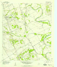 1957 Robinson1958 Print · USGSNear the banks of the Brazos River in the late 1950s, this area shows a landscape defined by rail and river. Genealogists can trace family roots through numerous sites like Rosenthal High Sch, Mt Zion Ch, and Mt Olive Cem.4 unique versions available
 - 1961 Map of Baileyville, 1964 Print
 1961 Baileyville1964 Print · USGSIn the early sixties, this rural intersection of Milam, Falls, and Robertson Counties was defined by its winding river bottomlands and family farmsteads. Researchers can locate family landmarks like Bozeman Cem, Morning Star Ch, and the Hooper Ranch.2 unique versions available
 - 1962 Map of Rosebud, 1964 Print
 1962 Rosebud1964 Print · USGSCentral Texas farming and rail life are captured here in the early sixties, centered on the Rosebud area. Researchers can trace family sites at Powers Chapel, Burlington Cem, and St Michaels Cem, or locate the historic Southern Pacific rail line.2 unique versions available
 - 1962 Map of Reagan, 1964 Print
 1962 Reagan1964 Print · USGSThe Brazos River valley in the early sixties remains a landscape of rail-side settlements and rural congregations. Researchers can trace family history through Washington Cem, Bowman Chapel, and the communities of Highbank and Reagan.2 unique versions available
 - 1962 Map of Cedar Springs, 1964 Print
 1962 Cedar Springs1964 Print · USGSThe Brazos River lowlands of Falls County appear here in the early sixties, centered on the community of Cedar Springs. Researchers can locate significant sites like Fort Milam, the ruins at The Falls, and old family cemeteries such as Gravel Hill Cem.2 unique versions available
 - 1962 Map of Bremond, 1964 Print
 1962 Bremond1964 Print · USGSBremond was a bustling railroad town in the early sixties, anchored by the Southern Pacific line and a tight-knit community of schools and churches. Genealogists can trace family names through several rural burial grounds including St Mary Cem and Cloverleaf Rest Cem.2 unique versions available
 - 1962 Map of Petteway, 1964 Print
 1962 Petteway1964 Print · USGSThe rural borderlands of Robertson and Limestone counties come into focus in the early sixties. Genealogists and local historians can trace family-named watercourses and community landmarks like Post Oak Sch, Petteway Ch, and the waters of Hurricane Creek.2 unique versions available
 - 1963 Map of Yarrelton, 1965 Print
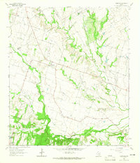 1963 Yarrelton1965 Print · USGSCentral Texas farmland near the Milam and Bell county lines is captured here in the early sixties. Genealogists and local historians can trace family homesteads near Yarrelton, Marak, and the Cem at North Elm.2 unique versions available
Showing maps 1-25 of 158
Top cities of Falls County
Frequently asked questions
- What are the different types of historical maps available for Falls County?
- What is the oldest map of Falls County?
- Where can I purchase historical maps of Falls County for my home or office?
- Where can I download high-res historical maps of Falls County?
- Are there historical topographic maps available for Falls County?
- Is there historical aerial imagery available for Falls County?
- Where are historical maps of Falls County sourced from?