2020s Maps of Golinda, Texas
Explore 2 historic maps of Golinda from the 2020s. These maps offer a rare glimpse into what life looked like during the 2020s — showing old roads, neighborhoods, homes, and landmarks that have changed or disappeared over time.
Whether you're researching your family's past, planning a metal detecting trip, or studying how Golinda's landscape evolved across the 2020s, these high-resolution maps are a powerful tool for exploring the history of this region.
- Focus on a specific era: All maps on this page are from the 2020s, giving you a focused view of this time period.
- See what’s changed: Compare century-old streets, trails, and buildings to today's modern landscape using overlays and satellite layers.
- Research with precision: Use these maps for genealogy, historical research, land use analysis, or educational projects.
- View, download, or print: Maps are fully viewable online in high resolution, and can be downloaded or printed for your own records.
Start exploring Golinda's history through authentic maps from the 2020s. This is your window into the past.
Golinda, TX maps
(2)- 2022 Map of Chilton, 2022 Print
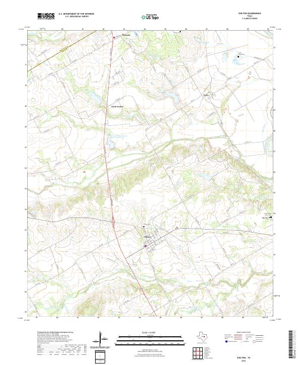 2022 Chilton2022 Print · USGSThe rural landscape around Chilton and the Brazos River is captured here in the early 2020s, showing a network of ranch roads and historic community centers. Researchers can pinpoint family burial sites at Chilton Cem and Cedar Grove Cem or trace the winding course of Cow Bayou.
 - 2022 Map of Robinson, 2022 Print
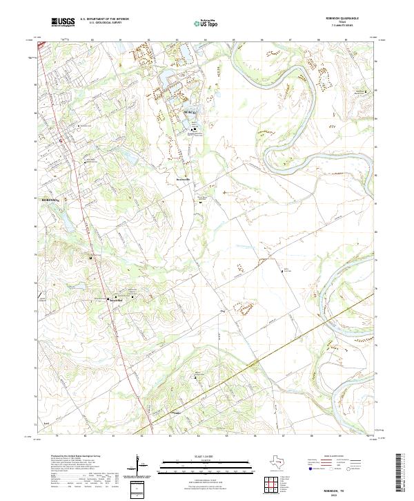 2022 Robinson2022 Print · USGSSettlements south of Waco thrive along the Brazos River in this modern Texas survey. Genealogists can locate family landmarks at Mount Olive Cem Old, Majors Chapel Cem, and old church sites in Downsville and Rosenthal.
End of results
Showing maps 1-2 of 2
Top cities near Golinda
- Waco historical maps
- Temple historical maps
- Hewitt historical maps
- Robinson historical maps
- Bellmead historical maps
- Woodway historical maps
See more
Frequently asked questions
- What are the different types of historical maps available for Golinda?
- What is the oldest map of Golinda?
- Where can I purchase historical maps of Golinda for my home or office?
- Where can I download high-res historical maps of Golinda?
- Are there historical topographic maps available for Golinda?
- Is there historical aerial imagery available for Golinda?
- Where are historical maps of Golinda sourced from?