Old Maps of Fayette County, Texas for Hiking & Exploration
Hike through history with 104 historic maps of Fayette County. Explore old trails, ghost towns, and forgotten backroads — perfect for outdoor adventurers and local explorers.
- Rediscover forgotten places: Map out old mining camps, roads, and footpaths that no longer exist on modern maps.
- Layer with modern tools: Combine with LiDAR or satellite views to plan hikes through historical terrain.
- Made for exploration: Popular among hikers, overlanders, and local history lovers.
Use these maps to find adventure and explore the hidden past of Fayette County.
Fayette County, TX maps
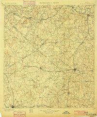
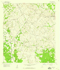
(104)- 1885 Map of Bastrop
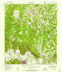
 1885 Bastrop1885 Print · USGSCentral Texas was undergoing a rail-driven transformation in the late nineteenth century as steam power connected the frontier to the Gulf. Genealogists can trace family names and old homesites near Rice's Crossing, Hills Prairie, and along the vital Houston and Texas Central Railroad.
 - 1893 Map of Bastrop
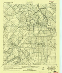
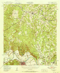
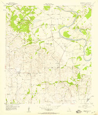
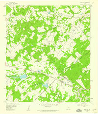
 1893 Bastrop1893 Print · USGSBastrop and the Colorado River valley are captured here in the late nineteenth century as the railroad transformed the Texas interior. Researchers can trace early property lines and community centers like Lexington, McDade, and the high vistas of the Yegua Knobs.
 - 1901 Map of Flatonia
 1901 Flatonia1901 Print · USGSCentral Texas at the turn of the century shows a landscape defined by the railroad and distinct ethnic communities. Trace family roots in the Bohemian Settlement or Negro Settlement, and locate early sites like Old Redrock and Old Flatonia.2 unique versions available
 - 1904 Map of Bastrop
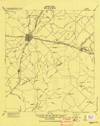
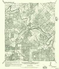
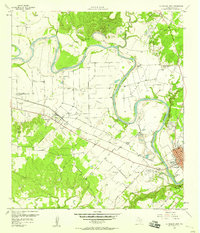
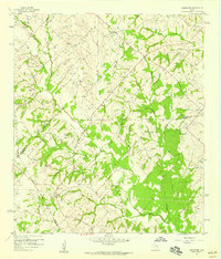
 1904 Bastrop1904 Print · USGSBastrop and Smithville thrive along the Colorado River at the turn of the century, serving as vital hubs for the Texas interior. Trace ancestral roots and old transport routes through Nashs Ferry, the Coal Mine near Sayersville, and Colorado Chapel.3 unique versions available
 - 1919 Map of Fayettsville
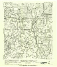
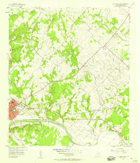
 1919 Fayettsville1919 Print · USGSFayette and Colorado counties are captured here in the years following the Great War, showing a landscape defined by the railroad and the river. Researchers can trace the routes of the Missouri Kansas and Texas Railway to historic hubs like Fayetteville and Ellinger.
 - 1919 Map of Giddings
 1919 Giddings1919 Print · USGSGiddings and the surrounding Lee County countryside are documented here at the end of the Great War era, when rail travel dominated the Texas interior. Local historians can trace the foundations of rural life through family-named landmarks like the Willy Branch School and numerous post offices including Northrup P.O. and Ledbetter P.O.
 - 1919 Map of Schulenburg, 1956 Print
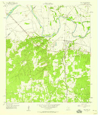
 1919 Schulenburg1956 Print · USGSTexas at the close of the Great War was a landscape of rail-connected towns and river crossings. Genealogists can trace family roots through the settlements of High Hill, Dubina, and St. Johns, while following the old fords across the Navidad River.
 - 1948 Map of Smithville, 1956 Print
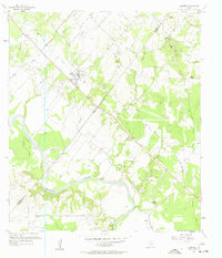
 1948 Smithville1956 Print · USGSBastrop and Fayette counties are captured here shortly after the war, showing the footprint of military expansion alongside traditional river life. Genealogists can locate family landmarks like Milton Chapel Cem, Crafts Prairie Sch, and the rural community of Paige.2 unique versions available
 - 1950 Map of Smithville
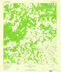
 1950 Smithville1950 Print · USGSBastrop and Fayette Counties come into focus at the dawn of the fifties, centered on the Colorado River and the busy rail hub of Smithville. Genealogists can trace family roots through numerous rural landmarks like Crafts Prairie Sch, Goebel Store, and St Michaels Cem and Ch.
 - 1953 Map of Seguin, 1965 Print
 1953 Seguin1965 Print · USGSSouth Texas in the early fifties shows a thriving river-and-rail economy across the Guadalupe and Colorado basins. Genealogists and historians can trace rail routes like the Southern Pacific through Seguin, locate oil wells, or find the Gary AAF near San Marcos.4 unique versions available
 - 1954 Map of Austin, 1964 Print
 1954 Austin1964 Print · USGSCentral Texas is captured during a period of steady growth as the capital city and its neighboring farm towns began to modernize. Researchers can trace historic rail corridors like the Southern Pacific RR or locate landmarks such as Bergstrom Air Force Base and Pilot Knob.4 unique versions available
 - 1956 Map of La Grange
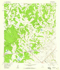
 1956 La Grange1956 Print · USGSCentral Fayette County thrived as a rail and river hub at the start of the twentieth century, anchored by the crossroads of La Grange. Genealogists can trace family footprints through rural settlements like Swiss Alps, Ammansville, and Oldenburg.
 - 1957 Map of Ellinger, 1958 Print
 1957 Ellinger1958 Print · USGSFayette and Colorado Counties are captured here in the late fifties, centered on the town of Ellinger and the winding COLORADO RIVER. Genealogists can trace family names and local landmarks like Rocky Hill Sch, Shaws Bend Cem, and the OLD RAILROAD GRADE.2 unique versions available
 - 1957 Map of La Grange East, 1958 Print
 1957 La Grange East1958 Print · USGSFayette County in the late fifties shows a rural landscape transitioning around the growing hub of La Grange along the Colorado River. Researchers can locate family landmarks like Moore Cem, the Randolph High School, and the rural community of Rutersville.2 unique versions available
 - 1957 Map of Ammannsville, 1958 Print
 1957 Ammannsville1958 Print · USGSFayette County communities like Ammannsville and Holman are captured in the late fifties as they remained centered on local parishes and rural schools. Genealogists can trace family footprints at Bictner Cem, Hostyn Sch, and the St Wenceslaus Ch.2 unique versions available
 - 1958 Map of La Grange West
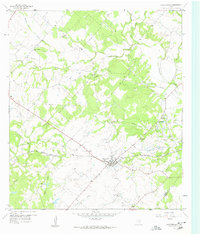
 1958 La Grange West1958 Print · USGSFayette County in the late 1950s is defined by the winding Colorado River and the industrial activity of the strip mines along its banks. Local historians can trace the rural church and school network through St Jerome Sch, Mt Zion Ch, and the Plum Grove Cem.3 unique versions available
 - 1958 Map of West Point
 1958 West Point1958 Print · USGSFayette County was a busy rail hub in the late fifties, where the Missouri Kansas and Texas met the Southern Pacific. Genealogists and local historians can trace family locations near West Point, Woods Prairie Cem, and Mt Olive Cem.3 unique versions available
 - 1958 Map of Seguin
 1958 Seguin1958 Print · USGSSouth Texas in the late fifties was a network of river-valley settlements and active oilfields tied together by major rail lines. Genealogists and historians can trace family-named sites across Rabb Prairie, locate the Behring Store, or follow the Southern Pacific through Schulenburg.
 - 1958 Map of Industry, 1959 Print
 1958 Industry1959 Print · USGSThe Austin and Fayette county lines intersect in the late fifties, revealing a rural landscape of German settlements and family farms. Trace local heritage at Industry, New Ulm, and Cherry Chapel, or follow the MISSOURI KANSAS TEXAS rail line.
 - 1958 Map of Ledbetter, 1959 Print
 1958 Ledbetter1959 Print · USGSLedbetter and the surrounding cattle-and-rail country of Lee County are shown here in the late fifties. Genealogists and local historians can trace the foundations of Jones Colony, locate the Atkinson Cem, and follow the Texas and New Orleans railroad line.2 unique versions available
 - 1958 Map of Greenvine, 1959 Print
 1958 Greenvine1959 Print · USGSThe rural Texas borderlands of Washington and Austin counties come into focus in the late fifties. Genealogists can trace family heritage through numerous pioneer burial sites and small settlements like Latium, Wesley, and the David Shelby Grave.2 unique versions available
 - 1958 Map of Nechanitz, 1959 Print
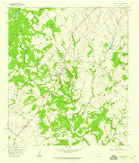
 1958 Nechanitz1959 Print · USGSThe rural landscape of Fayette County is captured in the late fifties, showcasing a network of small farming communities and family-named landmarks. Researchers can trace local history through Waldeck Ch, Walhalla, and cemeteries like Schumann Cem.2 unique versions available
 - 1958 Map of Carmine, 1959 Print
 1958 Carmine1959 Print · USGSThe rail-and-road junction at Carmine anchor this late 1950s survey of the Fayette and Washington County border. Genealogists and local historians can trace family-named sites like Hartstack Cem, La Bahia, and St Matthew Missionary Ch.2 unique versions available
 - 1958 Map of Fayetteville, 1959 Print
 1958 Fayetteville1959 Print · USGSFayetteville and its surrounding farmsteads were recorded here in the late fifties as the local economy balanced rail transit and rural industry. Genealogists can trace family landmarks like the Halimecek Cem, Ross Prairie Ch, and the old rail siding at Tamberg.3 unique versions available
 - 1958 Map of Round Top, 1959 Print
 1958 Round Top1959 Print · USGSFayette and Washington Counties are captured here in the late fifties, showing a rural Texas landscape of small farmsteads and creek-side settlements. Researchers can trace ancestral locations near Round Top through numerous burial sites like Weyand Cem and Drawe Cem.2 unique versions available
Showing maps 1-25 of 104
Top cities of Fayette County
- La Grange historical maps
- Schulenburg historical maps
- Flatonia historical maps
- Fayetteville historical maps
- Carmine historical maps
- Ellinger historical maps
See more
Frequently asked questions
- What are the different types of historical maps available for Fayette County?
- What is the oldest map of Fayette County?
- Where can I purchase historical maps of Fayette County for my home or office?
- Where can I download high-res historical maps of Fayette County?
- Are there historical topographic maps available for Fayette County?
- Is there historical aerial imagery available for Fayette County?
- Where are historical maps of Fayette County sourced from?