1960s Maps of Fayette County, Texas
Explore 11 historic maps of Fayette County from the 1960s. These maps offer a rare glimpse into what life looked like during the 1960s — showing old roads, neighborhoods, homes, and landmarks that have changed or disappeared over time.
Whether you're researching your family's past, planning a metal detecting trip, or studying how Fayette County's landscape evolved across the 1960s, these high-resolution maps are a powerful tool for exploring the history of this region.
- Focus on a specific era: All maps on this page are from the 1960s, giving you a focused view of this time period.
- See what’s changed: Compare century-old streets, trails, and buildings to today's modern landscape using overlays and satellite layers.
- Research with precision: Use these maps for genealogy, historical research, land use analysis, or educational projects.
- View, download, or print: Maps are fully viewable online in high resolution, and can be downloaded or printed for your own records.
Start exploring Fayette County's history through authentic maps from the 1960s. This is your window into the past.
Fayette County, TX maps
(11)- 1962 Map of Warda, 1965 Print
 1962 Warda1965 Print · USGSLee and Fayette Counties are shown in the early sixties as rural Texas life followed the rail lines and creek beds. Genealogists and local historians can trace family locations near Northrup, St Paul Ch, and the school at Warda.2 unique versions available
 - 1964 Map of Waelder, 1966 Print
 1964 Waelder1966 Print · USGSMid-century Gonzales County comes to life along the Southern Pacific tracks in the early 1960s. Researchers can locate family sites and rural landmarks like St Patricks church, Waelder School, and the local Oil Field.2 unique versions available
 - 1964 Map of Jeddo, 1967 Print
 1964 Jeddo1967 Print · USGSThe four-county corner of Central Texas is captured here in the mid-1960s, showing a landscape of wooded creeks and quiet rural settlements. Genealogists can trace family roots at St Phillips Cem or locate old community hubs like Salem and Jeddo.3 unique versions available
 - 1964 Map of Togo, 1968 Print
 1964 Togo1968 Print · USGSCentral Texas ranching and rail life come into focus in the mid-1960s along the Bastrop county line. Genealogists can locate legacy sites like Kovar, Czech-Moravian Ch, and the Old Bartons Creek Cem among the winding bends of Bartons Creek.2 unique versions available
 - 1965 Map of Muldoon, 1967 Print
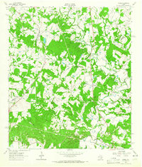
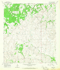
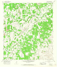 1965 Muldoon1967 Print · USGSMid-century Fayette County comes alive on this sheet, showing the rural communities of Texas as they balanced ranching with an emerging oil and rail economy. Researchers can locate family landmarks like Pitman Cem or trace the Southern Pacific line past a local Charcoal Oven and the Muldoon Field.2 unique versions available
 - 1965 Map of Weimar, 1967 Print
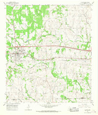
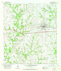 1965 Weimar1967 Print · USGSWeimar and its rural surroundings in the 1960s reveal a landscape defined by the Southern Pacific railroad and the East Navidad River. Researchers can trace the layout of Dubina, locate family plots at Hehr Cem, or identify historic church sites like St Cyril Ch.2 unique versions available
 - 1965 Map of Schulenburg, 1967 Print
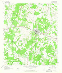
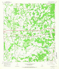
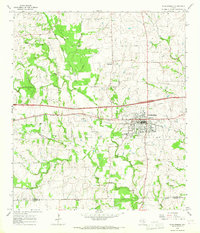 1965 Schulenburg1967 Print · USGSIn the mid-1960s, the rural border between Fayette and Lavaca counties centered on the busy rail town of Schulenburg. Researchers can trace old family sites at Old High Hill Cem, visit St John, or locate the site of the Drive-in Theater.2 unique versions available
 - 1965 Map of Cistern, 1967 Print
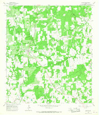 1965 Cistern1967 Print · USGSFayette County in the mid-sixties remained a patchwork of small communities and rural industry. Genealogists can trace family names at Robbins Cem or Psencik Cem, while researchers can locate historic energy infrastructure like the Southwest Muldoon Oil Field.2 unique versions available
 - 1965 Map of Swiss Alp, 1967 Print
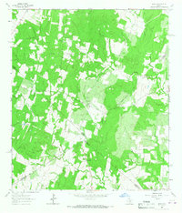
 1965 Swiss Alp1967 Print · USGSFayette County in the mid-1960s was a landscape of small farming communities and winding creek branches. Genealogists can trace family roots through landmarks like Swiss Alp, Hostyn, and the Kaasé Cem, or follow the course of the Navidad River.2 unique versions available
 - 1965 Map of Flatonia, 1967 Print
 1965 Flatonia1967 Print · USGSFayette and Lavaca Counties in the mid-1960s reveal a landscape defined by traditional rural settlements and the busy Southern Pacific rail line. Genealogists and local historians can trace family sites at Old Flatonia, the community of Praha, and the Slavonic Cemetery.2 unique versions available
 - 1965 Map of Flatonia NW, 1967 Print
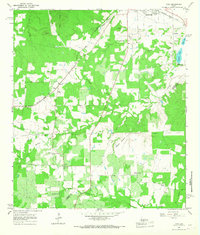
 1965 Flatonia NW1967 Print · USGSFayette and Gonzales counties are captured here in the mid-1960s as highway expansion began to reshape the rural landscape. Researchers can locate family burial sites like Sommers Cem and trace the path of the SOUTHERN PACIFIC through Armstrong.2 unique versions available
End of results
Showing maps 1-11 of 11
Top cities of Fayette County
- La Grange historical maps
- Schulenburg historical maps
- Flatonia historical maps
- Fayetteville historical maps
- Carmine historical maps
- Ellinger historical maps
See more
Frequently asked questions
- What are the different types of historical maps available for Fayette County?
- What is the oldest map of Fayette County?
- Where can I purchase historical maps of Fayette County for my home or office?
- Where can I download high-res historical maps of Fayette County?
- Are there historical topographic maps available for Fayette County?
- Is there historical aerial imagery available for Fayette County?
- Where are historical maps of Fayette County sourced from?