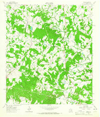
1962 Map of Warda
USGS Topo · Published 1965About this map
The boundary between Lee and Fayette Counties defines this rural landscape during the early 1960s, a period where small-scale agriculture and transit-oriented settlements anchored the region. Northrup sits along the Southern Pacific rail line, while further south, the community of Warda serves as a hub of local life, anchored by a Cem and nearby Holy Cross Sch. The topography is intricately carved by an extensive drainage network, including Rabbs Creek and several variations of Pin Oak Creek.
Find a feature on this map
27 named features on this map. Tap any name to fly to it.
Don’t see what you’re looking for? This feature index may not catch every label — zoom into the map to look around manually.
Map Details
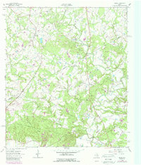
Editions of this 1962 Warda Map
2 editions found
Other maps of this area

1885 · Bastrop
USGS Topo · 1:125,000

1893 · Bastrop
USGS Topo · 1:125,000

1901 · Flatonia
USGS Topo · 1:125,000

1904 · Bastrop
USGS Topo · 1:125,000

1919 · Giddings
USGS Topo · 1:62,500

1948 · Smithville
USGS Topo · 1:62,500

1950 · Smithville
USGS Topo · 1:62,500

1953 · Seguin
USGS Topo · 1:250,000

1954 · Austin
USGS Topo · 1:250,000

1956 · La Grange
USGS Topo · 1:62,500