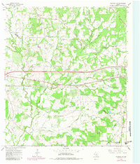
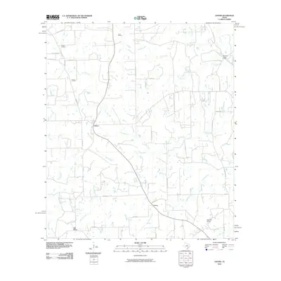
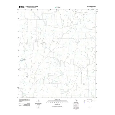
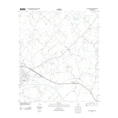
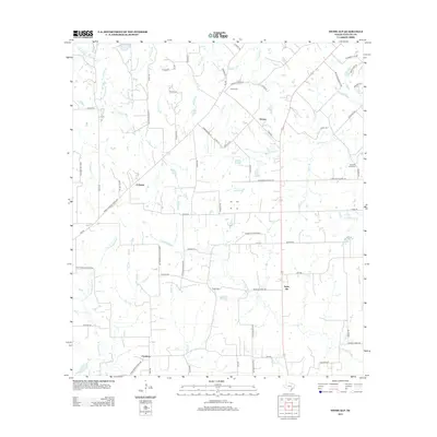
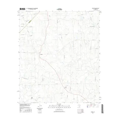
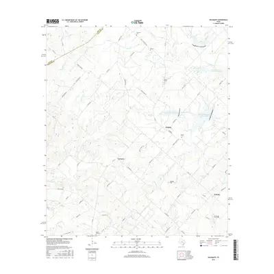
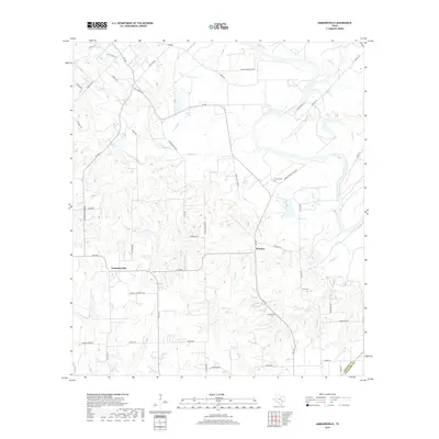
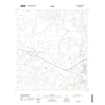
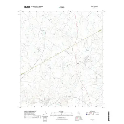
1962 Map of Warda
USGS Topo · Published 1989About this map
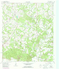
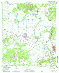
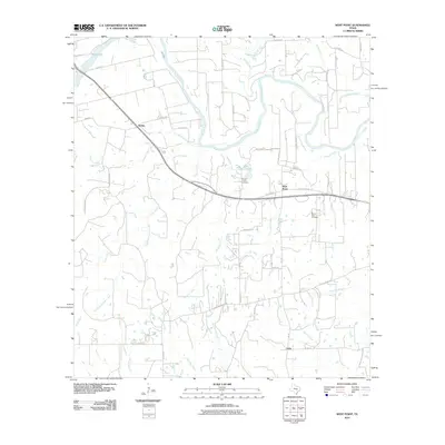
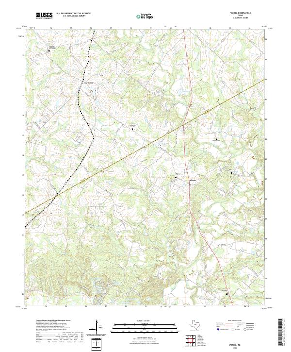
Rabbs Creek and its many tributaries, including Bowns Creek and Greens Creek, carve through this landscape at the boundary of Lee and Fayette counties. In the early 1960s, the rural community of Warda centered around Holy Cross Sch, while further north, the settlement of Northrup sat near St Paul Ch. The map reveals a countryside where traditional landmarks like the Foerster Cem exist alongside modern developments like a Radio Tower Substa and a Youth Camp. The proliferation of Oil Wells across the northern half of the quadrangle suggests the significant impact of petroleum extraction on the local economy during this period. Further industrial activity is evidenced by a Refinery and Gravel Pit near Cedar Creek, illustrating the transition from a strictly agricultural region to one shaped by resource exploration.
Find a feature on this map
27 named features on this map. Tap any name to fly to it.
Don’t see what you’re looking for? This feature index may not catch every label — zoom into the map to look around manually.
Map Details
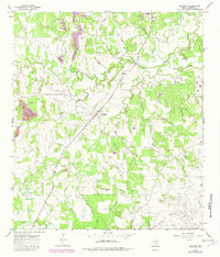
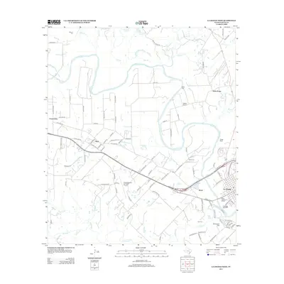
Editions of this 1962 Warda Map
2 editions found
Historical Maps of Warda Through Time
60 maps found
1957 Ammannsville
Fayette County, TX
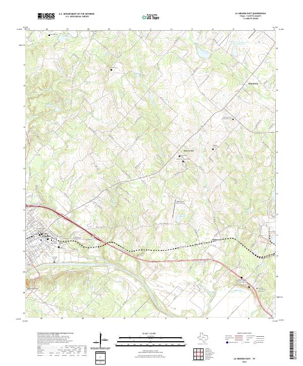
1957 La Grange East
Fayette County, TX
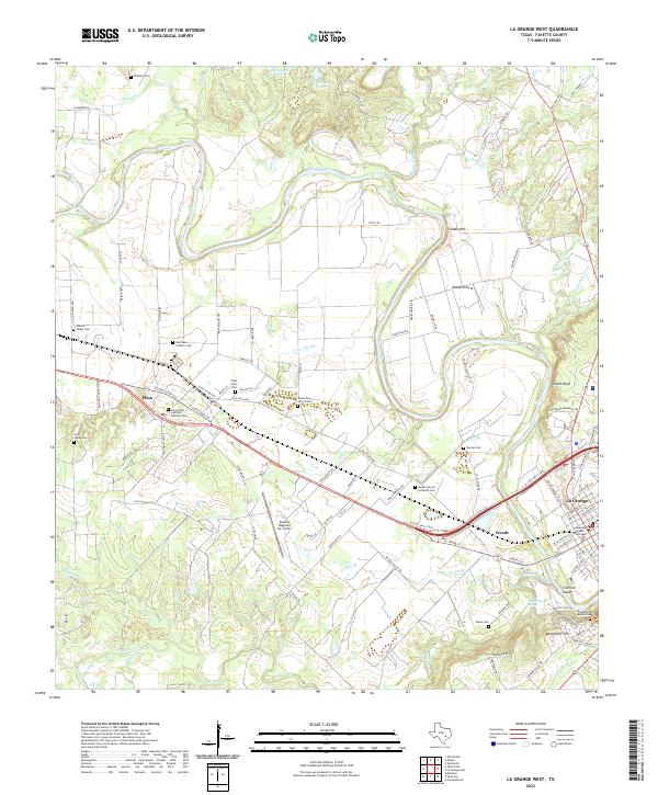
1958 La Grange West
Fayette County, TX
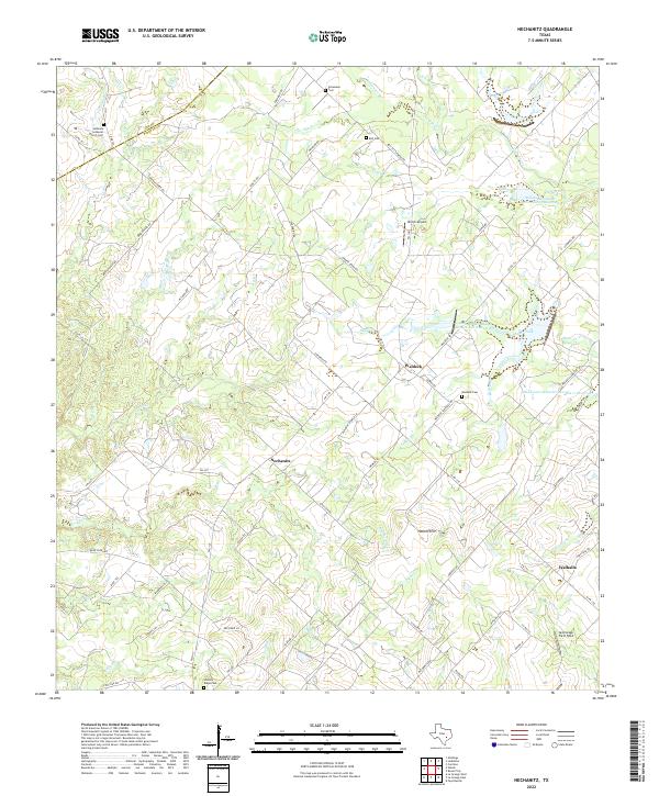
1958 Nechanitz
Fayette County, TX
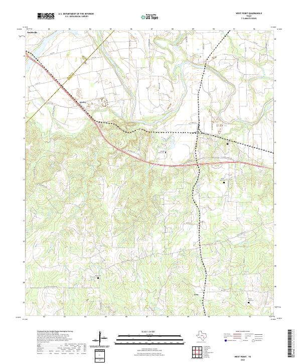
1958 West Point
Fayette County, TX
1962 Warda
Fayette County, TX
1965 Cistern
Fayette County, TX
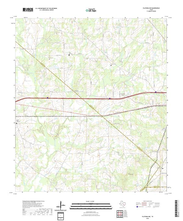
1965 Flatonia NW
Fayette County, TX
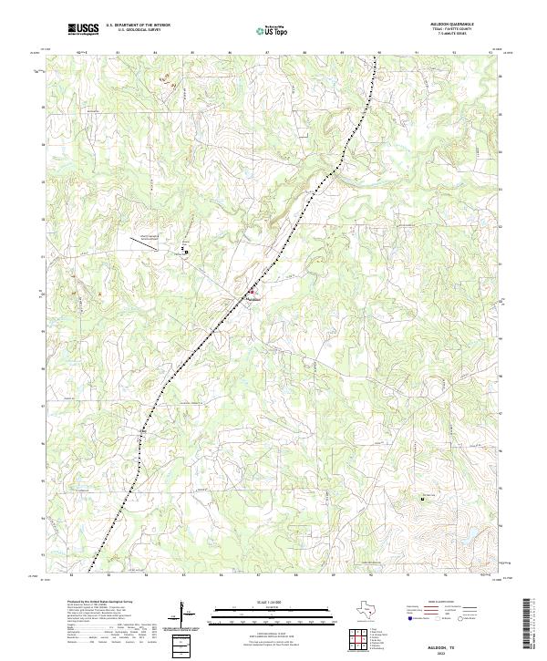
1965 Muldoon
Fayette County, TX
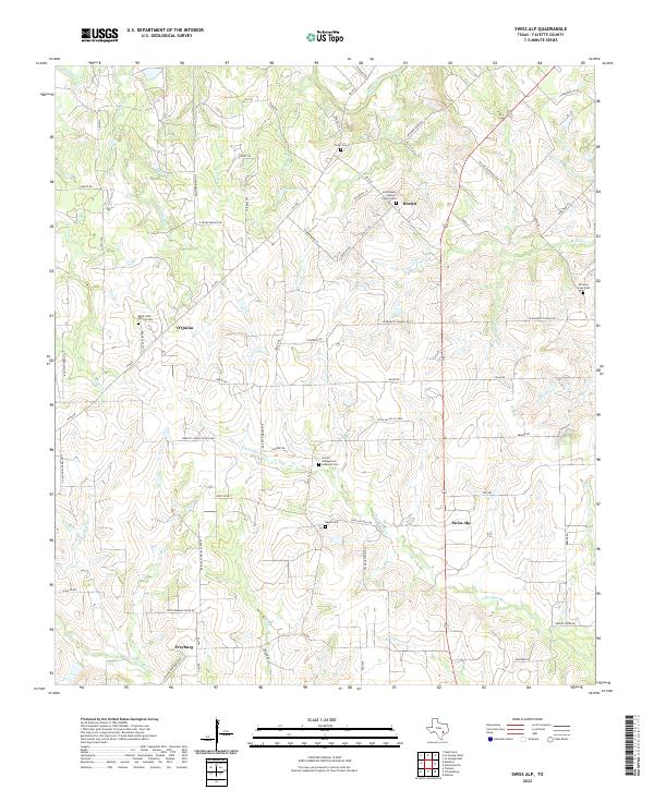
1965 Swiss Alp
Fayette County, TX
2010 Ammannsville
Fayette County, TX
2010 Cistern
Fayette County, TX
2010 Flatonia NW
Fayette County, TX
2010 La Grange East
Fayette County, TX
2010 La Grange West
Fayette County, TX
2010 Muldoon
Fayette County, TX
2010 Nechanitz
Fayette County, TX
2010 Swiss Alp
Fayette County, TX
2010 Warda
Fayette County, TX
2010 West Point
Fayette County, TX
2013 Ammannsville
Fayette County, TX
2013 Cistern
Fayette County, TX
2013 Flatonia NW
Fayette County, TX
2013 La Grange East
Fayette County, TX
2013 La Grange West
Fayette County, TX
2013 Muldoon
Fayette County, TX
2013 Nechanitz
Fayette County, TX
2013 Swiss Alp
Fayette County, TX
2013 Warda
Fayette County, TX
2013 West Point
Fayette County, TX
2016 Ammannsville
Fayette County, TX
2016 Cistern
Fayette County, TX
2016 Flatonia NW
Fayette County, TX

2016 La Grange East
Fayette County, TX
2016 La Grange West
Fayette County, TX
2016 Muldoon
Fayette County, TX
2016 Nechanitz
Fayette County, TX
2016 Swiss Alp
Fayette County, TX
2016 Warda
Fayette County, TX
2016 West Point
Fayette County, TX
2019 Ammannsville
Fayette County, TX
2019 Cistern
Fayette County, TX
2019 Flatonia NW
Fayette County, TX
2019 La Grange East
Fayette County, TX
2019 La Grange West
Fayette County, TX
2019 Muldoon
Fayette County, TX
2019 Nechanitz
Fayette County, TX
2019 Swiss Alp
Fayette County, TX
2019 Warda
Fayette County, TX
2019 West Point
Fayette County, TX
2022 Ammannsville
Fayette County, TX
2022 Cistern
Fayette County, TX
2022 Flatonia NW
Fayette County, TX
2022 La Grange East
Fayette County, TX
2022 La Grange West
Fayette County, TX
2022 Muldoon
Fayette County, TX
2022 Nechanitz
Fayette County, TX
2022 Swiss Alp
Fayette County, TX
2022 Warda
Fayette County, TX
2022 West Point
Fayette County, TX