1900s (20th Century) Maps of Frio County, Texas
Explore 46 historic maps of Frio County from the 1900s (20th Century). These maps offer a rare glimpse into what life looked like during the 1900s — showing old roads, neighborhoods, homes, and landmarks that have changed or disappeared over time.
Whether you're researching your family's past, planning a metal detecting trip, or studying how Frio County's landscape evolved across the 1900s, these high-resolution maps are a powerful tool for exploring the history of this region.
- Focus on a specific era: All maps on this page are from the 1900s, giving you a focused view of this time period.
- See what’s changed: Compare century-old streets, trails, and buildings to today's modern landscape using overlays and satellite layers.
- Research with precision: Use these maps for genealogy, historical research, land use analysis, or educational projects.
- View, download, or print: Maps are fully viewable online in high resolution, and can be downloaded or printed for your own records.
Start exploring Frio County's history through authentic maps from the 1900s. This is your window into the past.
Frio County, TX maps
(46)- 1925 Map of Pearsall 1-b
 1925 Pearsall 1-b1925 Print · USGSThe Frio River basin is captured here in the mid-twenties, showing the intricate drainage of the Texas brush country. Researchers can trace river access points like Cood Crossing and the paths of Hondo Creek and Buck Creek.
 - 1925 Map of Pearsall 1-c
 1925 Pearsall 1-c1925 Print · USGSFrio County in the mid-1920s reveals a landscape defined by the winding Frio River and early overland transit routes. Trace the early settlement at Derby and the corridor of the Jeff Davis Highway near its junction with Todos Santos Creek.
 - 1927 Map of Pearsall
 1927 Pearsall1927 Print · USGSSouth Texas ranch country comes into focus in the 1920s as early aerial photography began to transform traditional mapping. Researchers can trace the International Great Northern railroad through Derby and follow the winding Frio River.2 unique versions available
 - 1928 Map of Frio Town, 1956 Print
 1928 Frio Town1956 Print · USGSThe ranchlands of South Texas are documented here in the late 1920s, showing a landscape shaped by water rights and family holdings. Genealogists and local historians can trace the bounds of the Schuddemagen Ranch and Woodward Ranch or locate the old Post Office at Frio Town.
 - 1934 Map of Schattel, 1940 Print
 1934 Schattel1940 Print · USGSIn the mid-1930s, this Frio County landscape was a network of cattle ranches and remote schoolhouses. Genealogists and historians can trace family operations at Keystone Ranch and locate vanished rural centers like Schattel and Shallow Wells School.2 unique versions available
 - 1942 Map of Divot
 1942 Divot1942 Print · USGSThe cattle country of South Texas comes into focus in the early 1940s, where the Frio and Leona rivers meet amidst a network of large family ranches. Genealogists and historians can locate legacy holdings like Roberts Ranch and Rogers Ranch, or trace water sources like Berry Crossing and the Crawford Windmills.
 - 1942 Map of Dilley, 1956 Print
 1942 Dilley1956 Print · USGSSouth Texas ranching and rail infrastructure are on full display during the early 1940s at the Frio and La Salle county line. Genealogists and historians can trace family properties like Nagy Witherspoon Ranch and Julia Harris Ranch along the International and Great Northern railroad.
 - 1942 Map of Natalia, 1956 Print
 1942 Natalia1956 Print · USGSMedina and Atascosa Counties are captured here during the mid-century, showing the shift from traditional ranching to an oil and rail economy. Genealogists can trace family holdings and local landmarks such as Bear Creek School, the Sullivan Ranch, and the early settlement at Zig Zag.
 - 1953 Map of Crystal City
 1953 Crystal City1953 Print · USGSSouth Texas in the early fifties was a landscape of expanding oil fields and vital rail connections. Genealogists and researchers can trace family lands along the Nueces River or locate heritage sites in Asherton, Big Wells, and Batesville.
 - 1954 Map of San Antonio, 1964 Print
 1954 San Antonio1964 Print · USGSSan Antonio and the Texas Hill Country are captured here in the mid-fifties, showing a landscape defined by massive military air bases and the rising Canyon Reservoir. Trace family ties through historic rail towns like D'Hanis and Castroville or explore the Cold War footprint of Lackland AFB and Randolph AFB.3 unique versions available
 - 1955 Map of Crystal City, 1976 Print
 1955 Crystal City1976 Print · USGSSouth Texas ranching and oil country come into focus in the mid-fifties as the rail lines and rivers connect growing hubs. Researchers can trace the development of energy fields like Washburn Oil Field or locate historic settlements from Asherton to Three Rivers.
 - 1956 Map of Woodward
 1956 Woodward1956 Print · USGSMid-century ranching and rail life dominate the South Texas borderlands where four counties meet. Genealogists and historians can trace family holdings like Vesper Ranch or El Cid Ranch and locate the rail stop at Woodward.
 - 1956 Map of Divot
 1956 Divot1956 Print · USGSRanching life on the Frio County line during the mid-twentieth century centers on scattered homesteads and vital river crossings. Researchers can locate family landmarks such as Higdon Ranch and Rogers Ranch or trace early water infrastructure at Division Tank.
 - 1956 Map of Hindes
 1956 Hindes1956 Print · USGSSouth Texas ranching country comes alive in this mid-century survey of the Frio and La Salle county lines. Family history researchers can trace local landmarks like the Arnold School, Schoerp & Spettel Ranch, and rail stops at Prince Siding and Zella Siding.
 - 1957 Map of San Antonio
 1957 San Antonio1957 Print · USGSSan Antonio and the Texas Hill Country are shown here during the mid-fifties, capturing the region's expanding post-war military and transportation footprint. Genealogists and local historians can trace the early residential boundaries of Alamo Heights or locate rural landmarks like St Hedwig and Medina Lake.
 - 1961 Map of Crystal City
 1961 Crystal City1961 Print · USGSSouth Texas in the early sixties reveals a landscape of massive cattle ranches and emerging oil fields. Genealogists and historians can trace the Missouri Pacific rail lines through Crystal City, or locate water features like Espantosa Lake and Boynton Reservoir.
 - 1964 Map of Pearsall South, 1966 Print
 1964 Pearsall South1966 Print · USGSFrio County ranching and oil interests are captured here in the mid-1960s, showing the country south of the rail line. Genealogists and researchers can locate Buckhorn Cem, family landmarks like Shiner Ranch, and the McKinley Landing Strip.2 unique versions available
 - 1964 Map of Ghost Hill, 1966 Print
 1964 Ghost Hill1966 Print · USGSSouthern Frio County comes to life in the mid-1960s, showing a landscape defined by the intersection of the cattle industry and the energy boom. Genealogists and historians can trace family land at Moore Cem or study the reach of the Big Foot Gas Field and the Missouri Pacific railroad.2 unique versions available
 - 1964 Map of Moore, 1966 Print
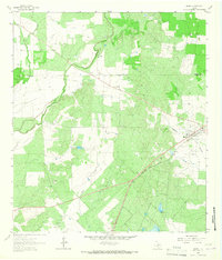 1964 Moore1966 Print · USGSMoore and the surrounding Frio County ranch lands are documented here during the mid-1960s. Genealogists and historians can trace the Missouri Pacific rail line and locate rural landmarks like Tehuacana Cem and Moore Hollow.2 unique versions available
 - 1964 Map of Wilson Ranch, 1966 Print
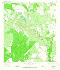 1964 Wilson Ranch1966 Print · USGSRanching life on the Frio and Medina County line is captured here in the mid-1960s, showing a landscape defined by water rights and wide-open range. Researchers can trace historic land use through cattle-country landmarks like Wilson Ranch, Javelin Windmill, and Slaughter Windmill.
 - 1964 Map of Pearsall North, 1966 Print
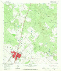 1964 Pearsall North1966 Print · USGSPearsall and the surrounding Frio County ranch lands are captured here during a period of mid-century growth. Researchers can trace family history at Pearsall Cem or locate the old Westside Sch and Jr High Sch near the Missouri Pacific line.2 unique versions available
 - 1964 Map of Derby, 1966 Print
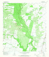 1964 Derby1966 Print · USGSSouth Texas ranching and resource extraction dominate this mid-sixties survey of Frio County. Genealogists and historians can locate the community of Derby along the Missouri Pacific tracks or trace water sources like Honeymoon Windmill and the Leona River.2 unique versions available
 - 1964 Map of Halff Ranch, 1967 Print
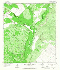 1964 Halff Ranch1967 Print · USGSSouth Texas cattle country during the mid-sixties is defined by the winding Frio River and a vast network of family ranch holdings. Genealogists and historians can trace the footprints of the Halff Ranch, Thompson Ranch, and dozens of named water sources like Buzzard Roost Lake.
 - 1964 Map of Bigfoot, 1967 Print
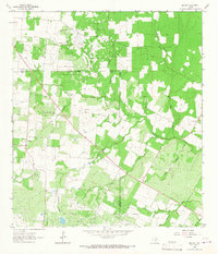 1964 Bigfoot1967 Print · USGSSouth Texas ranching and oil production define this area during the mid-sixties. Genealogists and historians can trace family-named sites like Brummett Cem and Moore Cem near the Big Foot Oil Field.
 - 1968 Map of Crystal City
 1968 Crystal City1968 Print · USGSSouth Texas in the late sixties reveals a landscape shaped by ranching roots and the vital waters of the Nueces River. Researchers can trace the rail-driven growth of Crystal City or locate landmarks like Pilot Knob and Espantosa Lake.
Showing maps 1-25 of 46
Top cities of Frio County
Frequently asked questions
- What are the different types of historical maps available for Frio County?
- What is the oldest map of Frio County?
- Where can I purchase historical maps of Frio County for my home or office?
- Where can I download high-res historical maps of Frio County?
- Are there historical topographic maps available for Frio County?
- Is there historical aerial imagery available for Frio County?
- Where are historical maps of Frio County sourced from?