1920s Maps of Frio County, Texas
Explore 4 historic maps of Frio County from the 1920s. These maps offer a rare glimpse into what life looked like during the 1920s — showing old roads, neighborhoods, homes, and landmarks that have changed or disappeared over time.
Whether you're researching your family's past, planning a metal detecting trip, or studying how Frio County's landscape evolved across the 1920s, these high-resolution maps are a powerful tool for exploring the history of this region.
- Focus on a specific era: All maps on this page are from the 1920s, giving you a focused view of this time period.
- See what’s changed: Compare century-old streets, trails, and buildings to today's modern landscape using overlays and satellite layers.
- Research with precision: Use these maps for genealogy, historical research, land use analysis, or educational projects.
- View, download, or print: Maps are fully viewable online in high resolution, and can be downloaded or printed for your own records.
Start exploring Frio County's history through authentic maps from the 1920s. This is your window into the past.
Frio County, TX maps
(4)- 1925 Map of Pearsall 1-b
 1925 Pearsall 1-b1925 Print · USGSThe Frio River basin is captured here in the mid-twenties, showing the intricate drainage of the Texas brush country. Researchers can trace river access points like Cood Crossing and the paths of Hondo Creek and Buck Creek.
 - 1925 Map of Pearsall 1-c
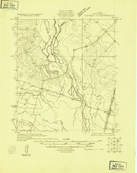 1925 Pearsall 1-c1925 Print · USGSFrio County in the mid-1920s reveals a landscape defined by the winding Frio River and early overland transit routes. Trace the early settlement at Derby and the corridor of the Jeff Davis Highway near its junction with Todos Santos Creek.
 - 1927 Map of Pearsall
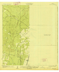 1927 Pearsall1927 Print · USGSSouth Texas ranch country comes into focus in the 1920s as early aerial photography began to transform traditional mapping. Researchers can trace the International Great Northern railroad through Derby and follow the winding Frio River.2 unique versions available
 - 1928 Map of Frio Town, 1956 Print
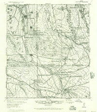 1928 Frio Town1956 Print · USGSThe ranchlands of South Texas are documented here in the late 1920s, showing a landscape shaped by water rights and family holdings. Genealogists and local historians can trace the bounds of the Schuddemagen Ranch and Woodward Ranch or locate the old Post Office at Frio Town.
End of results
Showing maps 1-4 of 4
Top cities of Frio County
Frequently asked questions
- What are the different types of historical maps available for Frio County?
- What is the oldest map of Frio County?
- Where can I purchase historical maps of Frio County for my home or office?
- Where can I download high-res historical maps of Frio County?
- Are there historical topographic maps available for Frio County?
- Is there historical aerial imagery available for Frio County?
- Where are historical maps of Frio County sourced from?