Old Maps of Pirates Cove, Galveston
Explore 15 old maps of Pirates Cove, spanning from 1931 to today. These high-resolution historic maps reveal how streets, neighborhoods, landmarks, and natural features evolved over time — perfect for genealogy, metal detecting, research, and local history exploration.
What you can do with these maps:
- See how Pirates Cove changed over time: Compare historical maps to modern-day views to trace roads, homesites, rail lines & more.
- View detailed metadata: Each map includes creators, publishers, year, scale, and archive source.
- Overlay maps with satellite & LiDAR: Visualize the past alongside modern tools to explore terrain & human change.
- Trusted historical sources: Maps sourced from the USGS, Library of Congress, and other archives.
- Access maps your way: View online, download high-res files, or order prints for personal or research use.
Start exploring old maps of Pirates Cove to uncover forgotten places, hidden landmarks, and the deep history beneath your feet.
Pirates Cove, Galveston maps
(15)- 1931 Map of Lake Como
 1931 Lake Como1931 Print · USGSGalveston Island's coastal geography is shown in the early 1930s just as aerial mapping was coming into its own. Local historians can trace the early settlement at Dana and the natural shorelines of Lake Como and Sweetwater Lake before modern expansion.
 - 1933 Map of Lake Como, 1945 Print
 1933 Lake Como1945 Print · USGSGalveston Island's central stretch appears in the early 1930s as a sparsely settled coastal landscape. Trace the early layout of Dana and examine the natural shorelines of Lake Como and Sweetwater Lake before decades of development.
 - 1943 Map of Lake Como
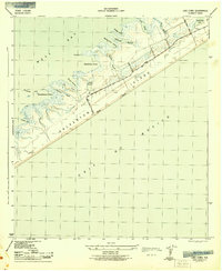 1943 Lake Como1943 Print · USGSGalveston Island's central reaches are shown here in the early 1940s, highlighting the natural drainage systems and coastal topography. Trace the early road network from Eight Mile Road to Thirteen Mile Road while exploring landmarks like the Lookout Tower and Lake Como.2 unique versions available
 - 1950 Map of Houston, 1953 Print
 1950 Houston1953 Print · USGSCoastal Texas in the early fifties reveals a landscape of massive civil engineering and industrial transit. Genealogists and researchers can trace the growth of the Houston suburbs and the maritime infrastructure of Galveston Bay, including the Gulf Freeway and the Texas City Dike.
 - 1954 Map of Lake Como, 1958 Print
 1954 Lake Como1958 Print · USGSGalveston Island in the mid-fifties remains a world of open salt marshes and intricate bayous before the onset of modern expansion. Genealogists and historians can trace the early road network of Stewart Road and find coastal landmarks like Lake Como and Carancahua Reef.4 unique versions available
 - 1956 Map of Houston, 1963 Print
 1956 Houston1963 Print · USGSSoutheast Texas in the mid-fifties is captured here as a powerhouse of oil and maritime trade. Genealogists and historians can trace the foundations of Houston and its ports, alongside landmarks like the Rice Institute and the Spindletop Oil Field.2 unique versions available
 - 1975 Map of Houston, 1977 Print
 1975 Houston1977 Print · USGSThe Texas Gulf Coast in the mid-seventies shows a sprawling Houston metropolis linked to the sea by the massive Houston Ship Channel. Researchers can trace the mid-century industrial landscape from the Astrodome to the Lyndon B. Johnson Space Center.2 unique versions available
 - 1983 Map of Galveston
 1983 Galveston1983 Print · USGSThe Texas Gulf Coast comes into sharp focus in the early eighties, centered on the thriving maritime and industrial hubs of Galveston and Texas City. Trace coastal change and land use through landmarks like Fort San Jacinto, the Texas City Dike, and the expansive Galveston Island State Park.
 - 1994 Map of Lake Como
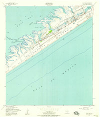
 1994 Lake Como1994 Print · USGSGalveston Island's western reach is shown in the mid-1990s, where residential growth meets protected coastal marshes. Researchers can trace the development of Jamaica Beach or locate historical landmarks like Lafitte Grove and the Mary Moody Northern Amphitheater Footbridge.
 - 2010 Map of Lake Como, 2010 Print
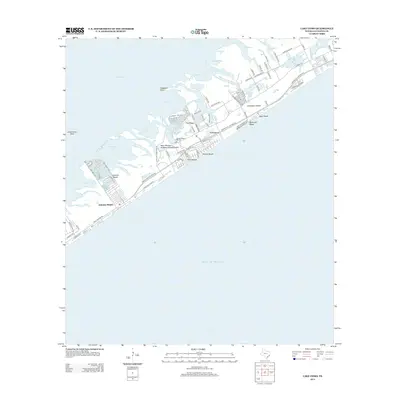
 2010 Lake Como2010 Print · USGSCovers Pirates Cove, including Galveston, Hitchcock, and other nearby areas
 - 2013 Map of Lake Como, 2013 Print
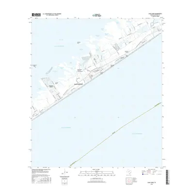
 2013 Lake Como2013 Print · USGSCovers Pirates Cove, including Galveston, Hitchcock, and other nearby areas
 - 2016 Map of Lake Como, 2016 Print
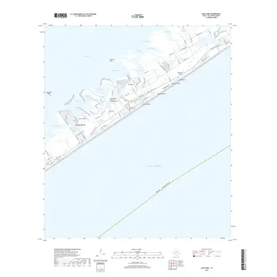
 2016 Lake Como2016 Print · USGSCovers Pirates Cove, including Galveston, Hitchcock, and other nearby areas
 - 2019 Map of Lake Como, 2019 Print
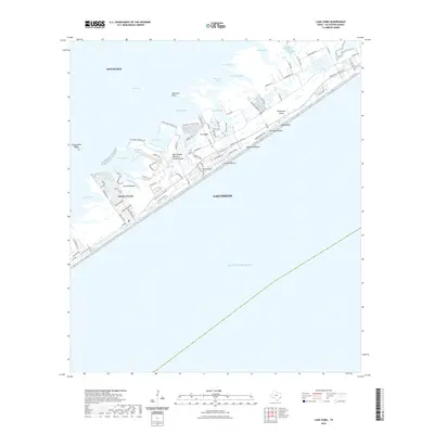
 2019 Lake Como2019 Print · USGSCovers Pirates Cove, including Galveston, Hitchcock, and other nearby areas
 - 2022 Map of Lake Como, 2022 Print
 2022 Lake Como2022 Print · USGSCovers Pirates Cove, including Galveston, Hitchcock, and other nearby areas
 - 2025 Map of Lake Como, 2025 Print
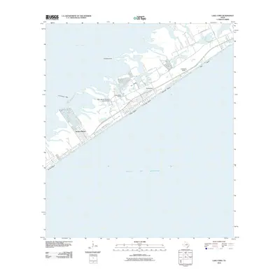
 2025 Lake Como2025 Print · USGSGalveston Island and its bay-side coves are documented here in the mid-2020s as modern coastal communities thrive alongside sensitive wetlands. Researchers can trace the development of Jamaica Beach, locate the Wern Cem, and explore the shoreline from Bermuda Beach to Starvation Cove.
End of results
Showing maps 1-15 of 15
Frequently asked questions
- What are the different types of historical maps available for Pirates Cove?
- What is the oldest map of Pirates Cove?
- Where can I purchase historical maps of Pirates Cove for my home or office?
- Where can I download high-res historical maps of Pirates Cove?
- Are there historical topographic maps available for Pirates Cove?
- Is there historical aerial imagery available for Pirates Cove?
- Where are historical maps of Pirates Cove sourced from?