Old Maps of Sunset Cove, Galveston for Genealogy
Trace your family roots with 14 historic maps of Sunset Cove. These high-res maps reveal old neighborhoods, homesites, landmarks, and streets — helping you uncover where your ancestors lived and how the area evolved over time.
- Explore historic neighborhoods: Identify where your relatives may have lived in the 1800s or 1900s.
- Compare maps over time: Trace the changes in streets, buildings, and landmarks for multi-generational research.
- Perfect for genealogy & ancestry research: Used by family historians and researchers to map out lineage and migration.
These maps are an incredible resource for exploring your personal connection to Sunset Cove's past.
Sunset Cove, Galveston maps
(14)- 1929 Map of Karankawa Lake
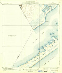
 1929 Karankawa Lake1929 Print · USGSThe Galveston and Brazoria county line meets the Gulf Coast in the late 1920s, revealing an era of undeveloped marshland and barrier island terrain. Researchers can trace the shifting shoreline of Galveston Island and identify historical landmarks like Karankawa Lake and Halls.
 - 1933 Map of Karankawa Lake
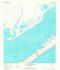
 1933 Karankawa Lake1933 Print · USGSThe Galveston coastline in the early 1930s is captured here, showing the unbridled geography of Galveston Island and the bay. Researchers can trace the original shoreline and water features like Karankawa Lake, Karankawa Point, and Lake Como.2 unique versions available
 - 1943 Map of Carancahua Lake, 1952 Print
 1943 Carancahua Lake1952 Print · USGSThe Galveston and Brazoria county line met in the tidal marshes and open waters of the West Bay during the 1940s. Researchers can trace the early path of the Intracoastal Waterway and locate landmarks like Rattlesnake Mound and Boathouse Ruins.
 - 1950 Map of Houston, 1953 Print
 1950 Houston1953 Print · USGSCoastal Texas in the early fifties reveals a landscape of massive civil engineering and industrial transit. Genealogists and researchers can trace the growth of the Houston suburbs and the maritime infrastructure of Galveston Bay, including the Gulf Freeway and the Texas City Dike.
 - 1956 Map of Houston, 1963 Print
 1956 Houston1963 Print · USGSSoutheast Texas in the mid-fifties is captured here as a powerhouse of oil and maritime trade. Genealogists and historians can trace the foundations of Houston and its ports, alongside landmarks like the Rice Institute and the Spindletop Oil Field.2 unique versions available
 - 1963 Map of Sea Isle, 1966 Print
 1963 Sea Isle1966 Print · USGSGalveston Island shows its mid-century growth as new coastal communities emerge along the Gulf. Genealogists and historians can trace early developments at Sea Isle and Bay Harbor or locate family landmarks like the Fishing Cabins on Halls Bayou.3 unique versions available
 - 1975 Map of Houston, 1977 Print
 1975 Houston1977 Print · USGSThe Texas Gulf Coast in the mid-seventies shows a sprawling Houston metropolis linked to the sea by the massive Houston Ship Channel. Researchers can trace the mid-century industrial landscape from the Astrodome to the Lyndon B. Johnson Space Center.2 unique versions available
 - 1984 Map of Angleton
 1984 Angleton1984 Print · USGSThe Texas Gulf Coast in the mid-eighties shows a landscape of salt domes and bayous at the height of its oil-and-river economy. Researchers can trace land use through the Damon Mound Oil Field and the sprawling State Department of Corrections (Retrieve Unit).2 unique versions available
 - 2010 Map of Sea Isle, 2010 Print
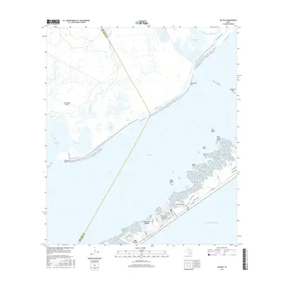
 2010 Sea Isle2010 Print · USGSCovers Sunset Cove, including Galveston, Alvin, and other nearby areas
 - 2013 Map of Sea Isle, 2013 Print
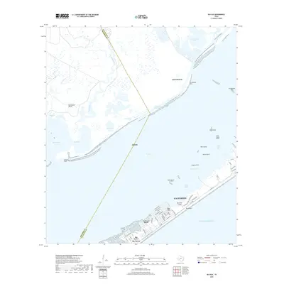
 2013 Sea Isle2013 Print · USGSCovers Sunset Cove, including Galveston, Alvin, and other nearby areas
 - 2016 Map of Sea Isle, 2016 Print
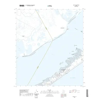
 2016 Sea Isle2016 Print · USGSCovers Sunset Cove, including Galveston, Alvin, and other nearby areas
 - 2019 Map of Sea Isle, 2019 Print
 2019 Sea Isle2019 Print · USGSCovers Sunset Cove, including Galveston, Alvin, and other nearby areas
 - 2022 Map of Sea Isle, 2022 Print
 2022 Sea Isle2022 Print · USGSCovers Sunset Cove, including Galveston, Alvin, and other nearby areas
 - 2025 Map of Sea Isle, 2025 Print
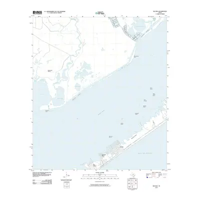
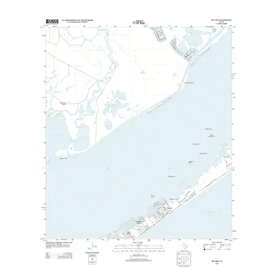
 2025 Sea Isle2025 Print · USGSGalveston Island and the West Bay coastline come into focus in this contemporary survey of the Texas coast. Researchers can trace the development of coastal communities like Sea Isle and Bay Harbor or locate landmarks such as Rattlesnake Mound and Carancahua Point.
End of results
Showing maps 1-14 of 14
Frequently asked questions
- What are the different types of historical maps available for Sunset Cove?
- What is the oldest map of Sunset Cove?
- Where can I purchase historical maps of Sunset Cove for my home or office?
- Where can I download high-res historical maps of Sunset Cove?
- Are there historical topographic maps available for Sunset Cove?
- Is there historical aerial imagery available for Sunset Cove?
- Where are historical maps of Sunset Cove sourced from?