Old Maps of High Island, Texas for Hiking & Exploration
Hike through history with 14 historic maps of High Island. Explore old trails, ghost towns, and forgotten backroads — perfect for outdoor adventurers and local explorers.
- Rediscover forgotten places: Map out old mining camps, roads, and footpaths that no longer exist on modern maps.
- Layer with modern tools: Combine with LiDAR or satellite views to plan hikes through historical terrain.
- Made for exploration: Popular among hikers, overlanders, and local history lovers.
Use these maps to find adventure and explore the hidden past of High Island.
High Island, TX maps
(14)- 1931 Map of High Island
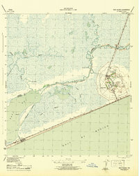
 1931 High Island1931 Print · USGSCoastal Texas in the early thirties reveals a landscape of salt domes and rail-linked settlements along the gulf. Trace the early footprint of High Island, the railroad at Gilchrist Sta, and the historic High Island Hotel before the era of modern development.
 - 1943 Map of High Island
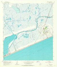
 1943 High Island1943 Print · USGSCoastal Texas during the early 1940s reveals a landscape of vital waterways and isolated gulf settlements. Genealogists and researchers can trace the routes of the Santa Fe railroad and Intracoastal Waterway near High Island and Gilchrist.2 unique versions available
 - 1950 Map of Houston, 1953 Print
 1950 Houston1953 Print · USGSCoastal Texas in the early fifties reveals a landscape of massive civil engineering and industrial transit. Genealogists and researchers can trace the growth of the Houston suburbs and the maritime infrastructure of Galveston Bay, including the Gulf Freeway and the Texas City Dike.
 - 1956 Map of Houston, 1963 Print
 1956 Houston1963 Print · USGSSoutheast Texas in the mid-fifties is captured here as a powerhouse of oil and maritime trade. Genealogists and historians can trace the foundations of Houston and its ports, alongside landmarks like the Rice Institute and the Spindletop Oil Field.2 unique versions available
 - 1962 Map of High Island, 1964 Print
 1962 High Island1964 Print · USGSThe Texas Gulf Coast comes into focus in the early sixties, showing the salt dome of High Island and the coastal community of Gilchrist. Trace oil field history and old infrastructure along the Old Railroad Grade and the Intracoastal Waterway.2 unique versions available
 - 1975 Map of Houston, 1977 Print
 1975 Houston1977 Print · USGSThe Texas Gulf Coast in the mid-seventies shows a sprawling Houston metropolis linked to the sea by the massive Houston Ship Channel. Researchers can trace the mid-century industrial landscape from the Astrodome to the Lyndon B. Johnson Space Center.2 unique versions available
 - 1983 Map of Anahuac
 1983 Anahuac1983 Print · USGSThe Upper Texas Coast and its energy-driven landscape are detailed here in the early eighties. Genealogists and historians can trace coastal settlements like Anahuac and Winnie alongside the storied Spindletop Oil Field and the Anahuac National Wildlife Refuge.2 unique versions available
 - 1994 Map of High Island
 1994 High Island1994 Print · USGSThe Texas coastline at the Galveston and Chambers county line appears here in the mid-nineties, showing the salt dome geology of the region. Researchers can trace the Oil Field infrastructure near High Island or locate the coastal community of Gilchrist near Rollover Bay.
 - 2010 Map of High Island, 2010 Print
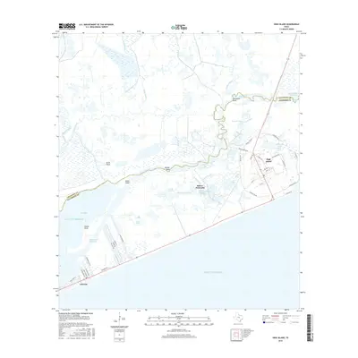
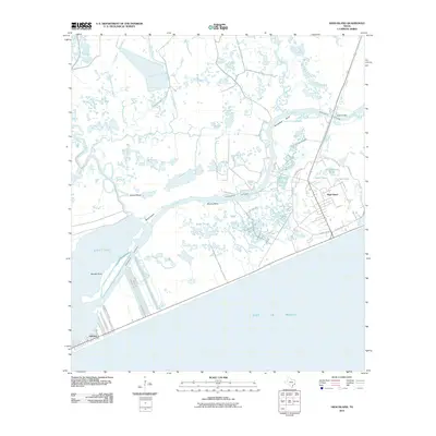 2010 High Island2010 Print · USGSCovers High Island, including Gilchrist, Chambers County, and other nearby areas
 - 2013 Map of High Island, 2013 Print
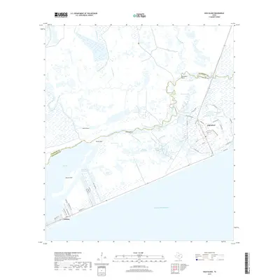
 2013 High Island2013 Print · USGSCovers High Island, including Gilchrist, Chambers County, and other nearby areas
 - 2016 Map of High Island, 2016 Print
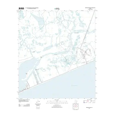
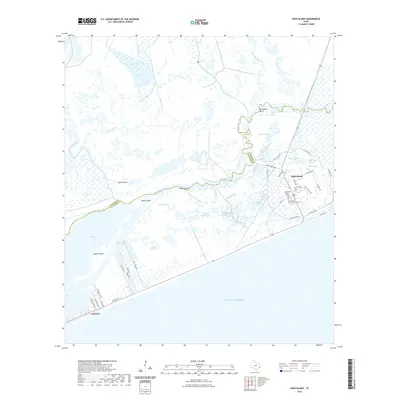
 2016 High Island2016 Print · USGSCovers High Island, including Gilchrist, Chambers County, and other nearby areas
 - 2019 Map of High Island, 2019 Print
 2019 High Island2019 Print · USGSCovers High Island, including Gilchrist, Chambers County, and other nearby areas
 - 2022 Map of High Island, 2022 Print
 2022 High Island2022 Print · USGSCovers High Island, including Gilchrist, Chambers County, and other nearby areas
 - 2025 Map of High Island, 2025 Print
 2025 High Island2025 Print · USGSThe Upper Texas Coast is captured here as it transitions from the salt marshes of the Bolivar Peninsula to the mainland. Genealogists and local historians can locate the High Island Cem - North and trace the complex waterways around Gilchrist and Mussel Point.
End of results
Showing maps 1-14 of 14
Top cities near High Island
Frequently asked questions
- What are the different types of historical maps available for High Island?
- What is the oldest map of High Island?
- Where can I purchase historical maps of High Island for my home or office?
- Where can I download high-res historical maps of High Island?
- Are there historical topographic maps available for High Island?
- Is there historical aerial imagery available for High Island?
- Where are historical maps of High Island sourced from?