Old Maps of Texas City Terminal Junction, Hitchcock for Academic Research
Study the evolution of Texas City Terminal Junction with 15 high-resolution historic maps. Whether you're teaching, researching, or modeling changes in land use, these maps provide essential visual documentation of urban, environmental, and geographic change.
- Analyze long-term change: Track patterns in development, transportation, and natural features.
- Ideal for environmental or urban studies: Support academic projects with primary historical map data.
- Use in the classroom or lab: Educators and researchers rely on these maps to bring historical context to life.
These maps are a powerful tool for teaching, research, and visualizing how Texas City Terminal Junction has changed over the decades.
Texas City Terminal Junction, Hitchcock maps
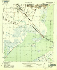
(15)- 1929 Map of Virginia Point
 1929 Virginia Point1929 Print · USGSThe Galveston shoreline in the late twenties was a hub of heavy industry and rail transport as the region expanded toward the mainland. Family historians can trace the early layout of La Marque and the dense rail junctions at Texas City Junction and Virginia Point.
 - 1932 Map of Virginia Point, 1943 Print
 1932 Virginia Point1943 Print · USGSThe Galveston mainland in the late twenties was a hub of industrial transit, dominated by rail lines converging at the shore. Trace the path of the Interurban and Southern Pacific as they reach Virginia Point and the Galveston Causeway.
 - 1943 Map of Virginia Point
 1943 Virginia Point1943 Print · USGSGalveston County was a hive of industrial and maritime activity during the war years. Local historians can trace the critical rail lines of the Santa Fe and the strategic connection at Virginia Point leading toward Galveston Island.2 unique versions available
 - 1950 Map of Houston, 1953 Print
 1950 Houston1953 Print · USGSCoastal Texas in the early fifties reveals a landscape of massive civil engineering and industrial transit. Genealogists and researchers can trace the growth of the Houston suburbs and the maritime infrastructure of Galveston Bay, including the Gulf Freeway and the Texas City Dike.
 - 1954 Map of Virginia Point, 1956 Print
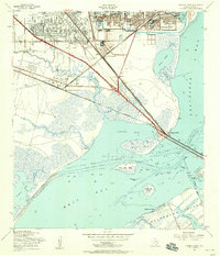 1954 Virginia Point1956 Print · USGSThe Galveston Bay shoreline in the mid-fifties reveals a critical junction of rail and maritime industry. Trace the infrastructure of the Texas City Terminal, old neighborhood schools like Highlands Sch, and the original Galveston Causeway.3 unique versions available
 - 1956 Map of Houston, 1963 Print
 1956 Houston1963 Print · USGSSoutheast Texas in the mid-fifties is captured here as a powerhouse of oil and maritime trade. Genealogists and historians can trace the foundations of Houston and its ports, alongside landmarks like the Rice Institute and the Spindletop Oil Field.2 unique versions available
 - 1975 Map of Houston, 1977 Print
 1975 Houston1977 Print · USGSThe Texas Gulf Coast in the mid-seventies shows a sprawling Houston metropolis linked to the sea by the massive Houston Ship Channel. Researchers can trace the mid-century industrial landscape from the Astrodome to the Lyndon B. Johnson Space Center.2 unique versions available
 - 1983 Map of Galveston
 1983 Galveston1983 Print · USGSThe Texas Gulf Coast comes into sharp focus in the early eighties, centered on the thriving maritime and industrial hubs of Galveston and Texas City. Trace coastal change and land use through landmarks like Fort San Jacinto, the Texas City Dike, and the expansive Galveston Island State Park.
 - 1994 Map of Virginia Point
 1994 Virginia Point1994 Print · USGSThe Texas Gulf Coast in the early nineties shows the dense intersection of industrial shipping and modern canal-front living. Trace the transition from the mainland to Galveston Island via Virginia Point, or locate local landmarks like Lamar Cem and the Village of Tiki Island.
 - 1995 Map of Virginia Point, 2000 Print
 1995 Virginia Point2000 Print · USGSThe Texas Gulf Coast comes into focus in the mid-nineties as industrial centers and master-planned waterfront communities expand toward the bay. Genealogists and historians can trace the development of Tiki Island and find local landmarks like La Marque Cem and Texas City Terminal Junction.
 - 2010 Map of Virginia Point, 2010 Print
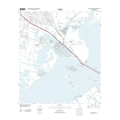
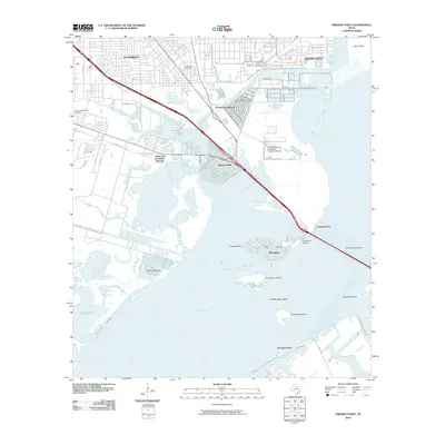 2010 Virginia Point2010 Print · USGSCovers Texas City Terminal Junction, including Galveston, Texas City, and other nearby areas
 - 2013 Map of Virginia Point, 2013 Print
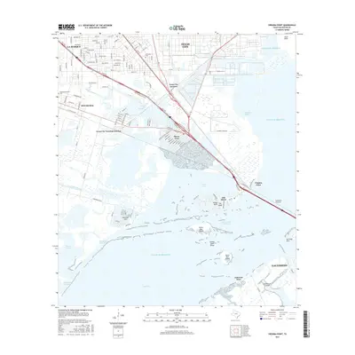
 2013 Virginia Point2013 Print · USGSCovers Texas City Terminal Junction, including Galveston, Texas City, and other nearby areas
 - 2016 Map of Virginia Point, 2016 Print
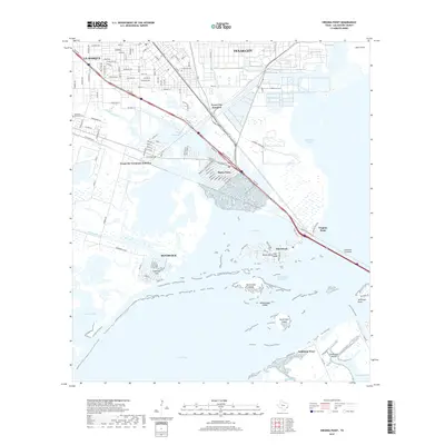
 2016 Virginia Point2016 Print · USGSCovers Texas City Terminal Junction, including Galveston, Texas City, and other nearby areas
 - 2019 Map of Virginia Point, 2019 Print
 2019 Virginia Point2019 Print · USGSCovers Texas City Terminal Junction, including Galveston, Texas City, and other nearby areas
 - 2022 Map of Virginia Point, 2022 Print
 2022 Virginia Point2022 Print · USGSThe coastal transition from the Texas mainland to Galveston Island is captured here in the early twenty-first century. Researchers can trace the layout of waterfront communities like Bayou Vista and Tiki Island alongside industrial landmarks like the Texas City Wye and La Marque Cem.
End of results
Showing maps 1-15 of 15
Top cities near Texas City Terminal Junction
- Houston historical maps
- League City historical maps
- Galveston historical maps
- Texas City historical maps
- Friendswood historical maps
- Alvin historical maps
See more
Frequently asked questions
- What are the different types of historical maps available for Texas City Terminal Junction?
- What is the oldest map of Texas City Terminal Junction?
- Where can I purchase historical maps of Texas City Terminal Junction for my home or office?
- Where can I download high-res historical maps of Texas City Terminal Junction?
- Are there historical topographic maps available for Texas City Terminal Junction?
- Is there historical aerial imagery available for Texas City Terminal Junction?
- Where are historical maps of Texas City Terminal Junction sourced from?